INTRODUCTION
Following the conquest of the city, Istanbul was declared the imperial capital of the Ottoman state and was thus not included in the Ottoman administrative divisions. In addition, due to the its unique civil and financial administrative structure, civilian and municipal services were directly carried out by the Ottoman central administration. Due to these differences, in order to examine the structure and administration of Istanbul’s districts and neighborhoods it is necessary to make use of all narrative, archival and visual sources available.
When discussing the districts and neighborhoods of Istanbul, the Historical Peninsula, known as nefs-i Istanbul or Dersaadet, which is surrounded by the Golden Horn, the Sea of Marmara and city walls, constitutes the epicenter. As for Galata, Eyüp and Üsküdar, known as Bilâd-ı Selâse, these were organized as juridical districts and integrated into the city over time; as such, they constitute a complementary aspect.
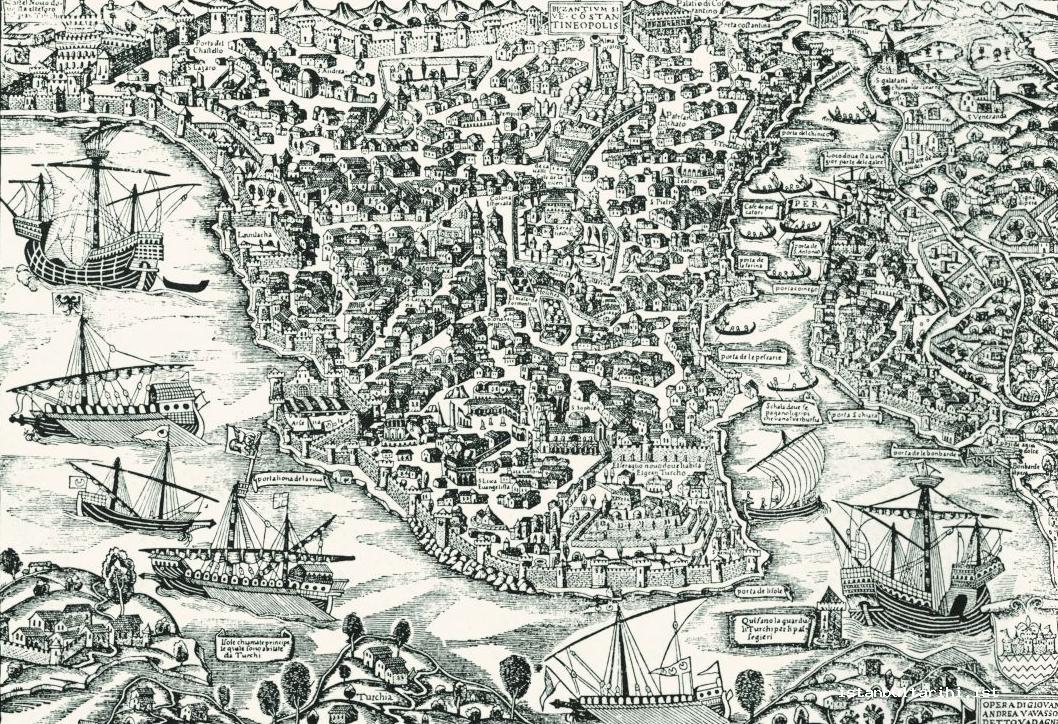
In order to embellish the fairly doomed city at the time of conquest with a “prosperous view”, city walls were repaired and a number of city gates were rebuilt within a programme of public works and settlement. At the time of the conquest the densest residential area was on the coasts of the Golden Horn, which had a connection to maritime trade; expansion of the city was to be carried out towards the hills and the coasts of the Marmara Sea.1
The deeds of Fatih Sultan Mehmed, within the context of settlement and construction policies, formed a basis for the districts and neighborhoods. One of the first things the sultan did after the conquest was to build a palace, which was to be known as Saray-ı Atik-i Âmire (the Old Palace); thus, the development of “the palace neighborhood” began. Settling one-fifth of his own captives from the war in the area of the Golden Horn meant that he had to provide them with residences; as a direct result a neighborhood was developed for the former inhabitants of the city. The same opportunity was also provided for captives who paid their ransom or guaranteed the same. In addition to slaves, people who had gone into hiding or fled to Galata during the conquest became the inhabitants of the first Greek neighborhood in the city.
The first neighborhoods of the city consisted of Byzantine-period houses. A Muslim neighborhood was established around the Hagia Sophia, Fatih, İmrahor İlyas Bey, Little Hagia Sophia, Fenari İsa, Bodrum, Koca Mustafa Pasha, Atik Mustafa Pasha, Kalenderhane, Eski Imaret, Zeyrek, Kariye, Fethiye, Gül, Molla Gürani, Ahmet Pasha, Manastir, Ibrahim Pasha, Sancaktar, Sheyh Suleyman, Sekbanbası Ibrahim Agha, Balaban Agha, Sheyh Murat, Sinan Pasha, Odalar, Kefeli, Toklu Ibrahim Dede and the Acem Ağa mosques; all of these had been converted from Byzantine-period churches or monasteries to Islamic places of worship. After the conquest, some churches and monasteries were converted into mosques immediately, while others were converted as the city started to be settled, with one place of worship being converted for each neighborhood.
THE FIRST NEIGHBORHOOD ORGANIZATION:
THE DISTRICTS
The organization of neighborhoods that was implemented by the Ottomans after the conquest of Constantinople occurred within the context of major units known as nahiye (districts). In addition to the administrative meaning, this term also has the meaning of side, vicinity, part, quarter, outskirts or zone. In terms of city planning a nahiye refers to an urban area or zone; that is, a unit that includes several neighborhoods. District system of Istanbul was consisted of several neighborhoods. The nahiye which created the different regions of Istanbul after the conquest formed a large qadi (juridicial) region; these separated into administrative regions that were administered by the naib (governors), who in turn were appointed by the qadi until the 19th century.
In addition to establishing the trade centers of the Grand Bazaar, Sultanpazarı and Saraçhane, the city of Istanbul grew with the kulliyes (social complexes centered around a mosque) constructed by the sultans and statesmen; these served as centers for growing nahiyes. Out of the 13 nahiyes that appeared during the era of Sultan Suleyman the Magnificent, three were named after sultans, while seven were named after statesmen and pashas, one was named after a tariqat sheikh, and two were named after geographical areas. We know that within the walls of Byzantium there were 13 regions; that is, 13 nahiyes. The districts that came into existence in Istanbul occurred when Fatih asked from Ottoman dignitaries to choose a part of the city to name after themselves, and then build mosques, depots, public baths and market places there. In compliance with this imperial order, the pashas had kulliyes built; over the seventy years following the conquest thirteen nahiyes came into existence. Thus, the walled city of Ottoman Istanbul took shape. After the formation of the Yavuz Sultan Selim district, no other single nahiye was named after a pasha who had established a kulliye.
It appears that the first nahiyes of Istanbul were the nahiyes of Hagia Sophia, Mahmud Paşa, Murad Paşa Ebulvefa, Sultan Mehmed Han and Topkapı. The nahiyes of Atik Ali Paşa, Ibrahim Paşa, Sultan Beyazıd Han, Davutpaşa, Koca Mustafa Paşa and Atik Ali Paşa (Çukurbostan) were established during the reign of Bayezid II. These nahiyes expanded the city from Fatih and Aksaray to the city walls. The last nahiye of Istanbul was that of Sultan Selim Han.
The nahiye of Hagia Sophia
This was the first administrative unit of the city. It was the nahiye built by Sultan Mehmed II following the conquest, and was the cornerstone of the city.
The nahiye of Mahmud Paşa
This was a pretty busy nahiye and was chosen for the kulliye of Mahmud Pasha. The bedesten (covered bazaar) in this region was affiliated to Tahtakale and the quay at Bahçekapı. It continued to be the most important trade center in the city until the 19th century.
The nahiye of Murad Paşa
This region was selected for the kulliye of Murad Pasha, and included Aksaray, Laleli, Cerrahpaşa, Langa and Yenikapı. This area was developed to a large extent during the reign of Bayezid II.
The nahiye of Ebulvefa
This is located between the Old Palace and Unkapanı Avenue and stretches towards the Golden Horn. Sultan Fatih Mehmed had a mosque and zaviye (Sufi lodge) built for Sheikh Ebulvefa. It was an important residential area with masjids (small mosques) constructed by Molla Hüsrev, Hızır Bey and Molla Gurani.
The nahiye of Sultan Mehmed Han
This area was selected by Sultan Fatih Mehmed for the construction of his own kulliye; here the Church of the Apostles was standing, although in disrepair. This kulliye enabled the city to stretch towards the Golden Horn.
The nahiye of Topkapı
This nahiye was constructed by Sultan Fatih Mehmed; it was also known as Sufiler, and grew up around the Ereğli Mosque. It continued to grow after the construction of two mosques, the Beyazıd Bey and Kürkcübaşı.
The nahiye of Sultan Beyazıd Han
This was a region centered around a kulliye that was constructed to the south of the Old Palace between the years of 1501-1505. It was located on the area stretching from Beyazıt Square to Kumkapı, from Grand Bazaar on Divanyolu to Saraçhane. Nisanci Mehmet Paşa’s kulliye was a second center in this area.
The nahiye of Atik Ali Paşa
The kulliye made by Atik Ali Pasha consisted of five neighborhoods.
The nahiye of Atik Ali Paşa
This is the second district known as Atik Ali Paşa, but this one is located near Çukurbostan. Hence, according Ottoman survey registers, the 3rd and 13th regions of Istanbul bear the same name, respectively.
The nahiye of Ibrahim Paşa
This district was formed around a mosque, madrasa and school that had been constructed by Çandarlı İbrahim Paşa in Uzunçarşı. It also included the populated trading center between the Grand Bazaar and the ports at Golden Horn, some of neighborhoods of the nahiye were established by wealthy merchants in the reign of Mehmed the Conqueror.
The nahiye of Davud Paşa
This district took shape around the kulliye that was built by the grand vizier Koca Davud Paşa. By constructing the district along the Marmara coast, Davud Pasha transformed this area into a residential area.
The nahiye of Kocamustafapaşa
When it was understood in the reign of Bayezid II that the Muslim settlement had expanded in the direction of Silivrikapı, the grand vizier Mustafa Pasha converted the Saint Andrew Church into a mosque; leading the way to the formation of the district of Kocamustafapaşa.
The nahiye of Sultan Selim Han
This nahiye was formed around the kulliye constructed in the name of Sultan Süleyman’s father Yavuz Sultan Selim, during the reign of Sultan Süleyman the Magnificent; this was the latest region in Istanbul.
NEIGHBORHOOD SYSTEM
Construction and Structure
The neighborhood unit in Ottoman cities and towns did not consist of random buildings or settlements; rather, they were constructed with a certain order, growing on a cause and effect relationship with the social and geographical environment. The neighborhood can also be defined as a space of solidarity, of participation in the administration, of labor effectiveness, and of limited autonomy.2 In Ottoman cities, the smallest unit was the neighborhood; when used in reference to outlying areas, this term referred to neighborhoods lying outside the citadel of a city or the city walls.
The neighborhood was not only a factor in determining the physical outlook of the city; at the same time it is both an administrative and social unit formed within the context of central and local services; it is a location where problems are solved in the center that forms around the main temple. It should not be overlooked that the neighborhood was a social fact reflecting the values of society.

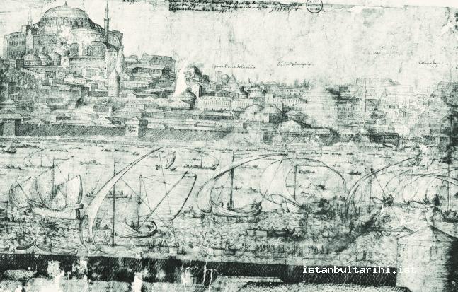
We can describe neighborhoods in Istanbul as living spaces that centered rround places of worship and as small administrative units. A hierarchy can be seen in the construction of neighborhoods. While nahiyes came into existence in the centers of the great kulliyes constructed by sultans or leading pashas; the neighborhoods were small kulliyes with a small mosque or madrasah at the center, which were generally constructed by other authorities or by men of wealth without official titles,. There were also pashas who established neighborhoods by constructing a mosque, masjid, or even a kulliye.
It should be emphasized that neighborhoods, which were named after persons who had played an important role during the conquest of Constantinople, like Molla Gurani, Molla Hüsrev or Akşemseddin, were primarily established as marks of respect to that individual. On the other hand, the public works that were carried out in the city and the fact that the kulliye also functioned within the body of a waqf (foundation) functioned as the core element of the establishment and growth of neighborhoods.
Neighborhoods were communal units with a specific identity and took shape around a mosque, church or synagogue. Inhabitants of the neighborhood were not only interconnected with a common root, religion and culture, but also with external factors that provided social solidarity. Since places of worship were general meeting places and “the symbol of the neighborhood”, their expenses were the joint responsibility of the neighborhood community.
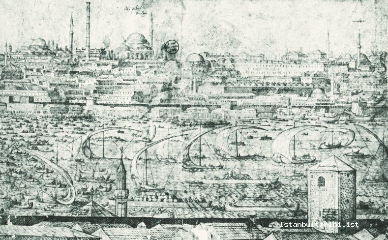
An important matter that should be pointed out concerning the construction of the neighborhood is that neighborhoods did not emerge as a result of obligation; rather, they took shape spontaneously as open residential areas. There were factors that supported this. For example, it is clear that the housing provided for the müderris (Islamic scholars) and other officials in the vicinity of Semaniye and Suleymaniye madrasahs constituted a different way to establish a neighborhood. As a result, the neighborhoods of Fatih and Vefa were also referred to as ulama districts. Yenibahçe was favoured by the Ottoman ruling elite.
It is accepted that a neighborhood generally consisted of 20 to 40 households; however, sometimes the number can be lower or higher. Many of the families in a neighborhood were often related.
We can talk about many factors in the construction of neighborhoods and their administrative and social structures. The factors stemming from the settlement policy of the central administration and society’s inclinations can be listed as follows: Religious identities and choices, ethnic identities and choices, occupational group identities, marital status, settlement in residential or non-residential areas, settlement inside or outside the walled city, planned or unplanned settlement, overpopulation or under-population, political, military, social or economic choices. Each of these factors can be taken as a cause or causes in the development of neighborhoods and cities. Sometimes administrative measures and governmental bodies, sometimes people or the mutual will of people and government had an effect on where and how those factors will be active.
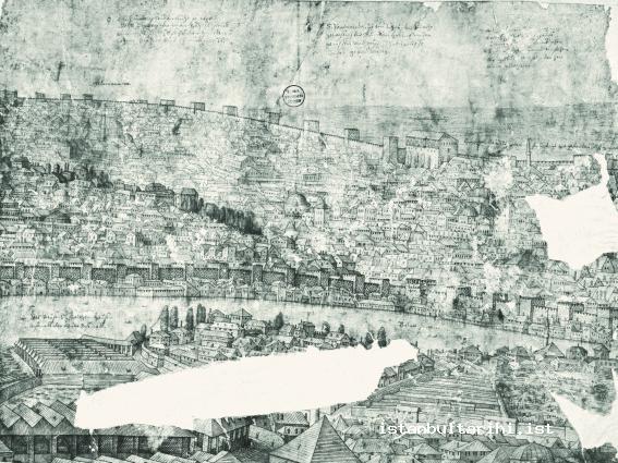
After the conquest, upon the announcement that lands and buildings would be granted as private property in order to increase the number of inhabitants of the city, communities from several different areas formed neighborhoods by taking up residence in deserted houses or houses that had been destroyed paying rent for the dwelling or purchasing it. For example, in 1594, during the distribution of land, which was intended to increase the community near Fethiye Mosque, those who had more land than they needed were listed and the excess land was taken from them and given to applicants. Likewise, when a church that no longer had a congregation was converted to a mosque, the open space around it was sold to establish a Muslim neighborhood; the land was subdivided into lots that were large enough for houses to be built. Also, the construction of a mosque or masjid in underpopulated areas encouraged settlement, thus leading to the emerging of new neighborhoods. A neighborhood established in this way became known as Yeni Mahalle (New Neighborhood) or the word cedid (new) would be added in front of the place name. In some areas, the number of neighborhoods was determined by the number of masjids there.
Religion was a very important factor in the forming of neighborhoods. In this sense, a neighborhood can be defined as “an urban section in which a congregation of a single place of worship resides with their families.” In this respect, the neighborhood is a “narrow” aspect of community life that precedes the urbanization phase. Dividing people into districts and neighborhoods is one of the most significant characteristic of Islamic urbanization. The saying Müslüman mahallesinde salyangoz satılmaz (snails are not sold in the Muslim neighborhood) and the description of the walled city of Istanbul as “the city of Muslims”3 should be seen as a reflection of religion over the neighborhood.
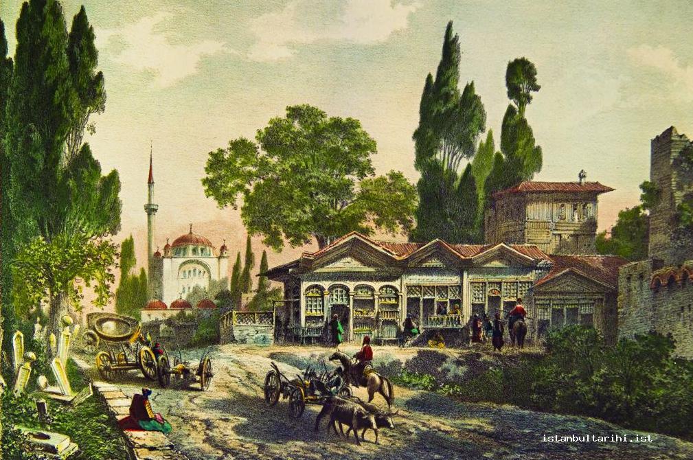
The principles that were applied in the development of Istanbul enabled the Muslim society to carry out their religious duties with ease; they benefitted from the conveniences of living in an Islamic city. This principle was also valid for non-Muslim communities. The economic and social institutions that supported urban life and provided welfare for residents of the neighborhood emerged as the waqfs of Hagia Sophia or other religious institutions. From the first, it was intended to make the Islamic character of the city and the neighborhoods visible in order to imbue Istanbul with the character of “a sacred Islamic city”. The feelings of devotion that people felt towards Sufi masters led to the establishment of neighborhoods around a zaviye (Sufi lodge) or a turbe (tomb) named after these religious leaders. The neighborhoods of Sheikh Ebulvefa, Sheikh Akşemsettin, Sheikh Sevindik-Koğacı Dede, Sheikh Mahmut Resmî are all examples of such establishments.
It can be seen that at first Muslim and non-Muslim people lived together in residential areas. As long as the centers of worship were not close to one another, people of different religions and neighborhoods could live in houses close to one another. A non-Muslim house could simply be “neighbour” to an area inhabited by Muslims. Although some sectors of society would separate themselves completely into a distinct neighborhood, this was not as strictly implemented in the Ottomans as it was in other Islamic cities. For this reason, religious and ethnic structures did not exist as communities secluded from one another in the city.
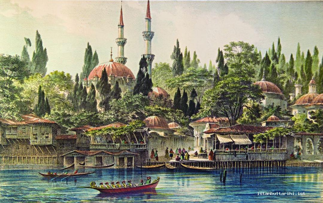
Neighborhood masjids were usually constructed by a prominent figure in the neighborhood, and over time, some were converted into mosques. Moreover, religious identity and the Sufi aspect of the persons whose names had been given to neighborhoods were influential in the development of the neighborhood. For example, dozens of waqfs were established in the neighborhood of Seyyid Emir Ahmet Buhari ( 922/1516) and named after him by “his followers and lovers”.
In the 16th century, approximately 30% of the neighborhoods that had been established inside the city walls had been erected during the reign of Fatih Mehmed Sultan, while 50% had been formed during the reign of Bayezid II, and 15% between 1512 and 1546. The formation of new neighborhoods in this century was lower, indicating that the increasing population did not lead to the creation of new neighborhoods, but rather settled in existing neighborhoods. On the other hand, as the number of inhabitants in existing neighborhoods increased, some masjids and synagogues were converted into mosques, and new masjids and kulliyes were cohenstructed; new neighborhoods were established in formerly uninhabited areas towards the walls, along the Bayrampaşa Stream.
The development of Istanbul continued for the most part inside the city walls until the 17th century. In the second half of the 16th century and in the first half of the 17th century neighborhoods expanded outside the walls, towards Eyüp. In this same period, the city also expanded outside the Topkapı Gate. For example, Takyeci İbrahim Ağa Mosque led to the development of the Takyeci neighborhood. The Merkez Efendi Mosque, zaviye and mevlevihane (dervish lodge), established by Malkoç Mehmed Efendi, helped the reclamation of the land. It can be seen that in the 17th century, the walled city was entirely inhabited, except for locations like Yedikule, Bayrampaşa Stream, and around the Yenibahçe walls and Langa gardens. One of the indicators of the development of neighborhoods was the increase in the number of waqfs. 1,163 waqfs were established inside the Istanbul walls between 1453 and 1521, this number reached 2,515 in 1546, and 3,265 in 1600. In the 16th century, the number of waqfs established in the Bayrampaşa valley, close to the gates, demonstrates the development of new neighborhoods in the region.
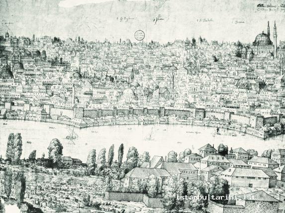
It can be seen that inhabitants of a neighborhood could also establish a dernek (fraternity/association) to construct a mosque. This was a move towards the construction of a new neighborhood. It should also be mentioned that schools and fountains, which encouraged settlement, were significant factors in the construction of neighborhoods. Each building and service that was significant in Istanbul can be considered to be a structure that directly or indirectly affected urban settlement and neighborhood development. However, settlements of exiled/resettled people in Istanbul also played an important role in the construction and development of Muslim and non-Muslim neighborhoods. Neighborhoods like Üsküplü, Tahtakale, Balat, Eyüpsultan and Kazancı were constructed using this method. As in order to be considered a member of the neighborhood meant residing in that area for five years without interruption, Muslim and non-Muslim exiles either became integrated in the neighborhood of their coreligionists or over time formed a new neighborhood.
In classical Islamic cities, residential and commercial areas were separated from one another. This formation, which is generally argued to have appeared due to the need to separate private and public domains, is thought to have emerged as a result of the state not taking a close enough interest in the daily life of people. The autonomous characteristic of neighborhoods has also been attributed to this factor. While the control mechanism of the state was most visible in commercial areas and in the administrative centre, neighborhoods carried out trade themselves, thus enhancing solidarity among the inhabitants. Neighborhoods in Istanbul that had commercial areas were areas like Mahmutpaşa, where there were no residential areas, or like Eminönü and the Grand Bazaar, where commerce took priority, and residential areas were at a minimum.4
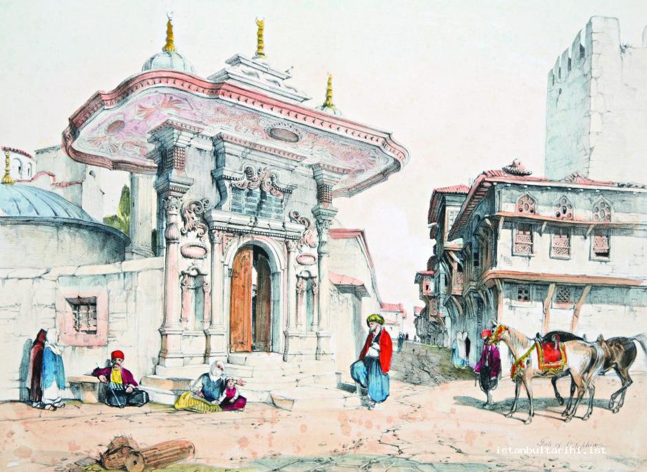
Due to the fact that people preferred to live in a residential area that had a lively commercial nature, some neighborhoods like Balıkpazarı, Bozahaneler and Lonca were built around commercial centers. Moreover, some trade guilds established neighborhoods named after their trades, like Demirciler, Vezneciler or Çıkrıkçılar. However, trade guilds, prominent in commercial and craft sectors of the city, were not reflected in the neighborhoods; people from different occupations, like dyers, bakers, barbers, and tinsmiths all lived together.
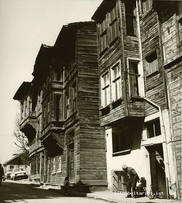
In neighborhoods that were mostly residential, construction was supervised by the state. Within this context, houses were not to be more than two stories, edges and overhangs could not protrude outwards in the direction of the street. Most houses in the neighborhoods were made of timber, due to the low cost of this material. Due to the housing needs that appeared in the 16th century, palaces that had large gardens in residential areas were torn down, with attached wooden houses being built in their place. In 1725, the height of houses was 12 zira (1 zira = approximately 2 ft.) for Muslims and 9 zira for non-Muslims and Jews; this was raised, according to a regulation dated 1817, to 14 and 12 zira respectively, , and later completely abolished after the Tanzimat. Non-Muslims could not build a house near a Muslim place of worship, or dwell in a house near such a place.
Istanbul houses can be separated into five main categories: The first is the bachelor rooms. Second group are the residences with one or two-stories, built of timber or mud-brick which measured 400 arşın (ell); these were for middle-class people. Houses with gardens constitute the third category; these residences were made up of one or more houses and could include a barn, bakery, bath, cellar, garden, well and fountain. The fourth category consisted of grand mansions belonging to statesmen and wealthy merchants, which were often called saray (palace). Finally, pavilions and yalı (seashore mansions) were constructed by sultans and princes outside the walled city, in a garden or in forestland. For this reason, settlement in Istanbul on the urban and neighborhood level resembles, to a certain extent, the settlement model that resulted in the development of Turkish and Islamic identity in Anatolia.
It is also known that neighborhoods in Istanbul could change hands between Muslims and Christians by passing of time. The reasons for such exchanges could be simply because the inhabitants preferred to settle in another residential area. For example, when families from Kefeli, the only Catholic group left inside the walls of Istanbul, with two churches in Edirnekapi, immigrated to Galata, the churches were called Kefeli and Odalar and converted into mosques; subsequently the neighborhoods became Muslim neighborhoods. When the construction of the Valide Mosque began in 1597, Jewish community in Eminönü was moved to Hasköy, where they were provided with housing and tax exemptions; the neighborhood, which had now approximately 100 vacant houses, was transformed into a Muslim neighborhood. In 1727 Jews residing outside Balıkpazarıkapısı were notified that they were to sell their properties to Muslims and move to other Jewish neighborhoods. The opposite also happened: In 1636, the number of Muslim houses in Kâtip Kasim Neighborhood in Langa decreased from 333 to 33, being bought by non-Muslims. The edicts that were promulgated as a result of this and similar cases stated that Muslim houses could not be sold to Christians, and the Christians were to build their houses outside the walled city. The changing identities of neighborhoods also caused those who were of the same religion but of different trade guilds to come together. For example, due to the necessity to change residential areas as a result of the 1633 and 1660 fires, the Romaniot, Sephardi and Karai Jewish communities started to live together.
Most Muslim neighborhoods consisted of narrow, quiet one or two streets or dead-ends, and one small mosque or masjid, which was located on a slightly larger and busier spot. An important matter related to the Istanbul streets was that as the existing streets were in keeping with the natural topography of the city, they did not undergo significant changes, other than being widened, over five centuries.5 Even in 1876, streets still maintained characteristics dating from the era of Sultan Mehmed the Conqueror. During the construction process that was carried out after fires, the former plan of streets was to a large extent maintained.
Streets in the Ottoman period are considered to be a hindering factor in the construction, function and development of the neighborhood. The city suffered greatly from the fact that the narrowness of the streets made the extinction of fires frequently occuring in Istanbul very difficult. During the month of Ramadan, the streets of Istanbul would be full of thousands of beggars who came from outside the city; those non-Muslims who had chosen Islam would travel among the streets on horseback. Istanbul also had a large number of dead-end streets. For the first time in 1839, plans were made to open dead-end streets and construct wide roads and squares; however, this was only put into practice after 1865. It is seen that dead-end streets, which are considered to be an example of unplanned urbanization, prevented strangers from entering the neighborhoods, ensured privacy and the security of residents. Every neighborhood catered to all needs of social life; the neighborhoods were divided with a main street which opened onto the dead-end streets. The costum of building cantilevered upper floors meant that the houses leaned over the streets, causing them to turn into gloomy and airless passages. Due to the closeness of the upper parts of houses that face each other, cats were able to jump from roof to roof.6 Again, due to narrow streets, transportation had to be conducted by sea from the Golden Horn. As can be understood from documents dating from the 16th century, there were sidewalks on the streets. Evliya Celebi records that all the streets of Istanbul, Eyüp, Tophane and Kasımpaşa had sidewalks. The construction and repair of sidewalks were secured with agreements made between the neighborhood administration and the kaldırımcılar lonca kethüdası (chamberlain of the pavement guild). Expenses for paving the main streets were met by the Ottoman government, while expenses for side streets were covered by the inhabitants of the neighborhood, shop owners and waqf trustees. Despite the instructions in imperial edicts, the general condition of the streets was neglected and dirty. As there was no street lighting, those who went out at night had to carry a torch. In 1879 the main streets of Istanbul was provided lighting. In the 19th century, Divanyolu, the most important avenue of the city, was only 3 to 3.5-meters wide.
Non-Muslim neighborhoods were constructed primarily by settling those who had always lived in Istanbul in certain areas. It should be stated that, in particular, places where churches, monastries or synagogues were located constituted a non-Muslim neighborhood. Indeed, building up spiritual and administrative units around a place of worship formed the core of a neighborhood. This was also the case with Muslims. The formation of a non-Muslim neighborhood shared many similarities with how the Muslims erected their neighborhoods. Those who were exiled from Aksaray and Karaman, transferred to Istanbul during the reign of Fatih Sultan Mehmet, erected the neighborhoods in which they were settled; during the same period the Armenians, who were brought from Bursa under the leadership of Patriarch Hovakim, organized neighborhoods near Samatya and Kumkapı, while those who were settled after the conquest of Belgrade formed the Belgrad neighborhood. These neighborhoods had the same structures although the religions of their inhabitants were different.
The non-Muslims, who had always lived in Istanbul, those who were brought to Istanbul in line with the imperial policies of later periods, and those who came of their own accord, created neighborhoods in a way that they were able to maintain unity. The concepts of neighborhood and “community” coincided with one another. Thus, the construction of neighborhoods by communities happened in a way that was directly related to the identity they represented and in such a way that they could preserve their identity. There were neighborhoods that were constructed with an ethnic identity, such as Armenian, Greek or Latin, or those that had a religious identity like Christian or Jew in Istanbul; in addition, there were also neighborhoods that had a structure which allowed unity to be maintained on the basis of ethnic affinity, like that of the Karais or Marranos, or sectarian fraternity like that of the Catholics and Rabbanis, or of geographical background like that of Sepharids.
Structures that constituted non-Muslim neighborhoods were named after the places the inhabitants came from or from where they wanted others to think they came from. For instance, the Jewish neighborhoods of Ohri, Karaferye Yanbolu, Cakacı were established in the mid- 17th century. Non-Muslims formed neighborhoods inside the walls of Istanbul, generally near the Golden Horn and coastal areas like Balıkpazarı, Bahçekapı, Unkapanı, Edirnekapı, Balat, Fener, Narlıkapı, Kumkapı, Topkapı, Samatya Kapısı, Belgradkapı, Bahçekapı, Cıfıtkapısı and Yedikule. As for outside the walls, there were non-Muslim neighborhoods in Hasköy, Kasımpaşa, Galata, Mumhane, Beşiktaş, Ortaköy, Kuzguncuk and Üsküdar. The construction of mosques near the neighborhood they were living in or fires breaking out in the city caused non-Muslims to distance themselves from Muslim neighborhoods and head for Galata. In the mid-16th century Greek, Armenian and Latin communities were scattered throughout several neighborhoods in Galata and Üsküdar.
The Administration of Neighborhoods:
Governors and Social Groups
The original purpose of local government was to create a habitable space, to maintain security, cleanliness and order. The most important characteristics of the neighborhood in Ottoman cities was that it was the smallest “basic administrative unit”, aotonomous in financial and governmental affairs. Ottoman neighborhoods had the characteristics of a physical environment shaped, not according to class or status, but ethnicity and religion. A modest house owned by a clerk of a waqf could be located across from the mansion of a pasha, or the shed of the suyolcu (the man in charge of water supply) of the neighborhood could be located next to the mansion of a dignitary from the ilmiye (Islamic scholar); despite differences in status, relations were maintained on a neighborhood basis.
The existence of a sharp line dividing the neighborhoods from one another was not apparent. Not only did people of the neighborhood provide security for one another, they were also jointly responsible for clarifying any matter that took place in the neighborhood and for compensating in case of loss. Even the matter of extinguishing fires that broke out in the neighborhood was directly under the responsibility of the concerned inhabitants. A neighborhood can be defined as a residential unit with a population of approximately 1,000 people worshipping in a common place. In the provincial law of the Ottoman State dated 1864, on the basis of the number of households,a neighborhood is described as “a residential area consisting of at least 50 houses.” In the neighborhoods, the reaya (tax-payers) were nominally recorded in registers according to the neighborhoods they resided in, and the boundaries in which the buildings of the neighborhood were determined. This also indicated that the administration of the neighborhood was under the supervision of the central administration.
Until the first half of the 19th century, the most prominent figures in the neighborhoods to establish relationships with the upper administrative body of the empire were the imams and muezzins in the masjids and the imams, muezzins and preachers in the mosques. Non-Muslim neighborhoods were likewise administered by priests or rabbis. The rabbi was the representative of the chief rabbi, while the priest was the representative of the patriarchate. However, it is seen that in practice the kocabaşes (governors) fulfilled the duty in Christian neighborhoods, or priests were referred to in this capacity. The position of the rabbi for the Jewish community was similar to that of the priest.Here, the cemaatbaşı (head of the congregation) and cemaat kahyası (congregation steward) was equivalent to the kocabaşı. The imam in the neighborhood was the representative of the neighborhood in all matters involving official authorities. Imams were considered to be among the “military” group as they were appointed by an official license from the sultan; the imam was exempted from certain taxes during his tenure, as well as from military service; this situation continued until 1826. We also know that the kocabaşes, who were the counterpart of the imams, were also exempt from taxes. The imperial orders were given by the qadis or they were announced in marketplaces and streets by heralds. In addition to religious training and communal prayers, the imams were in charge of maintaining moral order, which included expelling prostitutes and those who married these women from the neighborhoods and Istanbul, and ensuring social order in the neighborhood, as well as fulfilling the obligations that the inhabitants of the neighborhood as a whole owed to the central adminstration. Imams were obliged to notify official authorities, particularly the qadis (judges), about citizens who failed to do their share of work.
Imams were also in charge of preventing strangers from settling in the neighborhoods, of preventing criminals from fleeing, as well as being responsible for security. As of 1579, neighborhood residents were ordered to stand surety for one another, thus enabling the imam to fulfill these duties. The imams were civil servants who represented the qadis, the administrative and municipal leader of the region. In this respect, recording births, deaths and marriages in the neighborhood, registering those who moved into the neighborhood, organizing identity documents and residential permits, acting in marriages, divorces and disagreements, sometimes including those of non-Muslims, all fell under the duties of the imam. The imams and his colleagues were in a position that demanded the production of a great deal of records and documents; it can be understood that, to some extent, they met this demand. However, as there are no archival materials extant today, except for a few exceptions, it can be said that the imams, the priests and the rabbis did not properly carry out these duties. Unwittingly purchasing the records of the Kasap İlyas neighborhood, Cem Behar made a significant discovery about the everyday lives and social structures of the Arapkir people, who moved to that neighborhood from 1770.7 However, even if some officials recorded such sources of information at a certain time, there was no continuity and the records were not passed onto the subsequent officials who took over the post.
Everything in the neighborhoods depended upon the permission of imams. Surety provided by the imam and an additional inhabitant was a condition for a person to settle down in a neighborhood. Probably the most important duty of the imam was to levy taxes due among the neighborhood residents and collect the funds. This duty enhanced the authority of the imam. When the duty of collecting taxes was assigned to religious functionaries in non-Muslim neighborhoods, along with the responsibilities that the Patriarch took on in the 18th century, patriarchate bureaucracy also increased. The administrative role which the imam fulfilled in addition to his religious duties did not change until the Tanzimat era. From the reign of Mahmud II, as the hierarchy of the imam-qadi in neighborhoods began to collapse and as the qadis, under whose command the imams functioned, began to lose govermental functions and roles in providing local services, the neighborhood imams also began to lose their administrative characteristics, although this was to a lesser extent. In addition to imams, other than muezzins and hatips (preachers), his assistants, such as the naip (deputy) who worked under the qadi, the ihtisab ağası (official in charge of ensuring regulations in market place) subaşı (police officer), mimarbaşı (chief architect), ehlivukuf (expert), kassam (official in charge of dividing up inheritances), şehir subaşı (commander of the town), çöplük subaşı (head of refuse collectors), asesbaşı (chief of police) were other officials concerned with the administration of the neighborhoods. In addition to the sheikhs, the kethüda (steward), yiğitbaşi (guild official), and ehl-i hibre (expert of a craft guild), who formed guilds, the mütevelli (trustee), bekçi (watchman), saka (water-bearers), çöpçü (garbage collector) and tulumbacı (fire-fighters) were important officials.
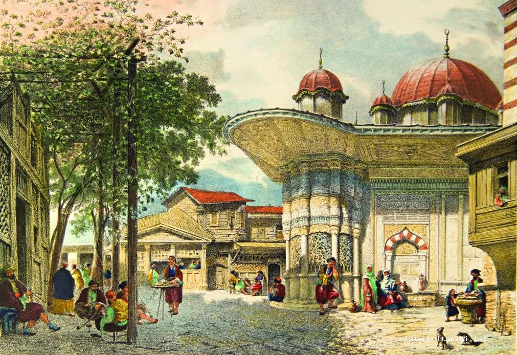
After the abolition of the Janissary corps during the reign of Mahmud II, the necessity to reconstruct the city to ensure security, the payment of taxes and organization of the neighborhoods arose. In the population census carried out in the Dersaadet (the walled city of Istanbul) and the Bilâd-ı Selase (Galata-Üsküdar-Eyüp), a correlation between population growth, unemployment and vagrancy was identified; as a result, when entrances and exits from the city were taken under close surveillance it was seen that there was an abuse in the practice of mürur tezkire (certificate of passage). Subsequently, the office of headman, known as the muhtarlık was introduced; two muhtars were appointed to each neighborhood. Although the kocabaş continued to be in charge, those who had been appointed as the counterparts to the muhtars were the kahya (stewards). For this reason, the establishment of an autonomous administration in Istanbul was perceived as “Village kahyas were commissioned in the neighborhoods.” There were many reasons for the establishment of the muhtarlık organization; such as, to ensure that the imams carried out their duties properly, to prevent infraction of rules, to control new settlement in the neighborhoods and, accordingly, in the city, to surveil human traffic to and from the neighborhoods, to provide security in the neighborhoods and to prevent the spread of harmful rumors. General security in the neighborhoods was provided by the Janissary corps. Yasakçı and zaptiye were present everywhere to prevent brawling and to ensure that no one was harmed. The first step taken towards local government was the election of muhtar in every neighborhood.
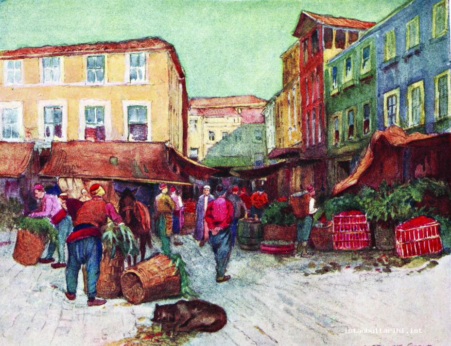
The complete transition to a muhtarlık in non-Muslim neighborhoods occurred later than that in the Muslim neighborhoods. When the office of headman began to be established in neighborhoods, the muhtars gained more authority as compared to the imams. Establishing muhtarlık in the neighborhoods began, for the most part, in Istanbul; as they became more widespread, the application and collection of taxes, matters of security and municipal services in the neighborhoods were handed over to the muhtars. In the new administrative structure, the muhtars vouched for the the neighborhood as a whole, while the imams vouched for the muhtar. With the Ottoman Provincial Regulation of 1864, fifty houses were regarded as constituting a neighborhood, and with the establishment of councils of elders, the office of headman in the neighborhood could be controlled.
While in general rendering police service was the concern of the central authority, every neighborhood had a bekçi (watchman). In the 16th century, the inhabitants of neighborhood undertook this responsibilty by turns. However, later on neighborhood residents hired a pasban (paid watchman) for the duty. Watchmen were appointed to neighborhoods upon the request of the residents and an official application from the qadi; these watchmen were responsible for the security of the neighborhoods, and were under the command of the imams. In following years, under the control of the muhtars, they started to wear uniforms. Neighborhood watchmen were also called (vekilharç) in the neighborhoods; they were assisted by a saka (water-bearer) - indeed, sometimes the job of the vekilharç and saka were carried out by the same individual. According to a law dated 1695, each neighborhood was obliged to hire two watchmen who had been vouched for to control the neighborhoods; they carried torches and had the authority to arrest strangers who were wandering in the streets after the night prayer. The watchman became an integrated part of Istanbul folklore as the care-taker of the neighborhood when they took on extra duties, such as carrying iftar (fast-breaking) meals to the poor, waking people for the sahur (meal before the fast) with a drum while reciting manis (rhymes), organizing a parade of children in religious festivals in the neighborhood.
The task of keeping the neighborhoods clean fell to the people of each neighborhood and tradesmen who were under the control of city officials. Later, like the bekçi, çöpçüs (garbage collector) were also employed in neighborhoods. Each neighborhood was obliged to pay for two or three çöpçüs. The responsibility of removing garbage fell to the çöplük subaşı; he commissioned workers known as arayıcı and he was given a sum of money in return for granting the right to collect garbage. The arayıcı collected garbage in baskets; that which could be recycled was put to one side to sell, while the rest was to be dumped in the sea. Garbage and rubble was usually dumped in the sea from spots known as bokluk nearby Odunkapısı or the Langa coast. The süpürücü (sweeper) cleaned common areas of the neighborhood and their wages were paid by the neighborhood residents.8 The cleanliness of the alleys in the neighborhood was the responsiblitiy of the imams.
Some neighborhoods that were more frequently exposed to fires than the usual had to purchase fire-fighting equipment. For this reason, until the establishment of a regular fire-fighting department, a firefighting team consisting of a few young fellows was formed in every neighborhood. Like the bekçi, tulumbacı (firefighters) were among the most colorful characters of the neighborhood. There was even a tulumbacılar coffeehouse in Istanbul.
ISTANBUL NEIGHBOURHOODS: NAMES AND THE HISTORICAL PROCESS
It has been determined that during the reign of Fatih Sultan Mehmed there were 262 neighborhoods in total; 181 neighborhoods were within the city walls, 8 were in Eyüp, 2 neighborhoods were near Kasımpaşa, 61 in Galata, 10 neighborhoods both along the Bosphorus and in Üsküdar.9 It has also been determined that neighborhoods were pretty dense and crowded near Fatih and Saraçhane and around the Golden Horn; those along the coasts of the Marmara Sea were sparse, while Yedikule and to the north were fairly secluded.10
Research carried out on the matter of neighborhood and district names in Istanbul has indicated that the origin of most names was known and their origin was known.11
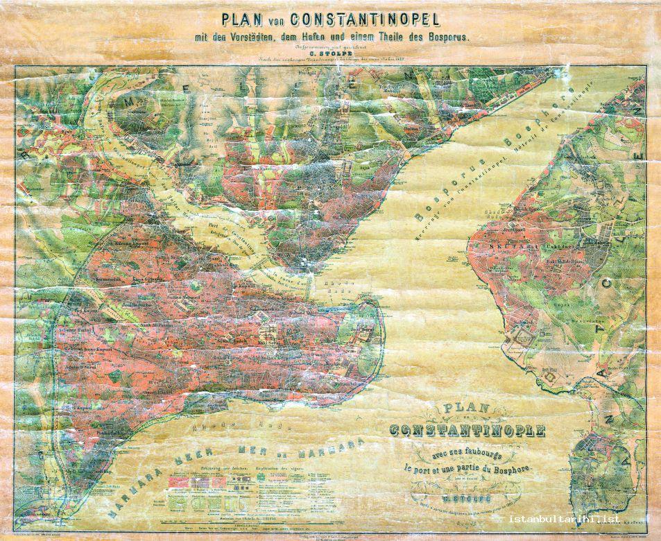
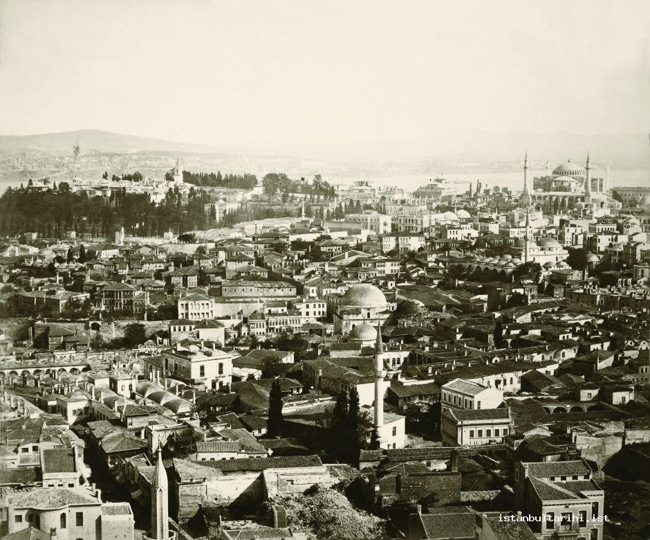
In 1600 there were 13 regions and 226 neighborhoods in Istanbul. The names of Hagia Sophia and Topkapı were derived from the regions in which they were located, while others were named after an individual, such as Mahmud Pasha, Ali Pasha, İbrahim Pasha, Sultan Bayezid Han, Sheikh Ebulvefa, Sultan Mehmed, Sultan Selim, Murad Pasha, Davud Pasha, Mustafa Pasha and Ali Pasha.
When the names are taken into consideration, two general structures appear: 1: regional names that have the same name of a mosque, or a neighborhood with the same name, 2: neighborhood names that have the same name as a masjid or mosque. Sultan Selim and Topkapı are exceptions on a district level. Although, in the region of Sultan Selim there was a mosque of the same name, there is no neighborhood with the such name. As for Topkapı, it is seen that there is neither a mosque nor a neighborhood with the same name. There are more exceptions on neighborhood level.
Neighborhood were largely named after a person. These figures were usually from members of an occupational or commercial group, for example, Üstat Mimar Sinan, Üstat Mimar Hayrettin, Üstat Kemal el-Harrât, Bıçakçı Üstat Acem Ali, Kürkçübaşı, Ahi Durmuş, Camcı Kara Ali, Nahlbend Hasan, or that of government officers, such as Dizdarzade Mehmet Çelebi, Yazıcı Murat, Abdi Subası, Çebecibaşı, Muneccim Sadi, Suhte Sinan. In addition to single-name neighborhoods, there were also neighborhood names composed of two or even three names.
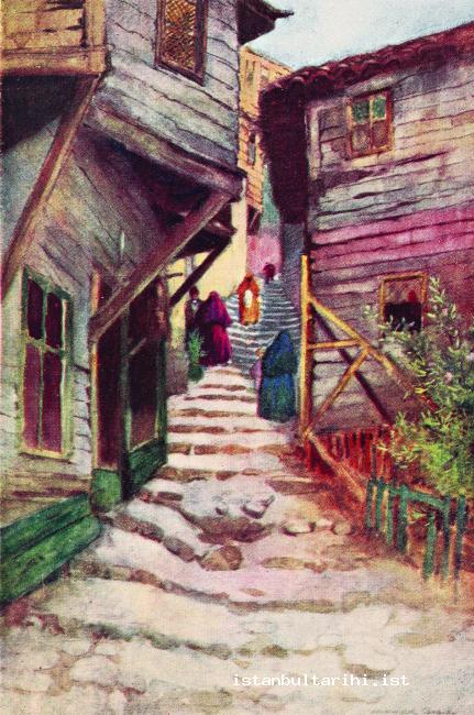
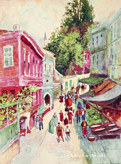
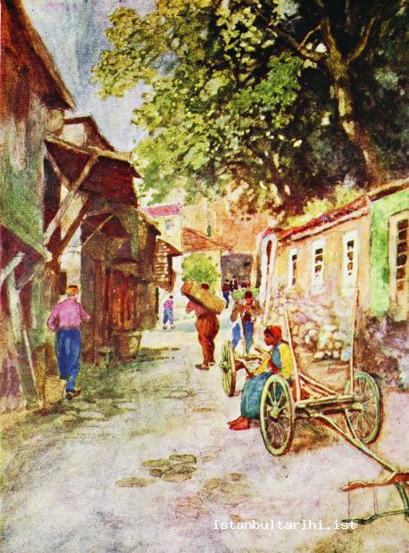
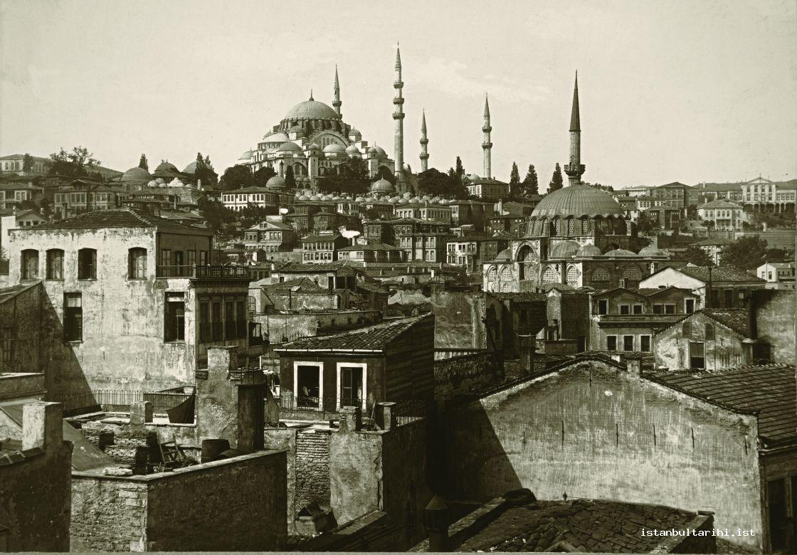
It can be seen that when necessary, a neighborhood could be divided into two, or neighborhoods were joined into one neighborhood. As an example of neighborhoods being joined, we can site the Camcı Kara Ali Neighborhood, which was a single neighborhood in 1546, was joined with Kalenderhane in 1600, and the joining of the Hace Teberrük Neighborhood with Voynuk Şüca as one neighborhood. This situation can be evaluated as an indication of administrative measure in the identification and determination of neighborhoods. Not only could this naming be the acceptance of two separate neighborhoods as one neighborhood, they could also result from the same neighborhoods having different names at different times, or even at the same time.
24 of the 226 neighborhoods were located around mosques. This demonstrates that there was at least one mosque for every district in which the people could perform the Friday prayer. On the other hand, there were neighborhoods that were first based around a masjid, but, later these were transformed into mosques in order to create a larger place of worship; as a result, the names of the neighborhoods also changed. For example, Hace Üverys Mescidi and Cezeri Kasım Paşa Mescidi were both transformed into mosques between 1546 and 1600.
Neighborhood names were largely based on religious centers, like masjids and sometimes mosques, and carried the name of these structures. Nearly 90% of neighborhood names in Istanbul are named after a masjid or mosque in the neighborhood. Moreover, it can be observed that a neighborhood also emerged around the Tomb of Kemal Paşa. There were also other neighborhood which were not named after mosques, masjids or tombs. Nearly twenty neighborhoods, such as Abdi Çelebi, Arap Taceddin, Suhte Sinan, Alemî Bey and Güngörmez are examples to this phenomenon.
One of the matters that should be taken into consideration for neighborhood names is that some neighborhoods were also known by a second name other than its official name. For example, the neighborhoods of Hüseyin Ağa Camii (Little Hagia Sophia), Hüseyin Çelebi Mescidi (Kara Kedi), Üstat Ali (Acem Alisi), Mehmet Çelebi Mescidi (Dizdarzade), Kemal-ı Nahhas (Halayıkçı Kemal), Mehmet Paşa Camii (Nişancı Paşa), Çakırcıbaşı Mescidi (Avcıbaşı) were all known by their second names.
In Istanbul, as there were 5 neighborhoods with female names, such as, Dâye Hatun, Dâye Hatun (Hûndî Hatun), Kiçi Hatun, Hacı Hatun and Melek Hatun among the 226 neighborhoods, there were also neighborhoods with female names outside the walled city. Neighborhood names could be derived from different persons with the same name or different neighborhoods could be named after the same person, for example, Sinan Agha who constructed masjids in various places.
The number of neighborhoods in Istanbul, int the end of Fatih’s reign was 182; this number, excluding non-Muslim neighborhoods, reached 219 in 1546 and 226 in 1600. Some neighborhoods in Istanbul underwent great changes and development over the 54 years between 1546 and 1600. This development is proportional to the number of waqfs founded in the neighborhoods. For example, the number of waqfs in the Kürkçübaşı Neighborhood increased by nearly five times from 11 to 51, while the number in the neighborhood of Sancakdar Hayrettin increased by nearly eight times, from 3 to 23. The increase in the cash and real estate waqfs meant that they directly and indirectly contributed to the development of the neighborhoods. On the other hand, it should be emphasized that new neighborhoods were not constructed in the districts of Hagia Sophia, Mahmut Paşa, Ali Paşa and İbrahim Paşa between 1546 and 1600. The neighborhood of Sultan Bayezid Han did not exist when the Sultan Bayezid Han District was being constructed and only seven neighborhoods were constructed within the walls of Istanbul.
It can be seen that the number of neighborhoods fluctuated between 1600 and the establishment of the Republic in Turkey. It is likely that the large number of fires and political incidents played a role in this fluctuation. Muslim neighborhoods increased in number for some time after 1600, and the total number of neighborhoods was 292 in 1634, falling off to 253 in 1672; at the same time, there were 24 non-Muslim neighborhoods. Evliya Celebi recorded that there were 9,990 Muslim, 304 Greek, 657 Jewish, 17 Frank and 27 Armenian neighborhoods12 within the walls of Istanbul in the middle of the 17th century; however, this is neither rational nor possible.
When a municipality was founded in Istanbul in 1855, radical changes in the neighborhood organization swiftly came to the fore. In the new structure, districts that had formerly existed in the walled city appeared as municipal regions, and decreased in number. With the Dersaadet İdare-i Belediye Nizamnamesi (Municipal Regulation), passed in 1868, Istanbul was divided into 14 municipal districts; these were Hagia Sophia, Aksaray, Fatih, Eyüp, Kasımpaşa, Beyoğlu, Beşiktaş, Mirgün, Büyükdere, Beykoz, Beylerbeyi, Üsküdar, Kadıköy and the Princes’ Islands.
In 1871, there were 331 neighborhoods in total inside the walls, 284 were Muslim, 24 were Greek, 14 Armenian and 9 were Jewish neighborhoods; there were 256 neighborhoods outside the walls.13 At that time the total number of neighborhoods throughout Istanbul was 587. With the Dersaadet Belediye Kanunu was introduced in 1877, the number of municipal districts in Istanbul increased from 14 to 20. The first seven districts were the same as the former 13 regions which were within the walls of Istanbul. According to this regulation, these municipalities were: Beyazıt, Sultan Ahmet, Fatih, Samatya, Eyüp, Beyoğlu, Hasköy, Beşiktaş, Arnavutköy, Yeniköy, Tarabya, Büyükdere, Beykoz, Anadoluhisarı, Beylerbeyi, Yeni Mahalle, Doğancılar, Kadiköy, the Princes’ Islands and Makriköy.
In 1878, a year after this regulation was introduced the number of municipalities decreased from 20 to 10. These ten municipalities were Beyazıt, Fatih, Cerrahpaşa, Beşiktaş, Yeniköy, Beyoğlu, Büyükdere, Kanlıca, Üsküdar and Kadıköy. It can be understood that in 1886 there were 194 neighborhoods within the walls.14 The neighborhoods of Istanbul outside the walled city were as below:
While there were 29 neighborhoods in the town of Eyüpsultan, there were 3 neighborhoods in Hasköy, and 22 neighborhoods in Kasımpaşa and surrounding areas, making a total of 54 neighborhoods in the region of Eyüp.15
While 15 neighborhoods were located inside and outside Galata, there were 19 neighborhoods in Tophane and 11 neighborhoods in Beşiktaş, making a total of 45 neighborhoods in Galata.16
While there were 11 neighborhoods on the Rumelian side of Bosphorous, there were no neighborhoods on the Anatolian side of the Bosphorous.17
In the town of Üsküdar there were 28 neighborhoods in total, 25 of them being located in the center and 3 located in Kadiköy.18
In conclusion, there were 138 neighborhoods in Eyüp, Galata and Üsküdar, on both the Rumelian and Anatolian sides of Bosphorous. When compared, it can be seen that the number of neighborhoods inside the walls of Istanbul were greater than the total outside the walls, and there was a total of 332 neighborhoods throughout Istanbul.
In 1908, there was another change in the organization of the city, with 20 municipalities; this regulation lasted for four years. According to this new regulation, the municipalities in Istanbul were as below:19
There were 76 neighborhoods in the First Municipality, 40 neighborhoods in the Second Municipality, 46 neighborhoods in the Third Municipality, 29 neighborhoods in the Fourth Municipality, 40 neighborhoods in the Fifth Municipality, 24 neighborhoods in the Sixth Municipality, 43 neighborhoods in the Seventh Municipality, 41 neighborhoods in the Eighth Municipality, 33 neighborhoods in the Ninth Municipality, 10 neighborhoods in the Tenth municipality, 30 neighborhoods in the Eleventh Municipality, 10 neighborhoods in the Twelfth Municipality, 14 neighborhoods in the Thirteenth Municipality, 26 neighborhoods in the Fourteenth Municipality, 17 neighborhoods in the Fifteenth Municipality, 11 neighborhoods in the Sixteenth Municipality, 30 neighborhoods in the 17th Municipality and 4 neighborhoods in the Eighteenth Municipality. One of the last two municipalities was the township of Erbaa and the other was the province of İzmit. Thus, there were 298 neighborhoods inside the city walls, and 524 neighborhoods throughout Istanbul.
In 1913, the entire city of Istanbul was regarded as one municipality and divided into 9 branches.20 Those that were previously referred to as municipal offices were known as şube (branches). The neighborhoods inside the walls constituted the first two of these şubes. On the basis of the şubes, there were 131 neighborhoods in Beyazıt, 215 neighborhoods in Fatih, 111 neighborhoods in Beyoğlu, 30 neighborhoods in Yeniköy, 24 neighborhoods in Anadoluhisarı, 37 neighborhoods in Üsküdar, 11 neighborhoods in Kadıköy, 11 neighborhoods in the Princes’ Islands and 8 neighborhoods in Makriköy. According to this, within the walls were 346 neighborhoods, while outside the walls there were 232 neighborhoods, making a total of 578 neighborhoods in Istanbul.
The fact that despite the fires, earthquakes, epidemics, political and social difficulties of the previous centuries, even in 1922, two-thirds of the neighborhoods21 within the walls of Istanbul still consisted of neighborhoods that had been established during the reign of Sultan Fatih Mehmet22 demonstrates the authenticity of the city. In a 1922 guidebook, we can see that the city consisted of three sections: Istanbul, Uskudar and Beyoglu. The central city consisted of 19 şubes and 353 neighborhoods, while Üsküdar consisted of 8 şubes and 67 neighborhoods; and Beyoğlu consisted of 15 şubes and 145 neighborhoods. Thus, in 1922 Istanbul consisted of 42 municipal branches and 565 neighborhoods in total.
BIBLIOGRAPHY
Ahmet Refik, Hicri On Birinci Asırda İstanbul Hayatı (1000-1100), Istanbul: Devlet Matbaası, 1931.
Ahmet Refik, Hicri On İkinci Asırda İstanbul Hayatı (1100-1200), Istanbul: Devlet Matbaası,1930.
Akyıldız, Ali, “Muhtar”, DİA, XXXI, 51-53.
Canatar, Mehmet, “Kâhya ve Kethüdâ Terimleri Üzerine”, Osmanlı Öncesi İle Osmanlı ve Cumhuriyet Dönemlerinde Esnaf ve Ekonomi Semineri, 9-10 May, 2002, Bildiriler, Istanbul: İstanbul Üniversitesi Edebiyat Fakültesi Tarih Araştırma Merkezi, 2003, vol. 1, pp. 181-199.
Canatar, Mehmet, “Kethüda”, DİA, XXV, 332-334.
Canatar, Mehmet (prepared by), İstanbul Vakıfları Tahrîr Defteri 1009 (1600) Târîhli, Istanbul: İstanbul Fetih Cemiyeti, 2004.
Emecen, Feridun, “Fetih Sonrası İstanbul: Cumhuriyet Dönemine Kadar Kısa Bir Tarihçe”, Akademik Araştırmalar Dergisi, 2010, issue 47-48, pp. 49-71.
Hürel, Haldun, Semtleri, Mahalleleri, Caddeleri ve Sokaklarıyla A’dan Z’ye İstanbul’un Ansiklopedik Öyküsü, Istanbul: Kapı Yayınları, 2010.
İpşirli, Mehmet, “Pâyitaht İstanbul’un İdaresi ve İdarecileri”, Akademik Araştırmalar Dergisi, 2010, issue 47-48, pp. 27-41.
Oktay, Tarkan, Osmanlı’da Büyükşehir Yönetimi: İstanbul Şehremaneti, Istanbul: Yeditepe, 2011.
Ortaylı, İlber, Tanzimat Devrinde Osmanlı Mahallî İdareleri (1840-1880), Ankara : Türk Tarih Kurumu, 2000.
Osman Nuri (prepared by), İstanbul Şehri Rehberi, Istanbul: İstanbul Belediyesi, 1934.
Öner, Erdoğan, İstanbul Şehremâneti (Belediyesi)’nin Kuruluşu ve 1917 Yılı Bütçesi, Ankara : Maliye Bakanlığı Strateji Geliştirme Başkanlığı, 2008.
Şahin, İlhan, “Şehir (Osmanlılar’da)” DİA, XXXVIII, 446-449.
Yel, Ali Murat and Mustafa Sabri Küçükaşçı, “Mahalle”, DİA, XXVII, 323-326.
Yücel, İrfan, “İmam (Osmanlı Devleti’nde İmamlık)”, DİA, XXII, 181-188.
FOOTNOTES
1 Ekrem Hakkı Ayverdi, Fatih Devri Sonlarında İstanbul Mahalleleri, Şehrin İskânı ve Nüfusu, Ankara : Vakıflar Umum Müdürlüğü, 1958, pp. 4, 83.
2 Adalet Bayramoğlu Alada, Osmanlı Şehrinde Mahalle, Istanbul: Sümer Kitabevi, 2008, p. 208.
3 İsmail Taşpınar, “Avrupalı Seyyahlar Gözüyle Osmanlı Döneminde İstanbul’daki Gayrimüslimler ve Dini Hayatlarına Dair Tespitler: XVI-XIX. Yüzyıllar Arası”, Akademik Araştırmalar Dergisi, 2010, issues 47-48, p. 360.
4 Robert Mantran, 17. Yüzyılın İkinci Yarısında İstanbul: Kurumsal, İktisadi, Toplumsal Tarih Denemesi, translated by M.Ali Kılıçbay and Enver Özcan, Ankara : V Yayınları, 1986, p. 43.
5 Ayverdi, Fatih Devri Sonlarında İstanbul Mahalleleri, p. 56.
6 Bertrand Bareilles, İstanbul’un Frenk ve Levanten Mahalleleri Pera-Galata-Banliyöler, translated by Ali Berktay, Istanbul: Güncel Yayıncılık, 2003, p. 35.
7 Cem Behar, İstanbul’un Bir Mahallesinin Portresi: 16.-19. Yüzyıllar, Ankara : Türkiye Bilimler Akademisi Forumu, 2006.
8 Tarkan Oktay, Osmanlı’da Büyükşehir Yönetimi: İstanbul Şehremaneti, Istanbul: Yeditepe, 2011, p. 10.
9 Ayverdi, Fatih Devri Sonlarında İstanbul Mahalleleri, pp. 10-69.
10 Ayverdi, Fatih Devri Sonlarında İstanbul Mahalleleri, p. 56.
11 Semavi Eyice, “İstanbul’un Mahalle ve Semt Adları Hakkında Bir Deneme”, TM, 1965, vol. 14, pp. 211-216.
12 Mantran, 17. Yüzyılın İkinci Yarısında İstanbul, p. 44.
13 Halil İnalcık, “İstanbul (Türk Devri)”, DİA, XXIII, 229.
14 Ahmed Nezih Galitekin (prep.), Osmanlı Kaynaklarına Göre İstanbul : Câmi, Tekke, Medrese, Mekteb, Türbe, Hamam, Kütübhâne, Matbaa, Mahalle ve Selâtin İmâretleri, Istanbul 2003, pp. 28-109.
15 Galitekin, Osmanlı Kaynaklarına Göre İstanbul, pp. 126-142.
16 Galitekin, Osmanlı Kaynaklarına Göre İstanbul, pp. 142-154.
17 Galitekin, Osmanlı Kaynaklarına Göre İstanbul, pp. 154-161.
18 Galitekin, Osmanlı Kaynaklarına Göre İstanbul, pp. 162-175.
19 This has been taken from a printed list located in the Atatürk Library which has not yet been filed.
20 Şehremâneti Hudûdı Dâhilinde Bulunan Mahallât Esâmîsi, Istanbul: Arşak Garoyan Matbaası, 1329.
21 İstanbul ve Bilâd-ı Selâse’de Kâin Mahallât ve Kurânın Hurûf-ı Hecâ Tertibiyle Esâmî ve Mensûb Oldukları Maliye Şuabât ve Mülhak Bulundukları Livâ ve Kazâ Esâmîsini Mübeyyin Rehberdir, Istanbul: Matbaa-i Âmire, 1338.
22 Ayverdi, Fatih Devri Sonlarında İstanbul Mahalleleri, p. 84.
