Architectural monuments of the Late Antique and Byzantine civilizations are divided into specific periods throughout Istanbul. Particularly as of the fourth century when the Roman Empire began to decline, its reflections were observed in the architecture. While loss of political and military power brought about financial weaknessses life-style changes with the influence of Christianity led to location changes for many people. For this reason, the periods of the Byzantine art and architecture since the Late Antiquity can be defined as follows: (1) Early period (330-726): the period commencing with Istanbul’s designation as the capital city during which traces of traditional Roman empire architecture could still be seen in monumental structures like Hagia Sophia. Destruction of icons-iconoclast period (726-843): Following the adoption of Christianity by the state, human, angel and sacred images, except geometrical shapes, were avoided and destroyed in social life and in architecture, which was shaped accordingly. (3) Mid-Period (843-1204): The period of military and financial revival when the powerful and dominant church authority shaped the religious architecture following the end of the iconoclastic movement (4) Fourth Crusade Period-First Latin Kingdom period (1204-1261): The period when Catholics, most of whom were Venetian origin, ruled and founded a kingdom in the city by seizing control of Istanbul instead of serving the purpose of saving the Christian holy land. (5) Final period (1261-1453): The process which commenced with the regaining of Istanbul by the Byzantine administration who had fled to İznik during the Fourth Crusade and shifted the administrative center; this process is also called the Palaiologos Dynasty which marked an era.
Byzantine architecture as the continuation of the Roman Empire at the beginning, showed major differences over time specially due to the conversion to Christianity. These differences were more in proportion and size than in material and workmanship. Monumental size and propagandistic structures of traditional Roman architecture began to decline along with the spread of the new religion Christianity. As indispensable elements of social life in Rome, theatres, stadiums and baths could not find a place for themselves in this new order. With the prohibition of theatres at the end of the fourth century, the venues where people came together for entertainment were limited. After the adoption of Christianity as the official religion at the end of the same century, old habits were abandoned and these structures were built on a much smaller scale, and began to exclude some of their in-built features since baths were considered to be evil places by the clergy. The Hippodrome became the new public gathering space for recreational purposes.
Another factor that changed with the new architecture was the material size. Brick continued to be one of the most commonly used material; however, large size bricks, bipedales, which were seen in Rome, often were used in small amounts - almost half the size.
In the field of architecture, the least is known about the architects. There are nearly twenty acknowledged architects in an empire that ruled for more than ten centuries. The architects for whom there is more information are the ones who were involved especially in the construction of Hagia Sophia. Among these, Anthemios from Tralles and Isidoros of Miletos have a special place. They built and designed Hagia Sophia. Among the architects who are acknowledged for their contributions to the repairs of Hagia Sophia, the earliest known one is the nephew of Isidoros, young Isidoros, who had been among the architects who built the first Hagia Sophia. The others participated in the repair were Trdat, Roukhas and Ioannis Peralta. Patrikes who built Bryas Palace on the Anatolian side and Nikephoros who built Pantokrator Monastery (Zeyrek Mosque) were among the architects worked in Istanbul.
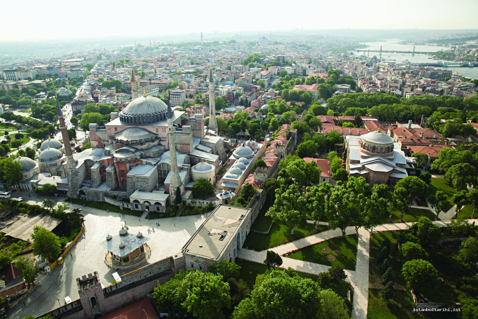
The majority of the pre-Byzantine period architectural works in the city was devastated due to natural disasters and as a result of man-made causes. Since the components of these structures were used as spolia material, they survived in the structures which were built in the following centuries. Istanbul’s Byzantine architecture is best seen in the field of religious architecture since religious structures were always in use. This is not valid for the walls that defended the city nearly for a thousand years and monuments which are related to the indispensable elements of urban life such as water structures, squares, ports and obelisks.
The earliest settlement around Istanbul is the Yarımburgaz Cave, which was inhabited in 600,000 BC and then abandoned after being inhabited during the Byzantine period for a while. In the following period, although some of the settlements were known on the Anatolian side, important findings with regard to the history of the peninsula were discovered after a small settlement consisting of clay-plastered pole structure houses from 6000 BC was found in recent Yenikapı excavations. According to the traditional myths, the earliest city established on the historical peninsula is Byzantion founded in the Topkapı Palace area in 660 BC. Among the findings suggesting the existence of Byzantion city, the earliest archaeological remains, are proto-Corinthian (BC seventh century) pottery rubbles found in colluvial soil in the Sarayburnu area. The city was annexed by Rome as of 146 BC, and incorporated into the province of Bithynia.
Several temples, squares and water facilities were created as a result of construction activities in the city administered by Rome. The city surrendered in 195 because of starvation after being besieged for two years as of 193 by Septimius Severus who was one of the commanders struggling for the Roman imperial throne. The city survived the invasions of the Goths as of the mid-third century, was partially destroyed and Claudius II defeated the Goths in 269/270 after this time the Goths were no longer a threat.
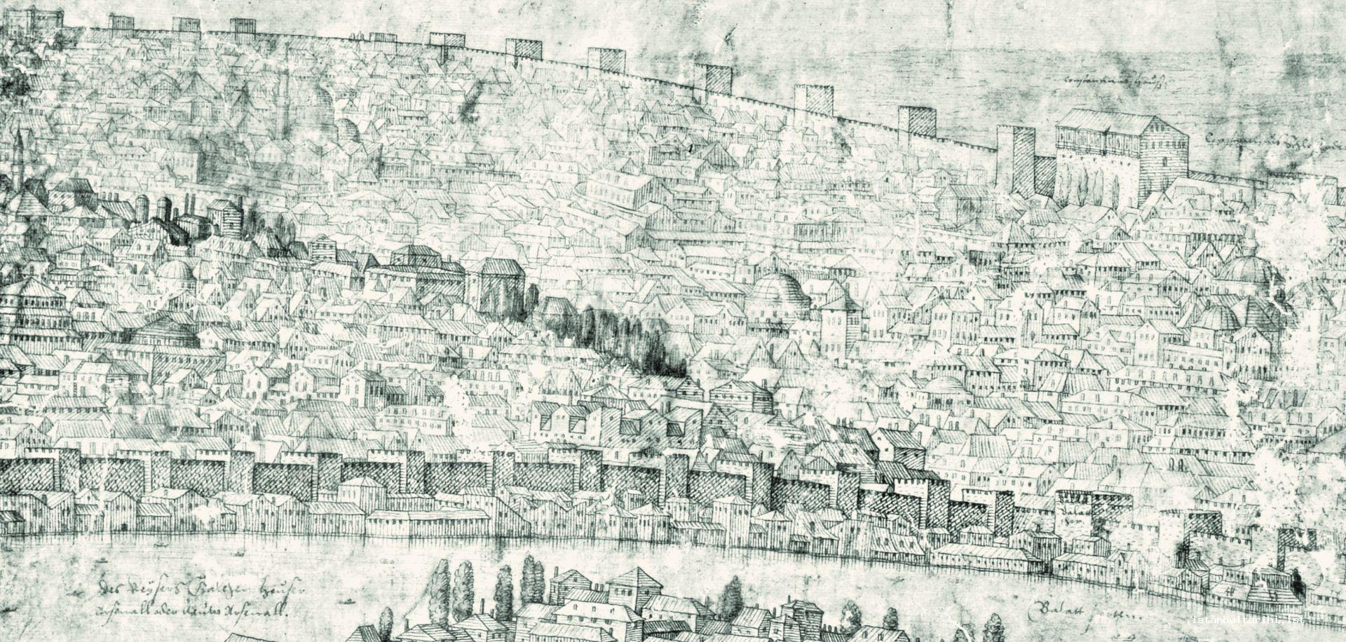
Becoming the single ruler following a long struggle for the imperial throne, Constantine I chose the city as the new capital on November 4 in 326 and the official opening of the city as the new capital was conducted on May 11, 330.
MILITARY ARCHITECTURE
City Walls
Walls constitute the most important part of the city defense. There is also another defense wall which begins 70 km away from the city. This wall, later called Germe by the Turks, was referred to with the name of the emperor Anastasios I since he built it in the early sixth century in order to prevent the threats from the west. This defense system known as the Long Wall, starts from five kilometers west of Silivri (Selymbria), covers a ground of 50 kilometers, and reaches up to the Black Sea at five kilometers west of Terkos Lake. Although this wall was abandoned due to the high maintenance costs in the seventh century, some pieces of the wall still survive today.
Land walls
It is believed that Byzantion had city walls since the seventh century BC, right after its foundation. As reported by Xenophon, one of the Athenian commanders who returned from Persia (lands of the modern Iran) where they went as mercenaries in 400 BC, as a result of a dispute with the city people, they entered the city crossing the city walls. Seizing the city in 195, Septimius Severus punished the settlers as they opposed him, and the city walls were demolished. Afterwards, the fortifications rebuilt to defend the city against the possible invasions in the following periods. Damaged during the Goth raids between 258 and 269, the city walls were repaired both at that time and later, keeping both the city and the people unaffected.
The city walls, which are thought to have existed during the reign of legendary founder Byzas, were expanded by the Emperor Constantine I right after its proclamation as the new capital city. Though the boundaries of the walls during Constantine’s reign are not known precisely, it is thought that the walls ended at a point around Cerrahpaşa Hospital in Samatya today, called İsa Kapısı or Ese Kapısı, which survived up until 1509. A part of Constantine’s walls of which nothing survives at all, was found during the recent excavations in Yenikapı.
In its current visible form, this defense system consisting of two rows with a ditch between them could only be scaled twice in almost a thousand years. The land walls are about seven kilometers long and had 96 towers and 10 main gates with about another 40 smaller entrances called as military gates. The towers are at 50-75 meters distance from each other, their average heights are 11 meters and average inner diameter of the polygonal ones are about five meters.
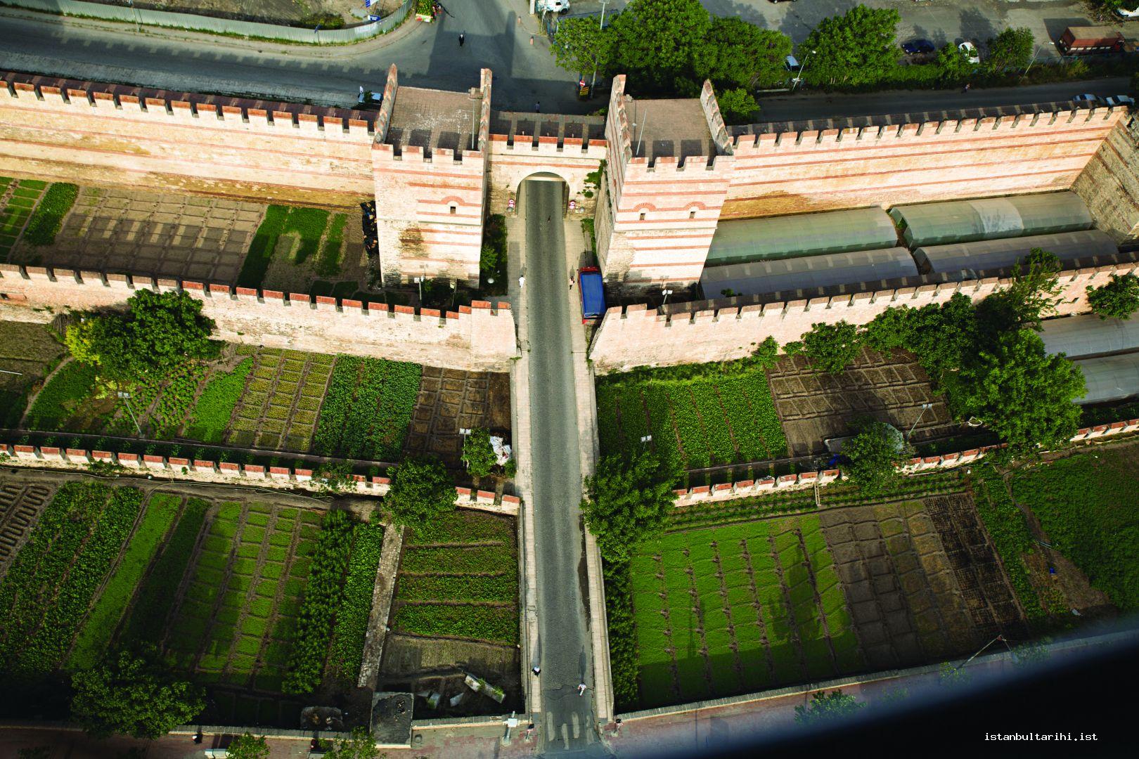
The masonry technique used for the walls, which as of that date were built generally in four rows of brick and four rows of stone with alternate course, was in use from the beginning to the final period of the Byzantine. Though brick-only walls were occasionally seen in cities like İznik (Nicaea), which are relatively in the hinterlands, this was not possible for Istanbul since brick production was time consuming and storing the amount of brick required for the wall repairs was difficult. The walls are composed of several parts: the body, bastion and gate. The bastions are generally rectangular, hexagonal and octagonal. It is understood that the bastions with dome vaults were planned so as to sustain the heavy catapults against the attackers in case of a siege.
The most important gate stands at the point called Porta Auera (Altınkapı), which would be referred to as Yedikule in the aftermath of the conquest. The entrance part of the gate that has the form of a large Roman arch with three sections was filled in time due to growing threats. On the right and left of the gate located directly in front of the outer wall of this gate in a total of twelve marble frames, there were marble reliefs portraying mythological scenes of twelve characters involving Prometheus and Heracles. These reliefs disappeared in time; today there remains only marble frames that contain the reliefs.
Built in two rows, the southern edge was in Yedikule-Mermerkule and the northern edge was in Golden Horn-Ayvansaray. As it was not possible to keep the open trench, between the two rows of wall, in such a city where the most important problem was water, and for this reason, these trenches must have been filled only in case of need. Located in the northern part of the wall, the Blakhernai area wall was built in 627 upon the order of Emperor Heraclius, and the secondary wall surrounding the former was built during the reign of Emperor Leon V in 813.
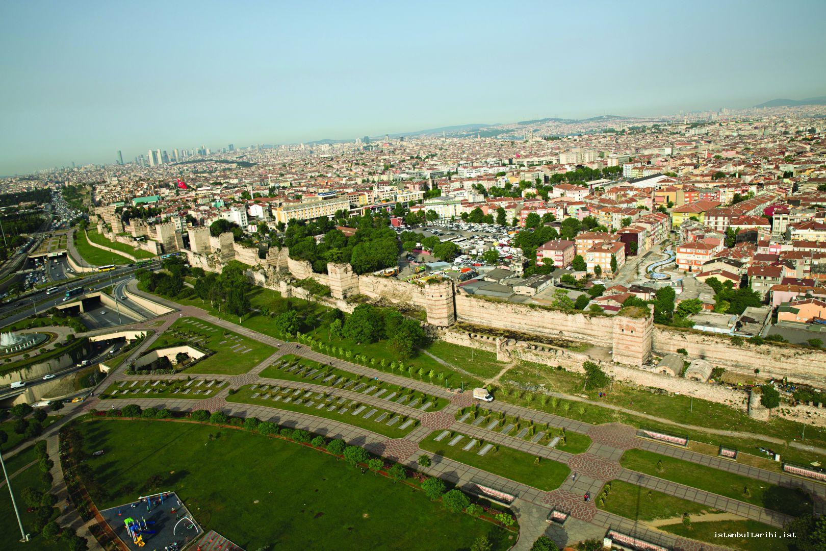
Theodosius II built a large portion of the city walls that can be seen today between 412 and 414. Although in an inscription found near Mevlanakapı it is written that the wall was built within two months, this must have been just a repair inscription since the construction of a building of this size was not possible at that time in such a short period.
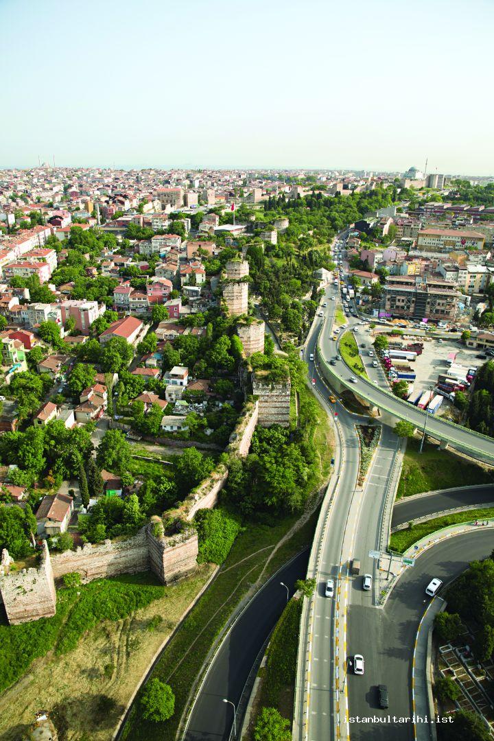
When the Ottomans besieged Istanbul, St. Romanos gate (today in the inner wall, about 50 meters south of the tramline road and the lane that interrupt the walls providing entrance to the Topkapı district) opposite Mehmed II’s tent also became the gate to the city during the conquest. The location of this gate could not be detected for a long time, but it was discovered that the gate was in the inner wall during cleaning-repair work conducted under the control of Istanbul Archaeological Museums between 1993 and 1994.
Golden Horn Walls
The length of the walls between Sarayburnu and Ayvansaray as a single line was approximately 6 km long with a total of 21 gates. Only a small number of these gates have survived today. While some of the gates used during the Ottoman period remain standing (for ex. Cibali, Ayakapı), the names of some of the destroyed gates such as Bahçekapı live as the name of the neighborhood.
Marmara walls
The Marmara section of the walls was approximately 8.5 km length and had more towers and gates than the land walls had: a total of 188 towers and 13 gates. Though some researchers assert that walls existed on the seaward side as of the early periods of the city, for a long time no city wall on the seaward side were built possibly because attacks were expected on the land side and strong winds and currents gave natural protection against attacks on the seaward side. The earliest source reporting that no seaward walls existed is dated back to 400 BC. Spartan admiral Anaksibios was able to re-enter the city from the non-walled coast of the city by a boat since Athenian soldiers prevented the entrance to the city by maintaining the wall side.
Even though it has been claimed that seawalls had been built in the reign of Constantine I, the widely accepted viewpoint is that these walls were built in 439. Shortly after they were built, the walls were damaged in the 447 earthquake and then repaired. The inscription regarding this repair could be seen in the mid-nineteenth century around Yenikapı, but disappeared later on. The winter of 763 brought the polar cold; an area for meters wide froze on the coast of Black Sea, as well as ice masses that calved off damaged the walls.
The most extensive repairs in the sea walls were done during the reigns of Emperor Michael II and his son Theophilos mainly between 829 and 842, as it is understood from the inscriptions on the walls. A very severe storm on February 12 in 1332 caused enormous damage to the Marmara walls, demolished the sea walls and destroyed the inner parts. Right before the Ottoman conquest, two repairs were carried out on the walls. The first one was carried out by Loukas Notaras who served for some time for the Ottomans after the conquest. It is documented with an inscription placed between Ahırkapı and Çatladıkapı. The other is learned from a 1448-dated inscription between Kumkapı and Yenikapı describing the restoration of a tower, which was built by Serbian despot George Brankovich.
During a railroad construction in 1871, some parts of the walls in Çatladıkapı, Kumkapı, Yenikapı and Davutpaşa were demolished. This demolition continued during the construction of a second railway line around 1910. Finally, Samatyakapı was demolished in 1913-1914.
CIVIL ARCHITECTURE
Hippodrome
Originally hosting chariot races, hippodromes were venues for the shows of wild animals and the staging of farces after the prohibition of theatre. As a venue where the public could see their emperors in person, the biggest indicator of the importance of the hippodrome politically can be understood from its direct connection with the Byzantine Grand Palace. Because archaeological excavations could not be done precisely, the Hippodrome’s correct dimensions are uncertain but it is thought to have an approximate length of 430 meters, a width of 75 meters and a capacity of 30,000 spectators. It is recorded that the rebels who were killed during the suppression of the Nika riot in 532 were buried in the arched bottom entrance divisions called Nekra across the emperor’s loggia kathisma (the region where the Blue Mosque is located today). Another change made to the Hippodrome, which fell into disuse almost completely as of the 11th century, was its transformation into a cistern by closing off the walls southward in the substructure sections of the Sfendoni area.
Palaces
In addition to the palaces in and outside the city there were also imperial palaces. While most of these palaces’ names can be learned from the sources, architectural remains of some are still visible. Magnaura and Secundiane in Hebdomon (Bakırköy); Rhegion (Küçükçekmece); Bryas (Küçükyalı); Damatris (Samandıra); Damalis (Üsküdar); Hieron (Fenerbahçe) are among the summer palaces of the Byzantine Emperors.
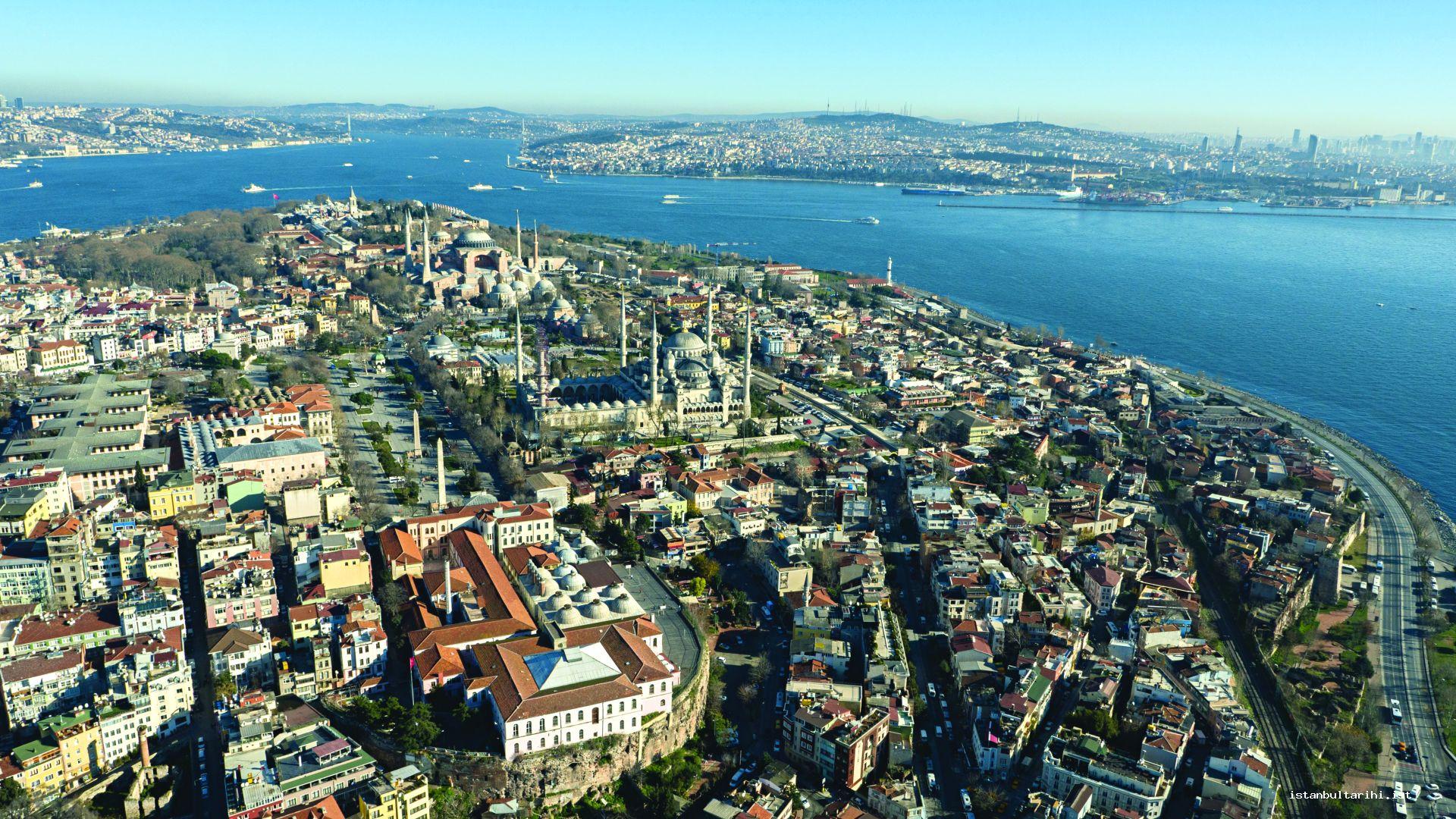
The oldest imperial palace remaining in the city center is a structure called the Grand Palace and it was in use between the fourth and eleventh centuries. Since it required constant repair after that date, it was abandoned only to be used for special ceremonies. After that date, Blakhernai Palace in today’s Ayvansaray district was used. The section known as Justinian house or Boukoleon Palace, which belonged to, the Grand Palace still stands around Ahırkapı today. The geometric decorated frescoed site, which was discovered during the excavation work carried out across Topkapı Palace entrance and towards the Four Seasons Hotel in the 1990s, was considered to be the archive building of the Great Palace. A follow-up of this excavation towards the south yielded the Halke Gate.
Mangana Palace stands in a location not too far from the Grand Palace, between Ahırkapı and Sarayburnu at a point that is now a military zone. After settlements in the same place were demolished upon an imperial decree in the eleventh century, a palace and monastery were built instead. Its derelict superstructure was demolished during the construction of Topkapı Palace after the conquest, but still surviving substructures were preserved.
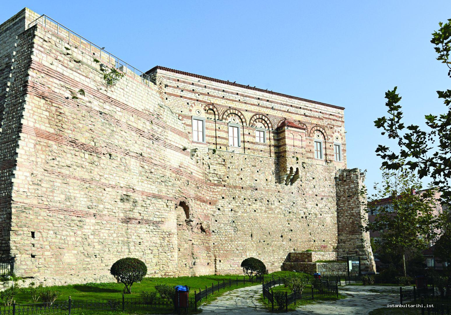
Some sections of the Blakhernai Palae to be settled as of the late eleventh century, is still in such a good condition that some parts of it can be used even today. The best-known part among these is Tekfur Palace. On the western façade, the best examples of keramoplastik decorations made from colored bricks and stones, which were widely seen especially in the last periods of the Byzantine (1261-1453), can also be seen in this structure. In addition to moving façade arrangement, it is interesting that it stands on the transition point of two rows of walls, which were built in different periods. Another interesting feature to be considered is that the small balcony in the eastward part of Tekfur Palace was used as a single sanctum.
In addition to the imperial palaces in the city, there were also private palaces. The most important among these are Antiokhos and Lausos palaces in Sultanahmet near the Cistern of Philoxenos dated to the fifth century and Princess Anicia Iuliana Palace located in the area between Istanbul Metropolitan Municipality and St. Polieuktus Church situated in the park area across this building. The architectural remains of the Palace of Lausos are still intact and furthermore, a part of this palace is used for theatre and music activities today. On the other hand, while architectural remains of the Anicia Iuliana palace dated to the sixth century are not in visible condition, the floor mosaics excavated from the palace survive in the atrium of the Hagia Eirene.
Ports
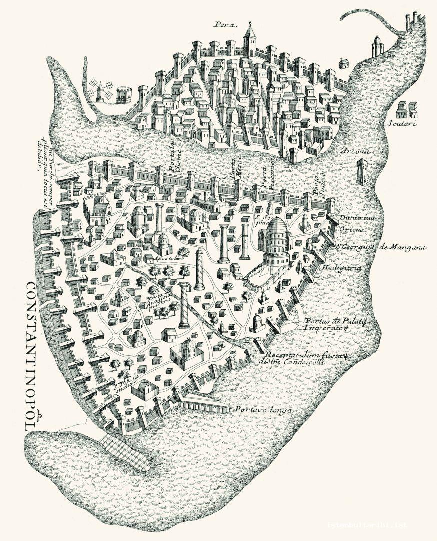
Constituting one of the most important elements of the city, both commercially and militarily, ports are lined in the south and north of the historical peninsula. Due to the repairs and changes they have undergone over time; these ports came to be referred to by different names.
It is understood from the best example Theodosius Port that the entrances of the southern ports were protected with a jetty and were also fortified by a wall with the aim of overcoming the interior defense weakness. The ports should not be considered as individual architectural structures but alongside related buildings. Accordingly, the warehouses that were supposed to be nearby should also be considered within this scope. The storehouses (horreums), the existence of which is known from the sources, are used to store items such as grain and oil and they must not have been far from the ports. However, so far, no structure has been identified as a horreum within the city.
Though no example of a port has survived in its exact form until today, their locations are certain. Especially the recent excavations carried out in Yenikapı provided detailed information about Theodosios Port, which was one of the largest ports of the ancient world and the city.
Julianos / Sofia / Kontoskalion / Kadırga Harbor
The earliest harbor in the southern part of the city was named after Emperor Julianus following his death. The natural bay, possibly on which a pier of an earlier period was located, was expanded and arranged. Given that the Emperor issued a decree facilitating the construction activities in 362 and died in the following year, it must also have been the construction year of the harbor. The same emperor also had a columned street built in order to ease the arrival to the harbor.
After the great fire of 465, the inside of the harbor was widened and deepened and a breakwater was added under Emperor Anastasius’s reign (491-518). After another fire destroyed the harbor in 561, it was restored by the Emperor Justin II (565-578) and then was named after the emperor’s wife Sophia; as Sophia Harbor. The Julian and Sophia harbors are the same. Port Julianus became the main harbor for wholesale trade in the eighth and ninth centuries. It is believed that this harbor was used with the name of Kontoskalion afterwards and possibly became one of the Byzantine naval bases. It is known that Emperor Michael Palaiologos VIII (1259-1282) restored the Kontoskalion Harbor to the Byzantine main naval base after the city was re-seized by the Byzantines in 1261.
In 1462, renovation activities were carried out under the name Kadırga Harbor for use by the Ottoman fleet. The harbor was filled upon the order of the Grand Vizier Sadrazam Sokullu Mehmed Pasha at the end of the sixteenth century since the palace, which was located in the same area, was affected by the malodor that the pier emit.
Port of Theodosius
At the end of the fourth century, a new harbor was built by the emperor Theodosius I at the point where Likos (Bayrampaşa) Stream flew into the sea in a bay recessing deeply, and it was named after the emperor. Although archaeological excavations have been carried out in the harbor by now, the boundaries are not yet known. As far as it is understood from the vessels found in the excavations, the use of the harbor continued until the 11th century. Being abandoned after the twelfth century, the harbor became a debris concentration place.
Eleutherios / Kaisarios Harbor
That Eleutherios Harbor and the palace with the same name were located more to the east is a more likely-to-be accepted view today as the sources of the period have been examined well. Eleutherios Harbor was filled because of the debris removed from the construction of Theodosius Forum. Eleutherios Harbor was possibly named as Kaisarios Harbor as of the Middle Age.
Port Boukoleon
Port Boukoleon is known to have existed from the sources, although its exact location has not been determined, functioned in the east of the Kontoskalion ports as the pier of the Grand Palace rather than a directly affiliated commercial or military port with the palace.
Emperor Theodosius II built a palace in the region in the fifth century. This new palace, built in the third quarter of the tenth century, is also known from the sources although no mention was made of this in the following centuries. Emperor Constantine the Great Porphyrogenitus’s Books of Ceremonies of the tenth century is the earliest source that refers to this palace and the harbor. In the twelfth century, Anna Komnene states in her book History, this marble covered harbor was named after a group of large cattle and lion sculptures, because of this not only the small harbor but also the palace was called with the same name. In the north of the harbor, there is a building called the House of Justinianus, which was a part of the Grand Palace, constituting a complex with the terrace and the remains next to it. It is thought that this part contradicts the name of the building and was renovated during the repair activities on the city walls in the ninth century. Apart from this sculpture group, marble lion sculptures were situated on the sides of a balcony and three-arched span behind this balcony were witnessed by the travelers and researchers of the eighteenth and nineteenth century as well. This three-arched arrangement was still in viewable condition as of 1850. There are photographs dated to 1914 showing the proximity of the building, called the House of Justinianus, to the sea and the whole view of the façade. Although these arches got lost in the railway construction of 1871, the marble lion sculptures were taken to Istanbul Archaeological Museums.
Boukoleon Harbor was directly connected with the Grand Palace for the purpose of providing convenience for the emperor when traveling within the city by sea. Before reaching the marble stairs of this harbor, sculptures of a lion, bull and ostrich could be seen. However, these sculptures were probably devastated after the earthquake of 1509. As an evidence to this, the depictions of ambassador Pietro Zen could be considered since he only describes lion and bull sculptures in detail. Pietro Zen was sent to İstanbul in 1532. Possible images of this port and palace have recently been drawn. In the second half of the thirteenth century, the palace was turned into a palace church referred to as St. Michael by the Latin who possessed the city. As of the sixteenth century, the imperial palace was abandoned. The small harbor, which was only reserved for the use of the imperial navy, was also the arrival spot for important guests like Seljukid Sultan Kılıçarslan II who came to the city in 1162 or the King of Jerusalem Amaury in 1171.
The destruction began in 1871 due to the railroad construction, followed by the fire on June 3, in 1912, and the coastal road whose construction began in 1957 led to the loss of important information about the Boukoleon Port.
Neorion Harbor
Neorion is known today by the same named small square located near Yeni Cami, with the other Golden Horn harbors which exist from the foundation of the city. It is known that this harbor has semi-circular porticos at the connection point with the city. The harbor and the nearby buildings suffered great damage in the fires of the fifteenth and sixteenth centuries. The cleaning of the mud from Neorion Harbor in 698 indicates the growing need here, thought to be near the Eminönü Yeni Cami. This process was held responsible for the plague that broke out immediately after dredging and it was regarded as bad luck. Venetians and Amalfitans settled to the west of the harbor as of the tenth century, then came the Pisans in the eleventh century and finally the Genoese established themselves in the south and east of the harbor beginning from the mid-twelfth century. Even though the harbor lost its importance because the Jews settled in the region with the Genoese, only the Neorion Gate began to be referred as the Çıfıt Gate commencing with the Ottoman period and the name Neorion was expunged completely.
Prosphorion Harbor
Grain was the foremost commodity since the foundation of the city. As an important source on the city history and monuments, Notitia Urbis Constantinopolitanae (fifth century) mentions warehouses, which were located near the harbor and in the vicinity. Prosphorion Harbor is thought to have been located in today’s Sirkeci. It is known that the harbor was used for a long time, and Venetian merchants were allowed to trade grain by using this port in the fifteenth century.
Water Plants
Aqueducts
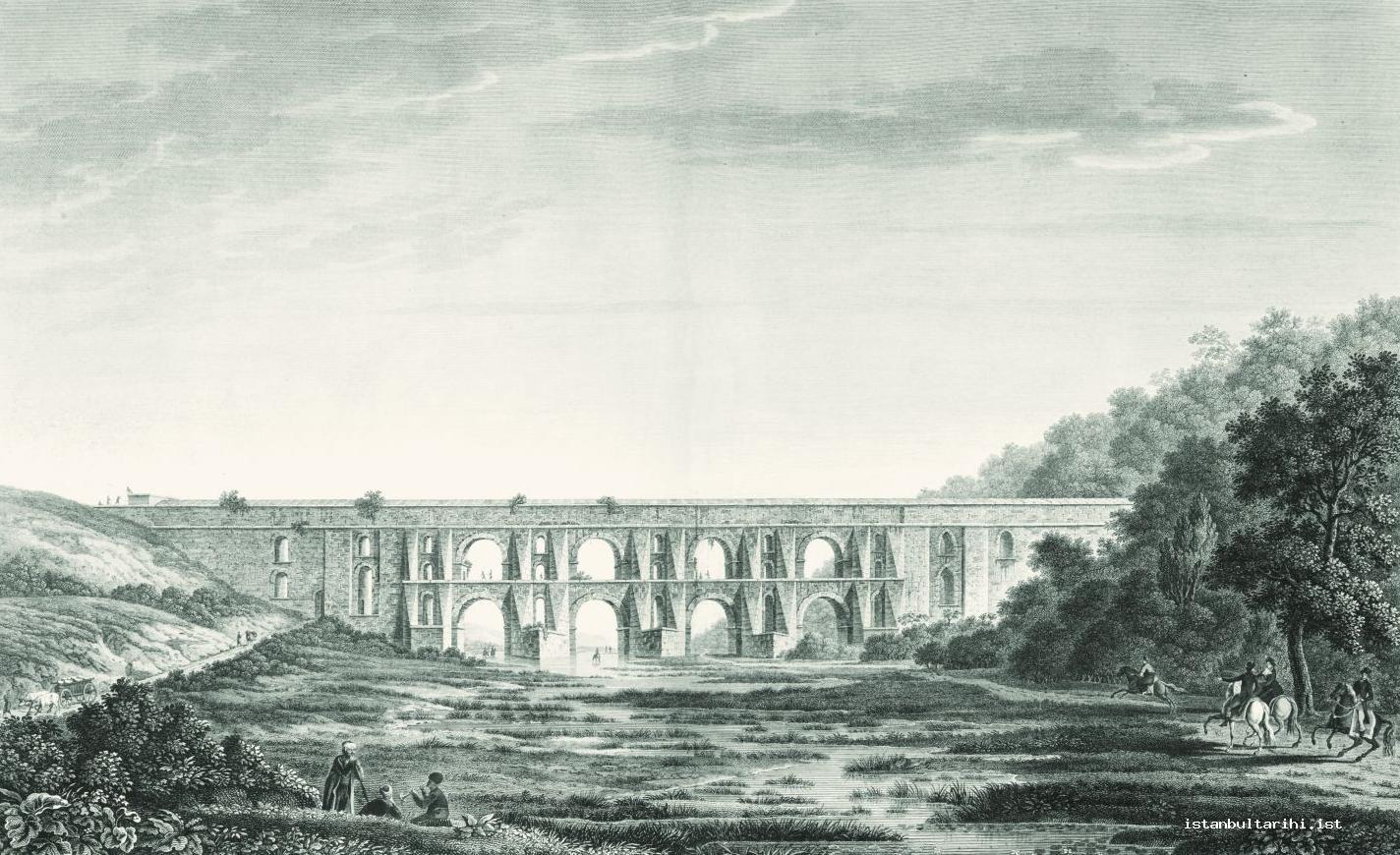
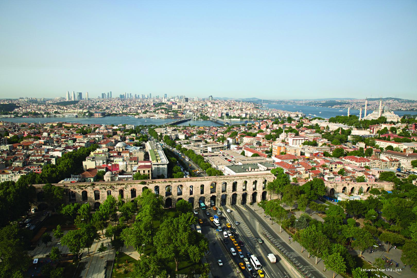
The first aqueduct in the city is known to have been built during the reign of Emperor Hadrian (117-138) in the second century. Undoubtedly, some arrangements and plans must have been made for water, the most basic need of the city after being proclaimed as the new capital. However, there is not an aqueduct that can be dated back to Constantine I or his successors’ period. On the other hand, surviving to this day, the aqueduct named after the Emperor Valens (364-378) and built by him, was completed in 373. It is known that, damaged by Avar attacks in 626, this aqueduct continued to be used in a small scale, and had an extensive repair in 767. The latest repair records regarding the aqueducts and water facilities belong to the first half of the eleventh century.
It is not possible to find any traces of an aqueduct though a tenth century source mentions the existence of an aqueduct in today’s Cerrahpaşa district, which was referred to as Xerolophos (Dry Hill) during the Byzantine period since it was one of the districts where water was scarce. Among the aqueducts included in the systems called the Kırkçeşme and Halkalı waters during Ottoman times, it is possible to see the traces of Byzantine architecture albeit small in Büyük Bent, Kovuk, Uzun, Mazul, Kara, Viran, Veysi Baba and Kahveci aqueducts. Based on either these or the aqueducts in Thrace, which have survived in much longer parts, it can be said that the water need of the city during the Byzantine period was provided mainly from Thrace and the west of the city. Whether the nearby Belgrade Forest was used as a water basin is a claim that has not been proved.
Cisterns
Cisterns were built in the Byzantine period when required. Starting in very large sizes, these structures were built in much smaller sizes over time and were also sometimes created by adding new functionality to the building different from its original function. As of today, the number of cisterns in Istanbul within the walled city is more than 100.
Outdoor cisterns
Outdoor cisterns whose likes were also seen in the Roman Empire are notable for their massive sizes. Except for the 126x86x9 meter Fildamı Cistern located in Veliefendi/Bakırköy outside the walled city, there are three other cisterns within. Each located on a hill, these cisterns were built with stone-brick alternating masonry. There are slight traces of hydraulic plaster used for preventing the leakage of the large amount of water they held. Also, another perspective is that the loss of water was at acceptable levels in these continuously fed cisterns where this plaster was not used. Losing their original function in time, these cisterns were used as gardens in the Ottoman period and referred to as “çukurbostan” among people since they were located at a lower level compared to the surrounding buildings and streets. By their periods, the names and construction dates of the outdoor cisterns that were referred to as Karagümrük Çukurbostan, Çarşamba Çukurbostan and Altınmermer Çukurbostan are as follows: Aetios Cistern dated to 421 (Karagümrük Çukurbostanı -Vefa Stadium, 242x83x16 m in size), Aspar Cistern, which was built in 459 (Çarşamba Çukurbostanı Fatih/Çarşamba, next to Çarşamba Yavuz Sultan Selim Mosque, 150x120x13 m in size), and Mokios Cistern thought to have been built under Emperor Anastasios I’s reign at the end of the fifth century (Altımermer-Fındıkzade Çukurbostanı 168x145x12 m in size). All these cisterns were built in alternate wall masonry technique, in the form of several rows of bricks and stone. During the Avar attacks in 626, the Valens Aqueduct was partially destroyed and no water could be provided to large size outdoor cisterns as a result. It is possible that after this date, the system carrying water to the city existed though not as strong as before. Maintenance work continued in the following period on a small scale. A large-scale maintenance in real terms was carried out only during the severe drought in 767. Though it is difficult to determine precisely when these cisterns fell out of use, it is possible to say that they gained a new function in the last periods of the Byzantine and turned into farmland. The failure to find traces of materials and maintenance of the following years support this argument.
Underground cisterns
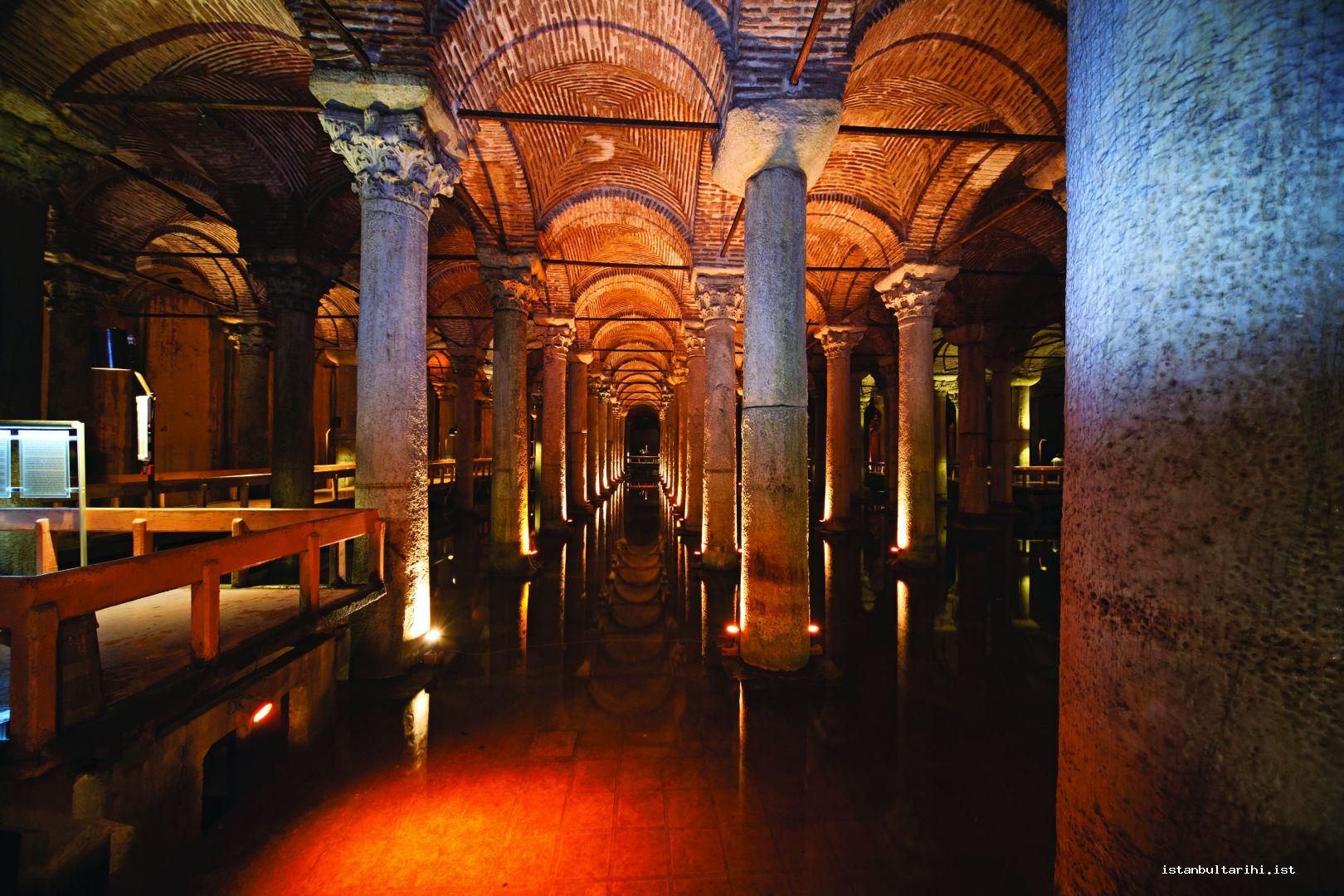
The largest underground cisterns are concentrated especially around today’s Sultanahmet, the area that constitutes the city center. They were built in order to support situations when outdoor cisterns, which were built a century ago, failed to meet the demand. The practices of hydraulic plaster and the rounding of the walls at the baseboard level that can be seen in small parts of outdoor cisterns can be observed in almost all of the underground cisterns. The floors of the underground cisterns were mainly covered with bricks.
One of the largest cisterns providing water to the Grand Palace which is located in this region and other buildings in the vicinity, the Cistern of Philoxenos (63x56x9m in size) is thought to have been built by Philoxenos around 525. Following this, referred to as the Sunken Cistern today, the Basilica Cistern (135x68x8 m in size) was completed. According to the sixth century historian Procopius, for the construction of this cistern, which became a necessity after dry summers, the open court of the basilica in the same place was partly demolished and for this reason the structure called the Basilica Cistern was completed in the early 530s by the order of Emperor Justinian I. In order to save money and time the column shafts, bedplate and column headings that were brought from other parts within the building were used. 336 columns were used in the building of 140x70x11 meters in size.
Spaces converted into Cisterns
The most important space among the structures with a different purpose that were converted into cisterns is the one located in the Hippodrome. The southern part of the Hippodrome, which was rarely used for its original purpose as of the eleventh century, was converted into a cistern. Even though the exact time of this conversion is unknown, Buondelmonti’s illustration right before the conquest portrays that there was a very large cistern under the turning section in the south called sfendoni. Another example is the cistern of Myrelaion’s Monastery (Bodrum Mosque). This space, which is thought to belong to the fifth century, was converted into a cistern during the construction of the monastery in the tenth century.
Squares-Obelisks
The city has a different plan from its predecessor, Rome. Reconstruction activities carried out in Rome especially after big fires are not a part of the construction activities in Constantinople. For this reason, the additions made time to time as needed has shaped the city.
While some of the urban squares like Philadelphion, and Amastrianon are known from the sources, some should be considered as obelisks and small squares that were supposed to be around them. The most important square in the city was Augustaion whose name is based on the title of Constantine I’s mother Helena, which is the equivalent of the title Augusta, meaning queen in Latin. While the boundaries are not exactly known, it must have been Mese Road in the west, Senate building in the east, where the Four Seasons Hotel Garden sits now, and Zeuksippos Baths in the south (fountain park today). Use of this square continued in the following centuries and Emperor Justinian I (527-565) had his equestrian statue placed on top of a column bearing his name. Though demolished now, it is learned from the accounts of a local author Paspates that this statue could be seen even at the end of the nineteenth century. No archaeological study has been carried out in this square. However, during the excavations conducted in 2011, a sixteenth century hollow water fountain, in which collected Byzantine parts were used and the existence of which was previously unknown, was discovered. Excavation of the water supply of this fountain or other Byzantine structures in the area will take place at the end of another repair or excavation activity.
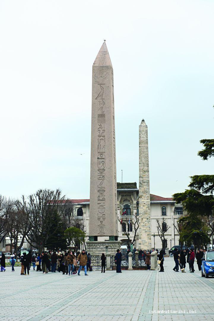
A single-piece pink granite Egyptian obelisk in the central part of Hippodrome was erected during the reign of the pharaoh Thutmosis III in BC fifteenth century was possibly brought to Istanbul in Emperor Julian Apostate’s (361-363) period; however, it was placed to its current location approximately 10 meters shorter than it was made in Theodosius I’s period (379-395). Not very common in the following periods of Byzantine art, there are marble reliefs on it depicting two brothers Honorius and Arcadius with their father Theodosius, after whose death the Roman Empire was divided between his sons. Next to this, as understood from the inscription on it, there is the walled obelisk, which was repaired in the tenth century. It was possibly erected by Constantine I, and the gilded bronze plaques covered on it in the repairs of tenth century were ripped off by the forces of the Fourth Crusade.
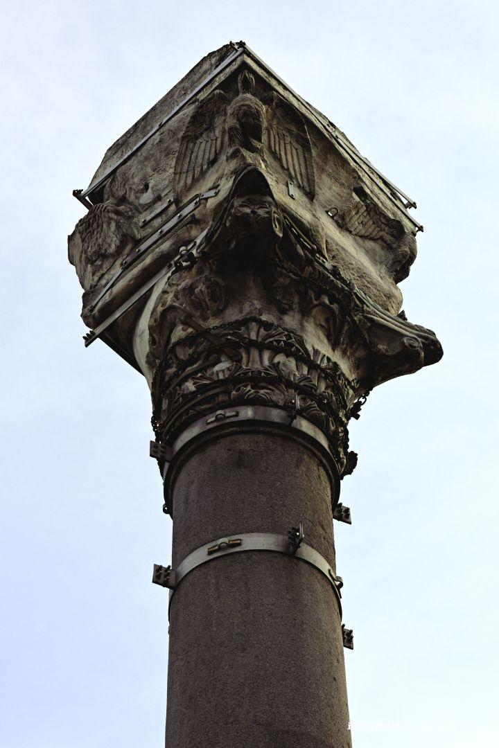
Column of the Goths, standing at one of the closest point of Gülhane Park to Topkapı Palace, is referred to with this name as Emperor Claudius Gothicus’ name was mentioned in the inscription on it. It is known that Goths attacked the city between 258 and 269 and finally were defeated by the Emperor Claudius II. The columns are thought to have been erected in memory of this event.
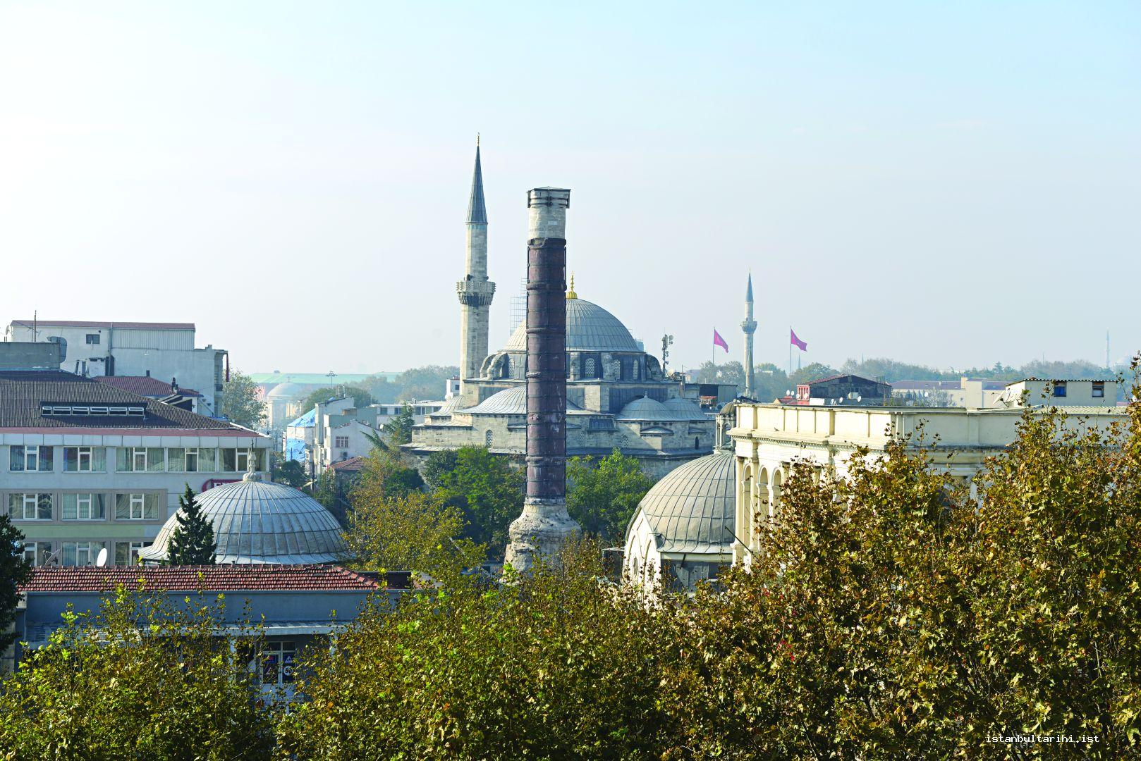
In the period when the obelisk Çemberlitaş – as it is called today – was erected, a forum surrounded it, which was a rare example in the ancient world due to its circular shape. The founder of the city, Constantine I (324-337), built this forum. In some sources, The Forum of Constantine is also referred to as Foros. In the period when the obelisk was built, it was standing right in the center of the square and there was a crowned statue of the Emperor Constantine. The statue fell down in the early twelfth century after an earthquake and was replaced with a large size cross. A related inscription for the repair was cleaned during the repair in 2007 and the entire long inscription, which was partly put upside down in the previous repairs, was straightened.
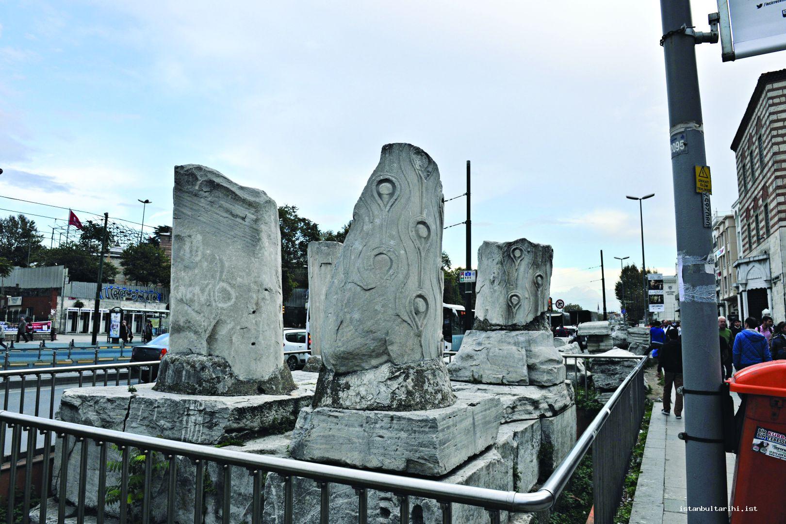
Whereas the exact date of Forum Tauri-Forum of Theodosios’s construction of whose parts were found across and next to Istanbul University Faculty of Letters between Beyazıt-Laleli is unknown, it is known that this forum was built in the time of Constantine I, or his successor Valence, and was rearranged in the time of Theodosius I to be opened in 393. Though the reason for naming the square as Tauri is not known for sure, it is claimed that this name was based on the name of a mayor or a bull statue that stood in the same location (tauros=bull). There is nothing left today from the column in the center of the square on which the equestrian statue of the Emperor Theodosius stood. On the other hand, parts of the three-vaulted triumphal arch can be seen both on the roadside and in the lower parts of Beyazıt Hammam where they were used as spolia construction material.
A part of the pedestal arch, which is thought to belong to Forum Bovis in the south of Murat Paşa Mosque in Aksaray today, was found during the construction of Vatan Street in 1956. This square, which is mentioned in one of the important sources about the city, Notitia Urbis Constantinopolitanae, dated to circa. 425, was probably built on a previous date. The reason for naming this square Bovis, which is the Latin equivalent of the Greek word bous=cattle, is the massive bronze statue of cattle brought from the ancient city Pergamon (Bergama). This square was also used as a livestock market and for executions. The square was last mentioned in the sources in the eight century. It is possible that it was not mentioned after this date because of the damage caused by the earthquakes.
Only the pedestal of the same-name column is extant from the Forum of Arcadius located approximately 150 meters ahead of Cerrahpaşa Mosque in the area of the same name. It is known that the Emperor Theodosius II completed the square and the column in the middle on which the statue of the Emperor Arcadius stands. The square’s completion date is thought to be 435. The statue on the column, which was destroyed during the earthquakes in the sixth century, toppled and was not renovated. Writing a guidebook for the city in the 1540s, Pierre Gilles did in-depth research of the column that included a spiral staircase inside, which enabled people to climb to the top. However, probably in the aftermath of the earthquakes in the sventeenth century, the spaces in the forum were devastated and the column was damaged presenting a threat. Therefore the Arkadios column was demolished on November 26, in 1711.
Another column surrounded by a small square like today was erected by the Governor Tatiatus around 450 in the name of the Emperor Marcianus; due to the Nike images on it bringing the victory, it was referred to as “Kıztaşı” in the Ottoman period. On its base probably depicting the emperor Marcianus, there are the letter remains of an inscription, which mentions Tatiatus, the person who erected the column. For the most part, the spaces where the letters were once placed, that were possibly made of bronze, are empty today. An abbreviation for the name of Prophet Jesus, a Christogram is depicted on the two round shields held by two Nikes. This practice was frequently followed in monuments as well as in tombs in order as a reminder that victory can come not only in this world but also with the help of Prophet Jesus.
RELIGIOUS ARCHITECTURE
A large part of the structures representing Byzantine religious architecture in Istanbul are monastery churches. Istanbul hosts more than 500 churches, which are cited in the sources and were built in different periods. Since they aimed at abstention from earthly affairs and worshipping by the purpose of foundation, the monasteries that were established in the provinces and in distant places by force of the changing conditions were founded in residential areas in order to guarantee the future of the ruling class in the old age or in the aftermath of a possible political change that could have resulted against them.
Monastery churches were representative of religious architecture in the best condition as they were built more meticulously, with more durable material that was also used for repair over centuries compared to the secondary structures located in the monasteries. However, community churches like Hagia Sophia and St. Irene are the best examples of religious architecture since they have always remained in use although their functions have always changed. These structures have played a very important role in architectural history from their construction until today.
Plan types used in the church building can be classified as follows: (1) the Basilica, (2) the domed Basilica, (3) the centrally planned, (4) Greek Cross (tetra conch), (5) Latin Cross/Cross-in-square, (6) Ciborium, (7) Trefoil (triconchos) (8), single nave, and (9) Vestibule.
A basilica has a hipped roof, is longitudinal rectangular, which is wide in the middle (naos), with sections are narrower in the north and south, ends with an apse to the east, and has a courtyard (atrium) in the west. Among these kinds of structures are Topkapı Palace Basilica in front of the treasury building in the second courtyard of Topkapı Palace; three buildings referred to as Beyazıt Basilicas that were discovered during the construction of Istanbul University Faculty of Letters Vezneciler building; and derelict Halkoprateia Basilica on the left while coming down from Hagia Sophia to Gülhane. However, Studios Monastery Church is the one in the best condition among the derelict and unnoticed buildings. As a non-Byzantine structure, another building in this plan type is Arab Mosque in Karaköy Perşembepazarı.
The best examples of a domed Basilica are Hagia Sophia and Hagia Irene. In these structures, the hipped roof was replaced with a dome seated on the middle space.
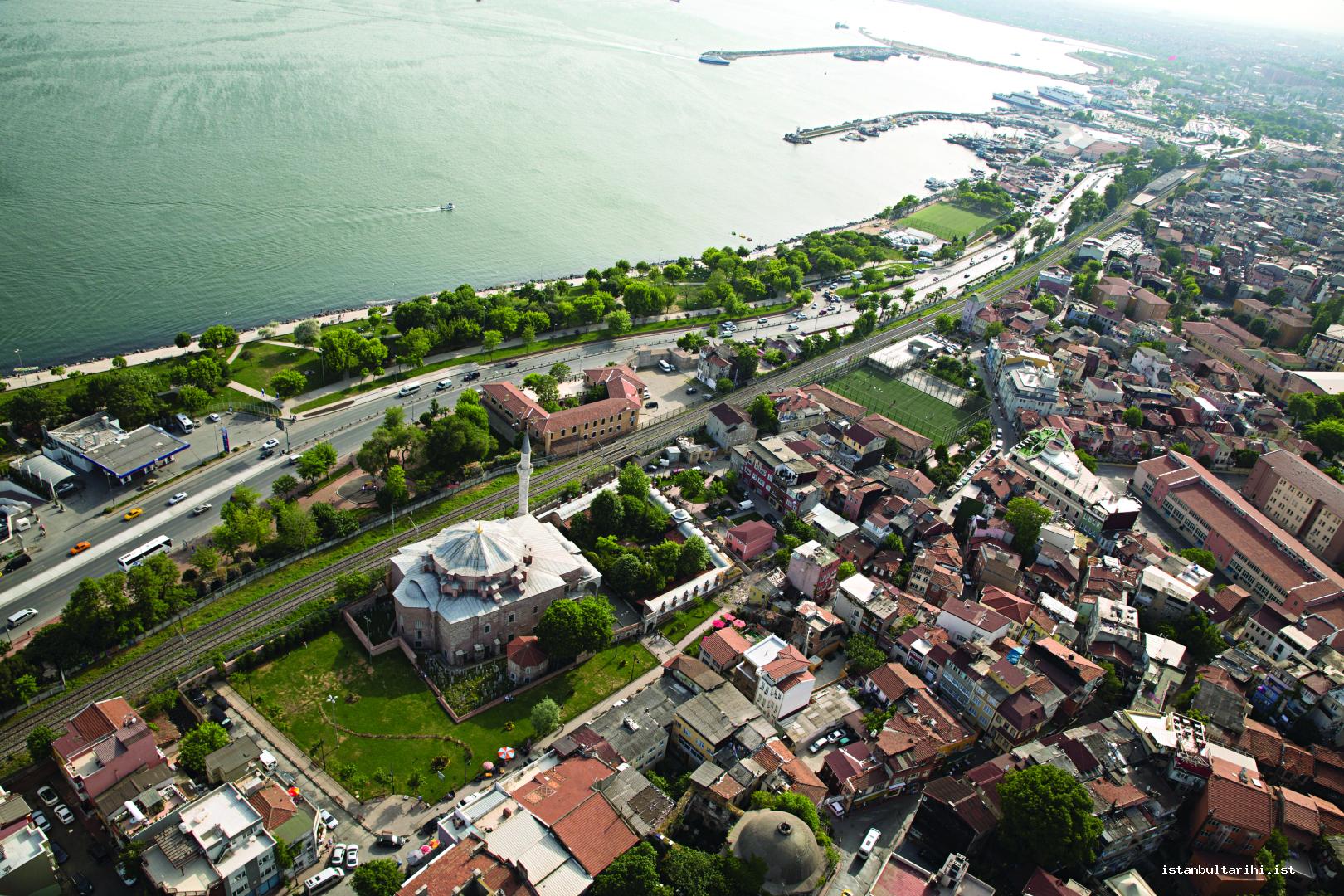
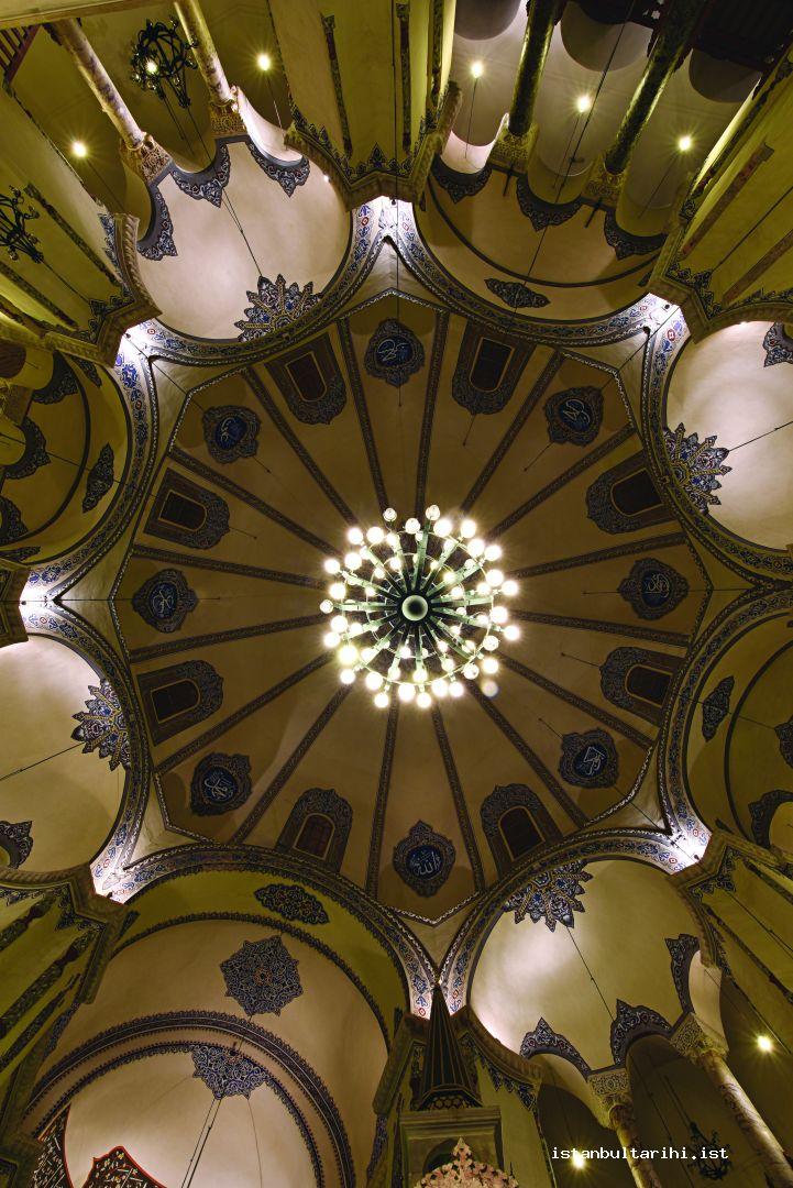
Centrally planned structures are often the continuation of Roman monuments, have round, hexagonal or octagonal plans and their main space is surmounted with a large dome. The best representatives of this plan type are Sergios and Bakkhos Church (Little Hagia Sophia) that have a square plan on the outside and octagonal plan inside. In addition to this, St. Menas under Karpos Papylos Church in Samatya is another structure, which was used as a church with its unclear main function. Smaller examples with this plan are Balaban Ağa Masjid, Hebdomon (Bakırköy) St. Johannes Prodromos, which is not in existence today, Sancaktar Hayrettin Masjid and Şeyh Süleyman Mosque.
There is no example of a Greek cross plan type church in Istanbul today. However, the church, which was dedicated to the 12 apostles of Prophet Jesus and is thought to have been located in the same area with Fatih Mosque was one of the most important structures of the period and the best representative of this church type.
Cross-in-square plan is a smaller structure in size compared to the others, in which the dome on the middle space is sustained with cradle vaults in equal length to all directions.
The Ciborium, the section that surmounts the altar in the bema and is the most sacred part of the church, describes churches in which the dome is elevated in a similar way. The only example of this in the city is Chora.
There are two examples of the trefoil layout, which has a cloverleaf shape, in which the semi-circular apse projection is also applied in the northern and southern sides of the building. The first of these is Hagia Maria Church, which preserved its plan type despite the radical changes it has undergone till today; and the other is Panagia Kamariotissa Church located within the boundaries of Heybeliada Naval High School.
Single nave churches are small in size considering their dimensions. Five examples of this are known in the city. Though the function of the first, Kefeli Masjid, as a church is not precisely known, it is generally regarded within this type. Another building is the structure, which is referred to as Chapel of Palace of Bogdania and only has a substructure today. As an interesting feature, this building is northbound unlike the other churches and therefore its apse is northward. The other three structures, Sinan Paşa Masjid and Ayakapı chapels’ apses are eastward. The last structure of this type is Toklu Dede Masjid, destroyed over time, and only a part of its northern wall remains under the house that was built on it.
As the only example of the vestibule plan type, the Constantine Lips Monastery is sustained by walls that are under the dome in the south building. The vestibule plan type was deemed appropriate for the structure because of the narrow and dark section formed between the walls and side sections at the ceiling level.
In this part of the article, information on some of the buildings with special importance will be given within certain limits instead of each religious building of the Byzantine period in the city.
Basilica Plan Type
Agios Johannes Studios Monastery Church (Imrahor Ilyas Bey Mosque)
This church, built in 454, is the oldest religious building in the city. While the building was referred to as Studios because the senator undertaking the construction, since the skull of John the Baptist was brought there, the name Johannes was added in time. It is built in a traditional basilica form, with a naos in the middle, narrower side sections in the north and south, in which a narthex enables entry to these sections. However, the parts belonging to the atrium of the structure do not exist today. While the west viewing windows of the top floor survived, the others disappeared over time. The columns in the southern row also disappeared over time but the column row in the north stands with metal supports. There are opus sectile flooring mosaics in the floor, which are made by inlaying colored stones into the small ditches. In the eastern part of the building, a crypta lies right in front of the apse section. Cross images were made with brick in the northern façade and on the enclosure wall of the church building. After its transformation into masjid, a wall was built in order to create a mihrab towards qibla. The Russian Archaeological Institute in Istanbul conducted the only archaeological excavation inside the building by the early twentieth century.
The monastery came to a very disciplined state in time and due to the incessant hymns recited, it came to be called as akoimetoi (the sleepless-ones) by the locals. The disciplined system built by the famous monk of the monastery, Theodoros served as a model for monasteries founded in different regions. It was converted into a mosque by Emir Ahur (Ahır Emiri) İlyas Bey in 1486 in the Ottoman period. Due to changes it underwent over time, Emir Ahur changed the name to İmrahor.
Arap Mosque
This gothic church built in the fourteenth century is important even just with this feature. This is the only Gothic church in Istanbul discounting the churches built in Neo-Gothic style in the nineteenth and twentieth centuries. Having a basilica plan when it was built, today this building is perceived as a single-space because of the changes it underwent over time. An important feature of the building is the bell tower located in the southeast corner. Today this tower is used as the minaret.
Byzantine fresco masters worked in the building, which was originally founded with the name San Domenico e Paolo, during its construction. Made probably in the first decade of the fourteenth century, these frescoes appeared only after the plasters in front of mihrab fell partly in the 1999 earthquake. The frescoes made by Byzantine masters working for the Catholics were discovered in the following years, during extensive repair works.
The structure is thought to have been converted to a mosque at the end of the fifteenth century. It is a traditional legend that the mosque was called as “Arap Mosque” because it was transformed for the Muslims who were migrating from Andalus. Because the last of the tombstones found in the building is dated to 1475, conversion of it into a mosque must have been earlier than this date.
Central Plan Type
Sergius and Bacchus Church (Little Hagia Sophia)
Justinian I built a church in the name of St. Peter and Paul before Sergius and Bacchus Church. This construction must have been completed before 527, probably around 520, before he received honorary titles and became an emperor. From a letter dated 519, it is learnt that Justinian requested some holy relics from Pope Hormisdas for the new church he was building and received a positive reply. The palace, where Justinian resided for seven years before he became an emperor, was referred to with the name of Sassanian Prince Hormisdas (Hormozd) who had taken refuge in the Byzantine. He continued construction activities with this church that is adjacent to the palace with a joint entrance and a secondary church, St. Sergios and Bacchus, and he combined Hormisdas Palace with the Grand Palace after he became emperor.
Ravenna San Vitale Church is similar to this structure, which has the form of an octagon inside and square plan on the outside. The dome of the building has sixteen ribs and there are windows in half of these. The columns and their heads in the building are made specifically for the building. There are two rows of columns in the building. Names of Justinian I and Theodora, who was his mistress before becoming an empress, are praised in the long inscription on the marble frieze, which runs along between the first and second floors of the whole building.
Whereas the reason for the construction of St. Peter and Paul Church is seen from Justinian’s real name Petrus, the reason for building another church dedicated to St. Sergius and St. Bacchus was different. Accordingly, when his uncle and Justinian were about to be put on trial for an alleged involvement in a coup plot against the Emperor Anastasius, they were saved with the miraculous intervention of St. Sergios and St. Bacchus. He is then thought to have built a church dedicated to them.
Although the exact place of St. Peter’s and Paul’s Church which has a joint entrance with St. Sergios and St. Bacchus Church is unknown, it is thought that there was a joint wall in the southern part of the other structure due to the wall thickness of the southern front of St. Sergius and St. Bacchus Church and the large arches. However, we are of the view that St. Peter and Paul Church must not have been built here because of its distance to the sea walls and because of the door situated at the place where a church is supposed to be. Therefore, it will be right to look for this building not in the south but in the west of the existing one. Indeed, some architectural remains supporting this claim were discovered in front of the house of the mosque’s Imam. Another example of building similar to this is Ephesus Mary Church.
As a pilgrimage center between the fourteenth and fifteenth centuries due to its Holy Relics, this building was converted into a mosque about 60 years after the Ottoman conquest, around 1510.
Domed Basilica Plan
Hagia Sophia
Known as the Holy Wisdom of God, the name of this structure in the fourth century when it was first built was the “Great Church.” Built on the site where Basilica Cistern is located today, this structure was demolished after a revolt in 404 and replaced with a new church in its current location in 415. In January of 532 during the Nika Riots opposing Justinian I, the new building was also demolished, and the current structure was built on the same site. Transformed into a mosque following the conquest, this structure was converted into a museum in the early 1930s.
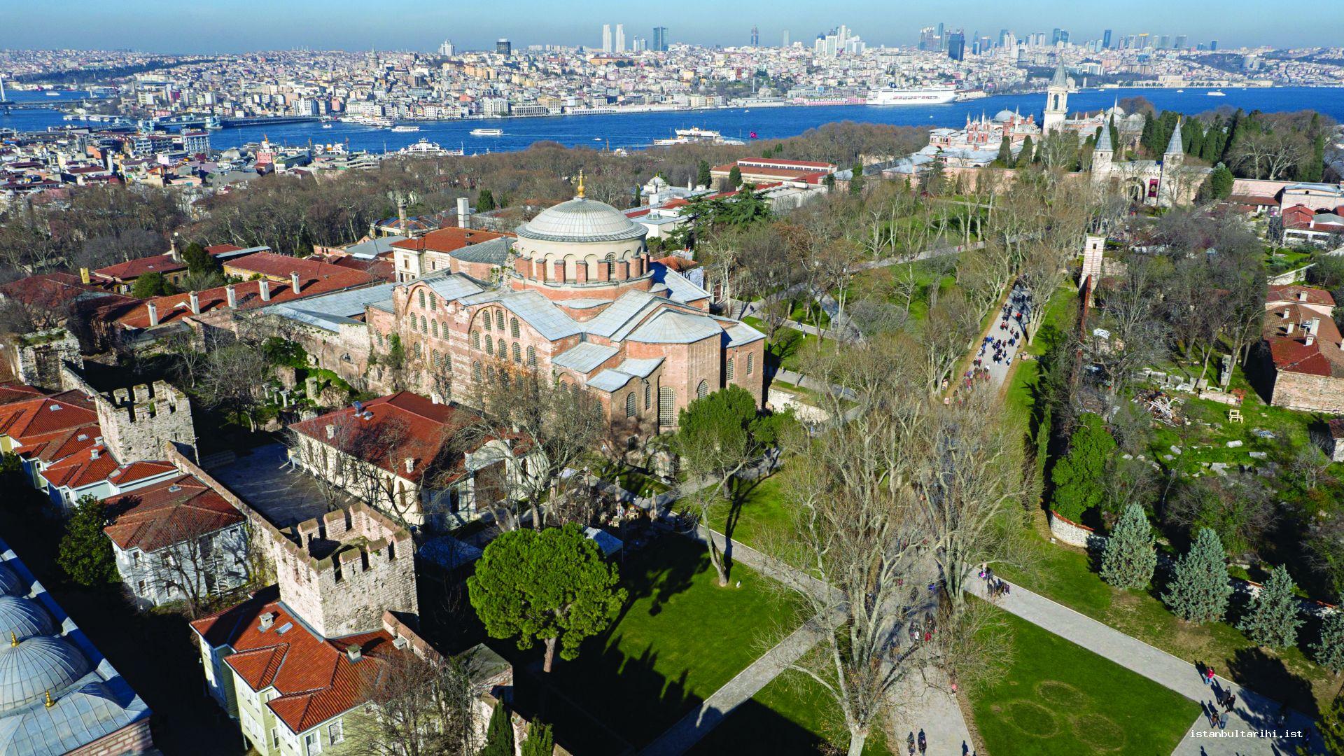
Hagia Eirene
One of the three churches in the city built by the Emperor Constantine I, the meaning of its name is “Holy Peace of the God.” Although no information is retained regarding its architecture at the time of building, it was probably in basilica plan as the other buildings of the period. The building was demolished during the Nika Riots, which broke out right after the ascension of Justinian I to the throne. It was rebuilt in the aftermath probably in the fourth century. The later structure is a domed basilica. In order to save time and money, spolia was used in the construction. In the building, both in the flooring, walls and arches, mosaics were used. Also, there are frescoes with geometric decorations in the ceiling of the southern nave and a derelict figure depicted with a halo in the upstairs south-eastern section. A massive cross in the apse among the mosaics is regarded as one of the most important representatives of the iconoclastic period. The Hagia Eirene was not transformed into a mosque in the Ottoman time but while it was a space to exhibit war spoils, it was transformed into a museum to be the first in the country.
Cross Domed Plan
Havariyyun (Agioi Apostoloi):
It is thought that the construction of this church of which nothing at all survives today was started by the Emperor Constantine I and completed by one of his sons Constantine II. The building was described in detail by the historian of the period, Eusebius. It is known that during the time it was built, it was aimed to collect and preserve the holy remnants of Jesus’s apostles in this building. The information regarding the plan of the building was obtained from the sixth century historian Propokopios’s De Aedeficii.
As one of the largest structures of the city at the time of construction, the structure is in the form of a tetraconch and surmounted by four domes. This plan type was then used in Seljuk Ayasuluk St. Johannes Church, which is a sixth century structure.
Together with the church, there are two burial buildings referred to as the Mausoleum of Constantine and the other as the Mausoleum of Justinian, and a stoa consisting of two sections. In the first of these burial buildings, twenty people including emperors from Constantine I to Constantine VIII, empresses and offspring were buried. This round shaped tomb was last used in 1028, after this date, the deceased were buried in other buildings as there was no space left. In the second Greek cross shaped tomb, which is referred to as the Mausoleum of Justinian, twenty- three imperial family members were buried starting from Justinian I and ending with the daughter of Emperor Theophilos.
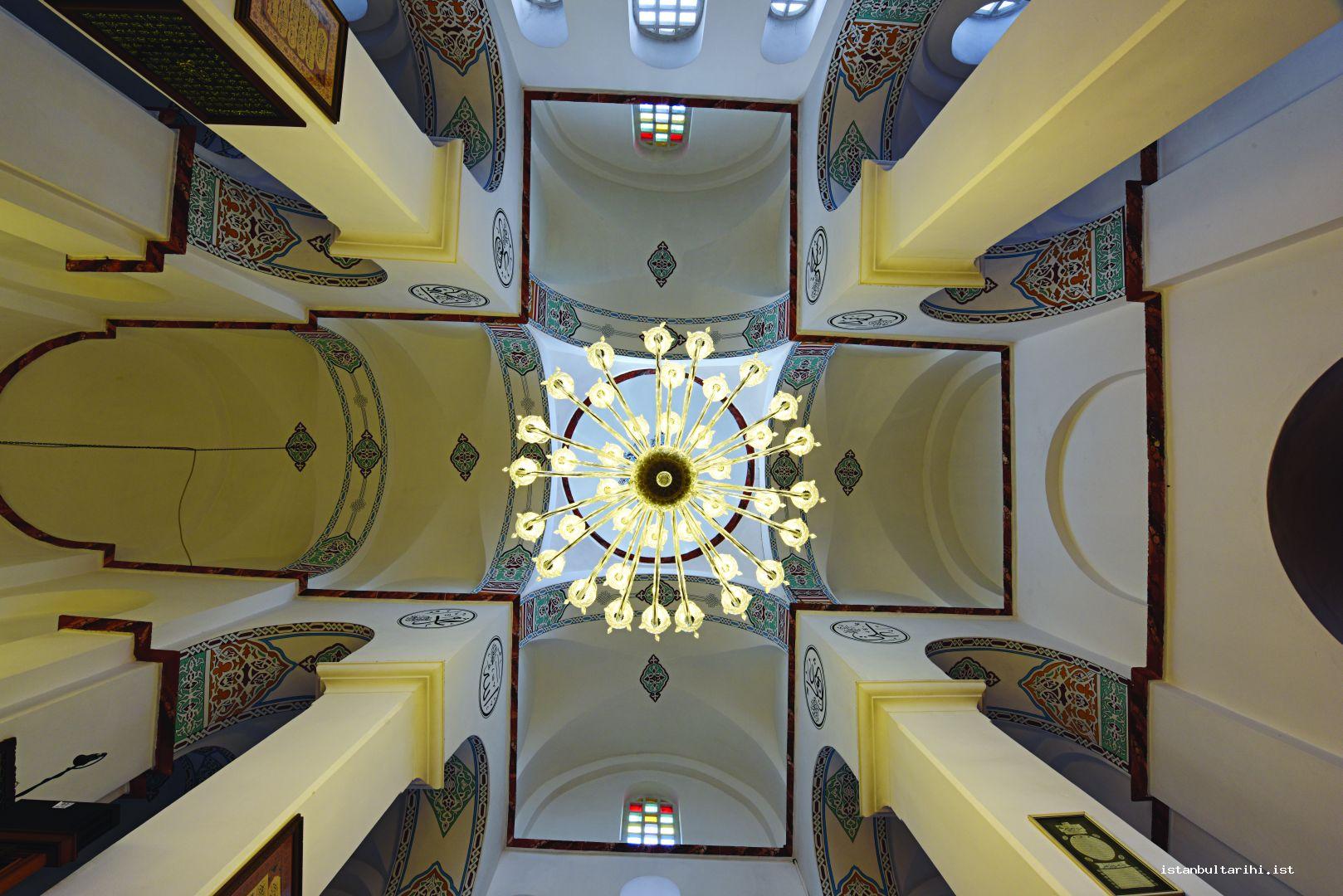
Becoming deserted after the conquest, the structure was used as the patriarchate until 1455. The broken-down building was demolished and replaced by the Fatih Mosque between 1463 and 1470.
Cross-in-Square Plan
Myrelaion Monastery Church (Bodrum Mosque)
It is known that other structures existed in the site of this church, which was also present in the eighth century according to some Byzantine sources. One of these structures is referred to as “the house of Crateros.” The monastery church, used as a mosque today, includes a terrace in the south east corner with a rotunda dated to the fifth century whose exact function is not certainly known. It is known that before the monastery that Emperor Romanos Lekapenos built, there had been another palace built on the west side of this site containing the half of this rotunda. The floor of the derelict rotunda was covered with an isolation plaster, which was applied to the cisterns in the tenth century; the building was probably used as a cistern in the following periods. Completed in 922 or sooner, the church was built for use by Romanos Lekapenos’s family’s mausoleum. In the following period, it is known that the church, which was used as a women’s monastery, owned some property around Miletus in 1073.
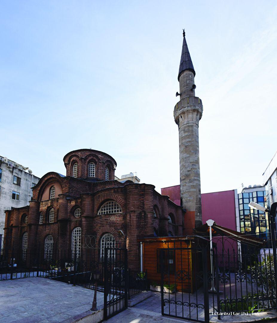
After 1200, the church probably suffered great damage in a fire during the Latin invasion, was repaired around 1300 and the substructure of the church was transformed into a mausoleum. The most obvious visible indication of this is the fresco portraying Virgin Mary and a woman bani ? next to her on the northern wall. Within the substructure of the church, on the southeastern wall, a fresco depicting a woman and Hodegetria Miriam (She who shows the Way) was discovered. Thus, it is understood that following the repairs that the substructure sustained during Palaiologos’s reign, the structure was used as a burial place for the first time. While the women’s monastery, with which the church was affiliated was an accommodation for noblewomen of the royal family in the tenth and eleventh century, it was converted into a men’s monastery around 1315 under the reign of Palaiologos. The substructure carries the church structure with the support of four columns that are spolia headers.
The sources mention that there was a senior center and a hospital except the rotunda and mausoleum. Myrelaion hospital continued to exist until the fourteenth century.
Mentioned around 1400 for the last time in the sources, no information is available on the Myrelaion Monastery Church regarding its condition in the aftermath of the conquest. However, the general belief is that Mesih Ali Paşa transformed the building into a mosque in the reign of Bayezid II (1481-1582). The structure was continuingly used as a mosque until the fire in 1911. Two restorations were carried out on the structure in 1964-1965 and in the late 1980s.
The building is in cross-in-square plan. The barrel vaults supporting the umbrella dome give the structure a look of undulating eaves in the outer cover. A terrace is found in the southern side of the building that consists entirely of bricks. This section was probably designed for a parecclesion (a vault that was put as an annex to the church where the body of the donor is placed).
There are two side apses next to the apse. However, since there was no sign of an altar inside these apses during the excavations, it would be more correct to call these pastophoria chambers diaconicon and prothesis instead of apse. An interesting feature of the edifice, which is one of the earliest applications of the crossed dome plan, is that the narthex’s north and south interior walls were rounded and turned into large niches. It is also interesting that the likes of the round brick plasters in the façade can only be found in Thessaloniki Panagia Halkeon. There is a substructure to the church, though its function in the period of construction is unknown.
During the 1960s excavations, a porphyr foot of the Tetrarch reliefs was discovered. It had been placed to the southwest façade of San Marco Church in Venice, after they were removed from the Philadelphion Square by the Fourth Crusade army. This suggests that the square must have been very close to the area.
Pantocrator Monastery (Zeyrek Church Mosque)
A private property, which is thought to belong to the Late Byzantine and referred to as House of Hilara, was probably the first structure in the site where Pantocrator Monastery Churches are located. The possibility of the presence of a Roman cemetery stretching from this site to Cibali in the first centuries of the Byzantine should not be overlooked. The existence of a hypogene near Bıçakçı Ali Mosque supports this view.
Although some sources claim that the Hungarian King Ladislas’s daughter and Byzantine Empress Irene built three adjacent churches remaining from the monastery, the general view is that it was built by the Emperor John II Komnenos (1118-1143). On the one hand, thanks to its foundation typicons, important information was obtained about the monastery. The typicon, signed by the emperor on October 15, 1136, suggests that this complex was completed by then. On the other hand, because the Empress Irene who passed away in 1134 was buried there, the fact that at least some parts of the monastery were completed by this time should not be ignored. This kind of monasteries were often thought of as shelter for the elderly or from unpleasant incidents that might arise as a result of a political event. Because there was no space in the circular building after 1028, which was the mausoleum for the dynasties next to the Havariyun / 12 Apostles Church, the monastery was planned in a way to serve the purpose of burying the founder’s family members as well. Passing away in 1134, Empress Irene became the first to be buried in these monastery churches, followed by John II Komnenos (1118-1143) who was also buried here when he died in 1143.
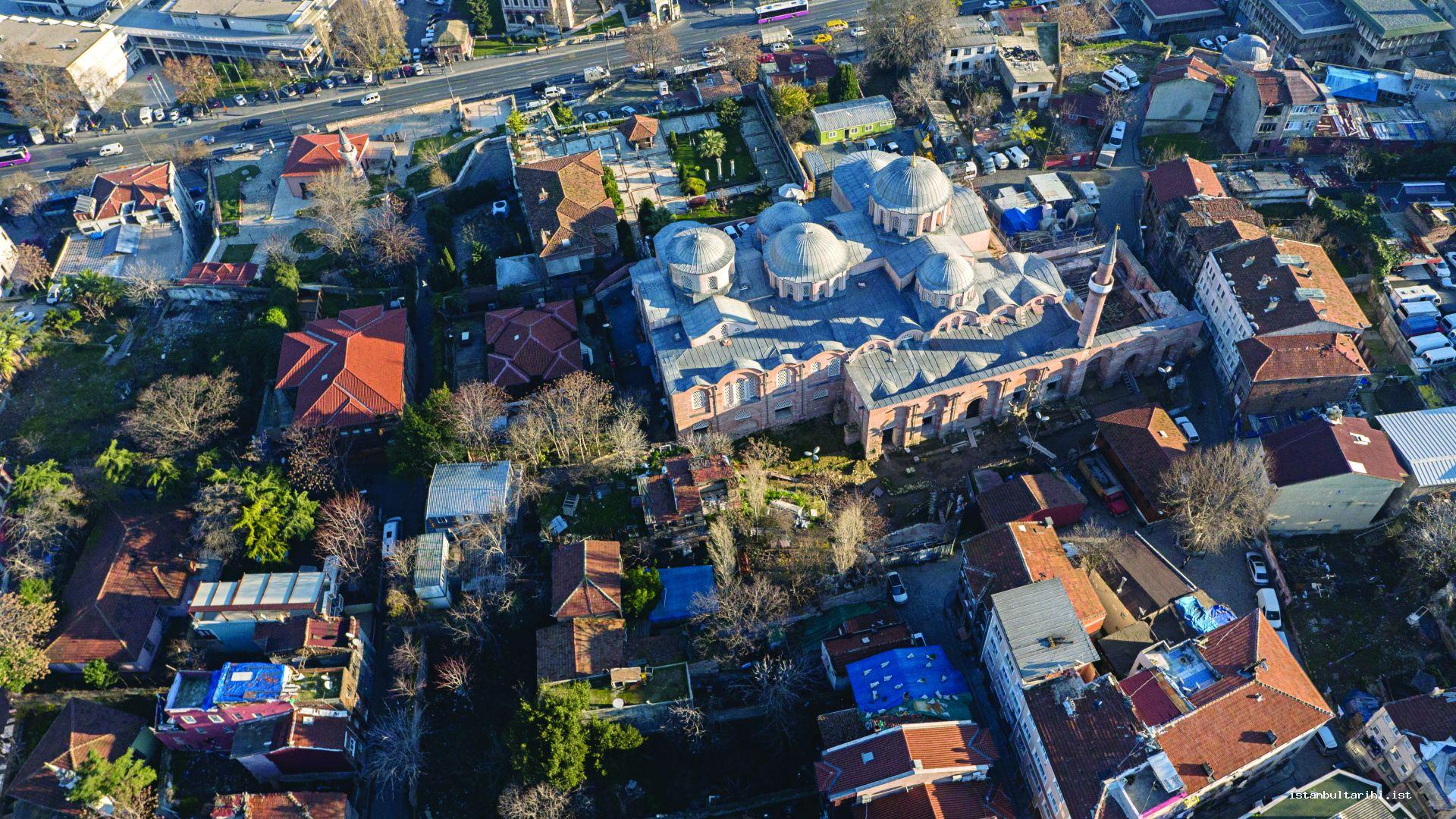
Pantocrator Monastery was quite a large monastery with its eighty monks; in time it earned a reputation because of its collection of religious items gathered from the other cities.
The architect Nikephoros built the monastery with these three adjacent churches. The church to the south was dedicated to Jesus Christ, to the middle was dedicated to Saint Michael the Archangel and to the north was dedicated to Theotokos Eleousa, The Merciful.
A six-bed sanatorium reserved for sick priests, a mill, bath, pharmacy, bakery, kitchen, barn, senior center for 24 bedridden elderly people, a leprosy hospital, a hospital with 56-beds of which 50 were to be used in five wards and 6 to be used in every ward in case of emergency, were present in the complex. There was also one female doctor assigned to work with the male doctors in the 12-bed women’s ward. These doctors worked with low wages without leaving the city for half of the year. Along with the beds reserved for the sick, the number of hospitals decreased over time, and female doctors were moved away from the medical profession possibly under the influence of the West between 1136 and 1282.
The monastery was not damaged at all in the fire of April 12-13 that was started by the Fourth Crusader army attack on the city, but it was looted by the Crusaders who took control of the city the following day. During the invasion of Fourth Crusaders between 1204 and 1261, the edifice fell under the authority of the Venetians, and many holy items were taken. The Hodegetria Miriam icon, which was originally kept in St. Sophia, was taken with a procession on Fridays and regarded as one of the most sacred objects in the city in this period; it was brought back to and stored at this monastery.
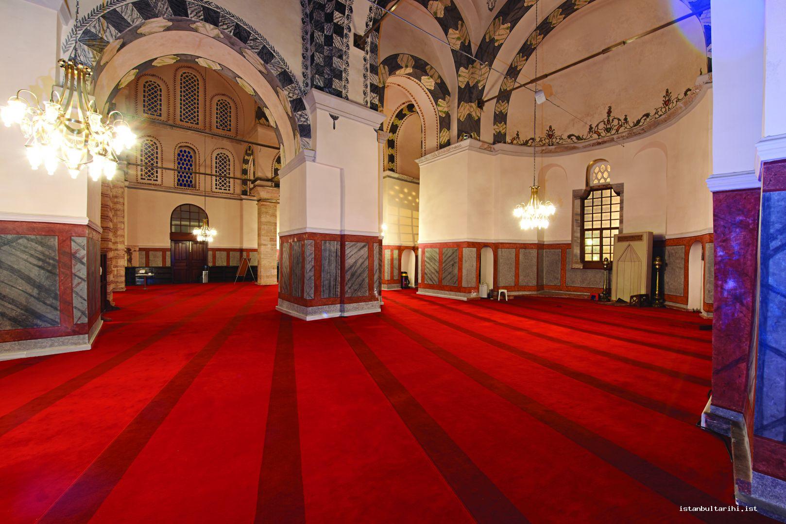
The last Latin Emperor, Baldwin, could not allocate money for the repairs of the Byzantine palaces due to financial problems; instead he used the monastery as an imperial palace during the final days of his reign. He even sold the lead coatings of the roof during his residency. Previously, the Venetians also used the monastery as a treasury, administrative building and a court.
After the city was retaken from the Fourth Crusader army, the monastery became a prison of Byzantine central authority founded for political opponents since the early periods of the monastry. It was claimed that the edifice was used as a covered bazaar for some time after the Islamic conquest. However, this collection of buildings became one of the first five or eight Byzantine churches, which were transformed into mosques. Initially, it was used as a mosque, then a madrasa for 18 or 20 years. Madrasa came to be referred to by one of the first professors’ name, Mehmed Zeyrek Efendi’s. Because it was the first Ottoman building providing education in Istanbul until 1470, this madrasa is very important. It is claimed that while some buildings of the monastery were converted into a madrasa, fifty-five priest rooms to the west of the church were used for the accommodation of the madrasa students. Only three adjacent churches have survived from the complex, which was one of the largest monasteries of the city.
The southern church dedicated to the Prophet Jesus is believed to have been built the earliest and has a cross-domed plan. The edifice is surmounted with a dome with sixteen ribs in the middle and a window within each rib. The names of the four caliphates are written in Ottoman handwriting on the pendentives under the dome. In order to support the dome, Ottoman baroque style stone piers were put under the point where each barrel vault forming the arms of the crossed dome plans overlap. These piers were probably replaced with the previous columns.
The chapel in the middle dedicated to the Archangel Michael, is a single nave space. There are two domes in this section, one in the west and the other in the east. Although the western side of these has sixteen ribs with window openings, six of them were closed by building walls within them. A hand-carved pin-wheel like ornament was made in the center of the dome. The eastern dome is elliptical and gives the impression of an unplanned construction that was carried out in a later phase. In every rib of the twelve-ribbed dome, there is a window. There is a hand carved botanical decoration, which was probably placed in the middle of the dome during the latest repairs. There is an arch transecting the entire middle structure in north-south direction between two domes.
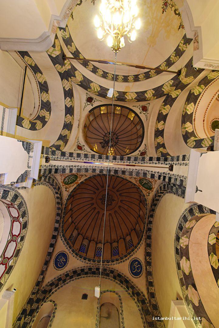
The northern chapel, dedicated to the Virgin Mary, is in cross in square Greek-Cross plan, in which the dome is supported by the columns. Four pillars that supported the dome in the Byzantine period were replaced with the piers in the Ottoman period. Two of these in the eastern side were built in rectangular shape and of cut stone, two in the western side were built in hexagonal and in alternate courses of brick and stone.
The dome of this section is relatively smaller in size compared to the size of the building. Unlike the other parts, no ribs are visible on this dome, and it has eight windows. Right in the center of this dome exists a botanical decoration made in the last repairs as its examples were also seen in the middle structure. In cross domed type, strange looking deep-set windows in the vault’s eastern and western directions, which constitute the southern arm of the cross and set in the passage to the middle structure, probably cause the weight of the dome to shift in this direction. With the restoration work started in 1997, a major part of the lead coating on the roof was renovated. During this process, large numbers of amphoras were found on the apse of the northern church and also a small part was found on the diaconicon of the northern church. The rest of the amphoras, of which nearly half were left in the findspots, were taken to the Museum of Foundation Construction and Artworks.
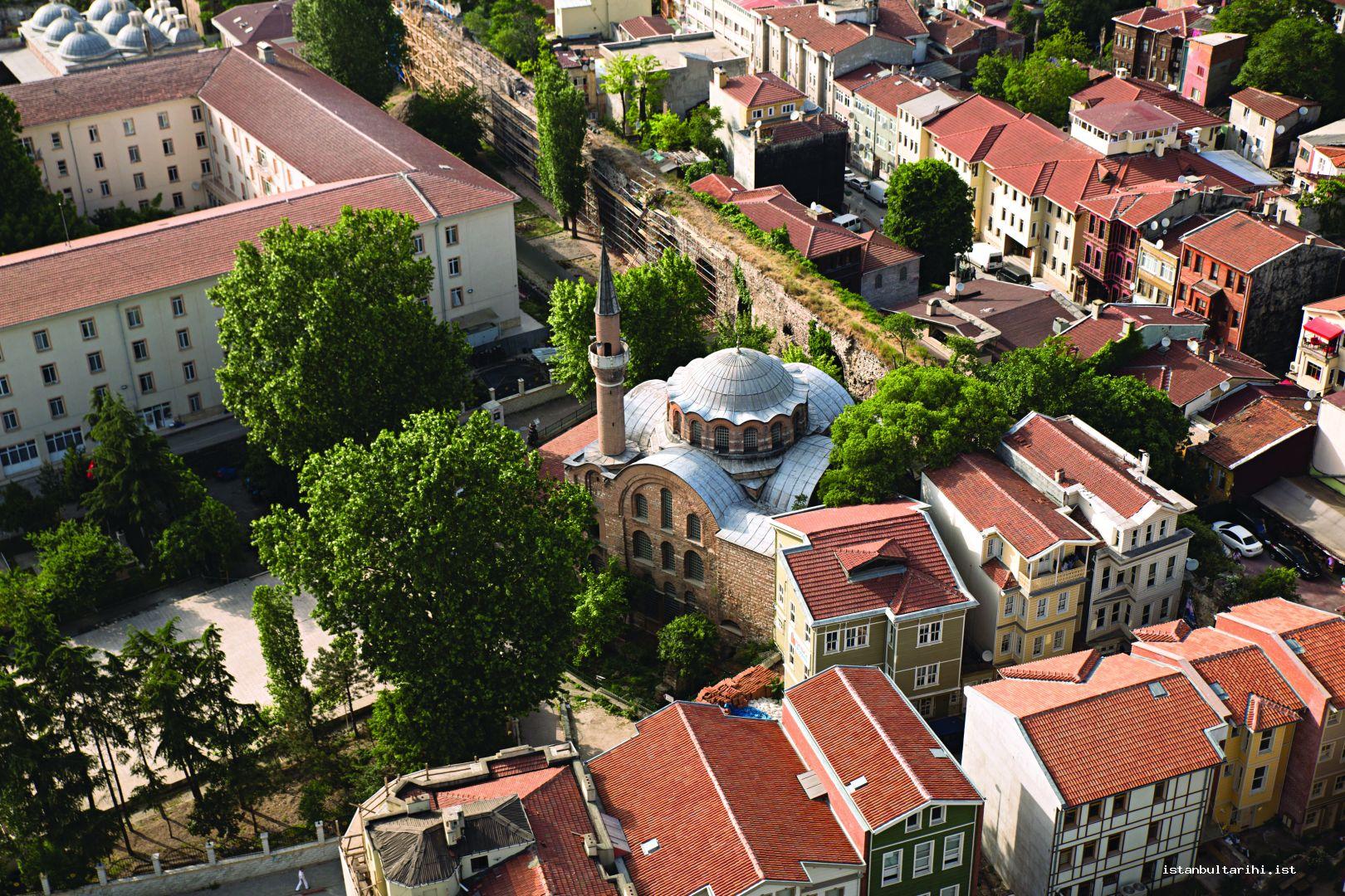
Though a crypt-like room was revealed under bema during the previous repairs, it was thought that the structure had no substructure. However, in the repair work that started in the mid-2000s, a substructure was a chance finding. Since repair work is still in progress, no definitive information regarding the form of this substructure has been reached.
Kalenderhane Mosque (Virgin Mary Anna Kyriotissa Church)
Archeological excavations showed that the first building in the area was a Roman bath built in ca. 400 had been in use until the sixth century. The first church built on this site was the Northern Monastery dated to the last quarter of the sixth century and Bema Church was built here afterwards. Both churches are connected to a monastery. However, Mango discusses that specifically, the construction dates of these two churches should not be regarded as completely exact and accurate. Mango also considers that there is a lack of hard evidence to suggest that the building identified as Bema church belongs to a monastery. The Northern Monastery was demolished, except for the apse, between the tenth and twelfth centuries, but naos and the inner narthex sections were used as a cemetery. The Bema Church remained in use until the twelfth century. Before the construction of the extant church two small chapels were built in so-called diaconicon section and Bema gave its place to the current building in ca. 1195 with the construction of the current church. According to the description by the poet of the period Constantinos Stilbes, the construction of the new building must have been initiated after the great fire on July 25, 1197. In the meantime, it is possible to say that the building was probably dedicated to Mary Kiriotissa during the Palaiologos period and it was the main church (katholikon) of the monastery, because of the Mary Kiriotassa fresco in the diaconicon of Bema Church dated to the early twelfth century and another Mary Kiriotissa fresco dated to the Paleologos period on the inner narthex entrance gate of the current main church. It was believed that the site of the church, which was considered to have been dedicated to Mary Kiriotissa, was somewhere between St. Romanos gate in Topkapı and St.Mokios Cistern in Kocamustafapaşa. However, what is meant with Kirou Monastery which was mentioned in the Byzantine sources posterior to the tenth century, is the main church situated in today’s Kalenderhane area, first identified as Bema Church and later identified with its current name.
The church fell under Latin rule after the city was captured by the Fourth Crusader army. Situated on a semi-dome in diaconicon and considered to have been painted between 1228 and 1261 by the French, frescoes of St. Francis of Assisi provide important information regarding the use of the structure. This is the oldest known cycle of Saint Francis in frescoes. While other murals possibly existed right next to these frescoes, no traces from these paintings have survived since a house, which was built during the Ottoman period, was situated on this structure. Because Franciscan and Dominicans worked together in the period it started to develop, it is not possible to say exactly by whom this structure was used during the Latin invasion.
There are different views on how the structure was used after the Ottoman conquest. According to the first view, as a result of the convergence between the Kalenderi and Mevlevi, the first Mevlevihane was in this building. According to another view, it was used as a foundation or dervish lodge in Sultan Mehmet’s time and later became notable with the name Kalenderhane. A researcher claims that because Sultan Mehmet endowed the building to the poor, it was identified as Kalenderhane and later a madrasa and school was added to it. He wrote in another article that the building was first used as a foundation and lodge, followed by a madrasa and finally as a mosque. However, it would be inaccurate to think that the building, which was named after Kalenderis, remained in the hands of Kalenderis for a long time. It was probably assigned in order to keep them under control due to their general attitude towards the system. From an inscription dated 1746-1747, it is determined that Beşir Ağa repaired the dilapidated structure. In another inscription dated 1854-1855, it is seen that the building, which was desolate and burnt down, was repaired by Hacı Kadri at those times. Apart from the demolition of the madrasa and primary school in 1930, the minaret was razed by lightning in 1928. We also learn that the structure was open to worship by the year 1953, but no information is available regarding its condition. With regard to the name of the structure, the buildings that belonged to Mevlevies were once identified as “Mevlevihane” as such the ones belonging to the Kalenderis would be appropriately called Kalenderihane.
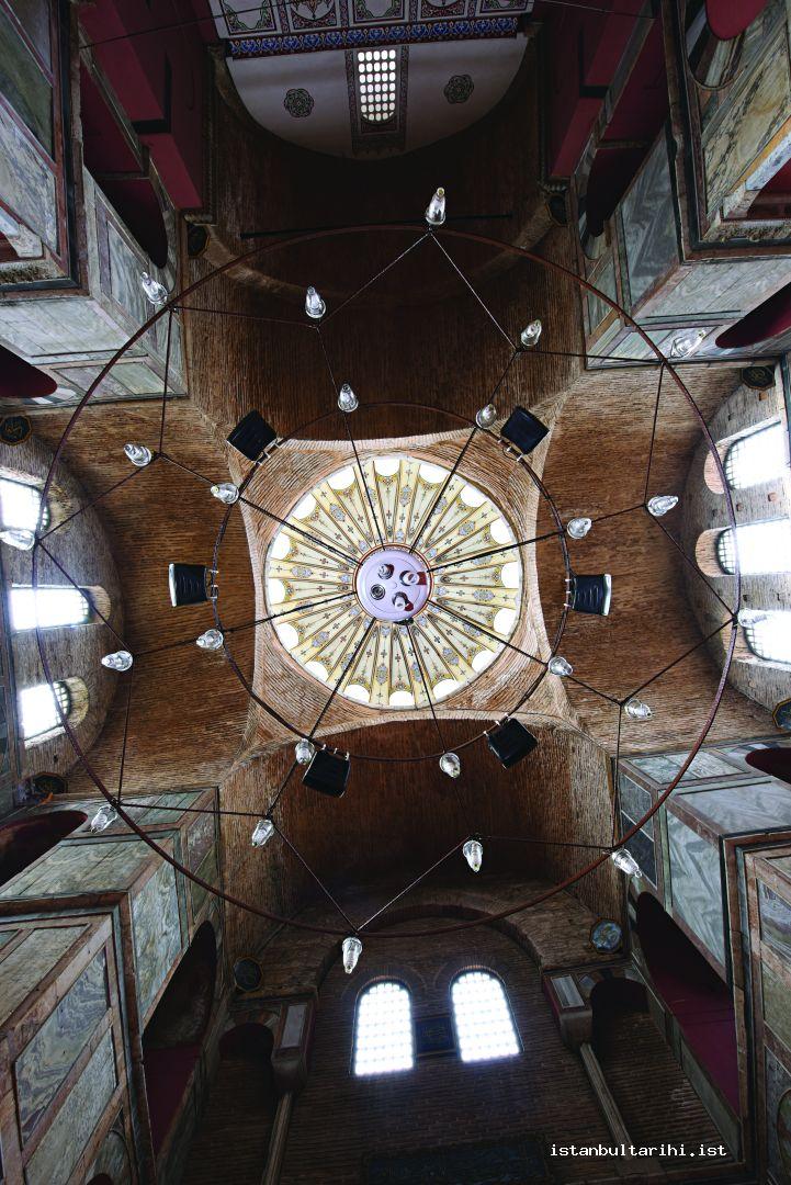
There are three separate churches whose different construction phases were uncovered in excavations. The extant structure today is a cross in square Greek cross type; the dome is sustained by “L” shaped corner walls. On top of the main space lies a flattened and windowless dome. The section, which was supposed to be with an apse, is in flat form because of the house that was once built there. Prothesis and diaconicon entrances in the north and south were closed after the repairs. In the diaconicon to the south there are both frescoes of Francis of Assisi (exhibited in the Istanbul Museum of Archaeology) and mosaics with frescoes, which are still preserved in their original places. The openings to the north and south of the main space were filled in time; in fact, there were once exits from these points. Probably, there were veranda-shaped parekklesions in the north and south made for the donors who were granted the privilege of being buried with their family members in a site adjacent to the monastery church. The most absolute proof supporting this is the fresco remains, especially to the south façade and the walls two meters away that run parallel to the building.
Vefa Church Mosque (Mullah Güranî Mosque)
Since no detailed scientific or archaeological research was conducted on this building, many differing views have been put forward on either its dedication or history.
The building was erected in the site of a fifth century building; however, besides this building of the fifth century that had an undefined purpose, many other cisterns dated to earlier periods were determined to exist in the area. Therefore, due to its proximity to the city center, this area must have been densely settled, especially in the early period. What exactly the Byzantine walls nearby the building are not known but these walls also indicate the dense settlement pattern of the site.
There are different views on the dedication of the building in the time of the Byzantines. These are St. Theodoros Monastery, St. Mary Theotokos, St. Procopius the Helene and Gorgoepikoos.
It has been suggested that the structure was one of the first eight sites converted to mosques after the conquest of Istanbul. According to the only information given almost in all of the sources, Seyhülislam Şemseddin Ahmed Efendi, also known as Molla Gürani (d. 1487) tuned it into a mosque after the conquest. Hidayet Fuat Tagay, a classic work lover, obtained permission to do research and repairs inside the building; as a result, the mosaics in the building were uncovered. However, although he took the permission for himself it was claimed that he transferred the research work in the building to Miltiadis Nomidis between May, 1937 and March, 1938.
The cross-in-square planned building is a column supported type. It is obvious from the interior and exterior cracks that the dome, which is supported with very thin columns, has structural problems. As in the example of the northern chapel of the Constantine Lips Monastery, though there was an arrangement of triple windows with a column in the middle, either the apse or the side apse and pastophoria were filled differently from the period they were originally built. In the nineteenth century, an annex was built in the western section of the building. There are mosaics in the domes on the top cover of this additional section. Although the mosaics in the southern and central parts of these were plastered by the mosque attendants, they are still seen as a shade, and are very important as they are among the very few number of Byzantine wall mosaics in the city. The depictions of the prophets in the Old Testament were placed in the eight-ribbed dome around the image of St. Mary with Baby Jesus in her arms. Similar to other monastery churches dated to the middle period, a cistern lies under the church in this building. Currently, it is not possible to enter this cistern, which went out of use over time. Finally, the pieces of the parapet plates belonging to previous periods were used for the western façade and parapets of the minaret.
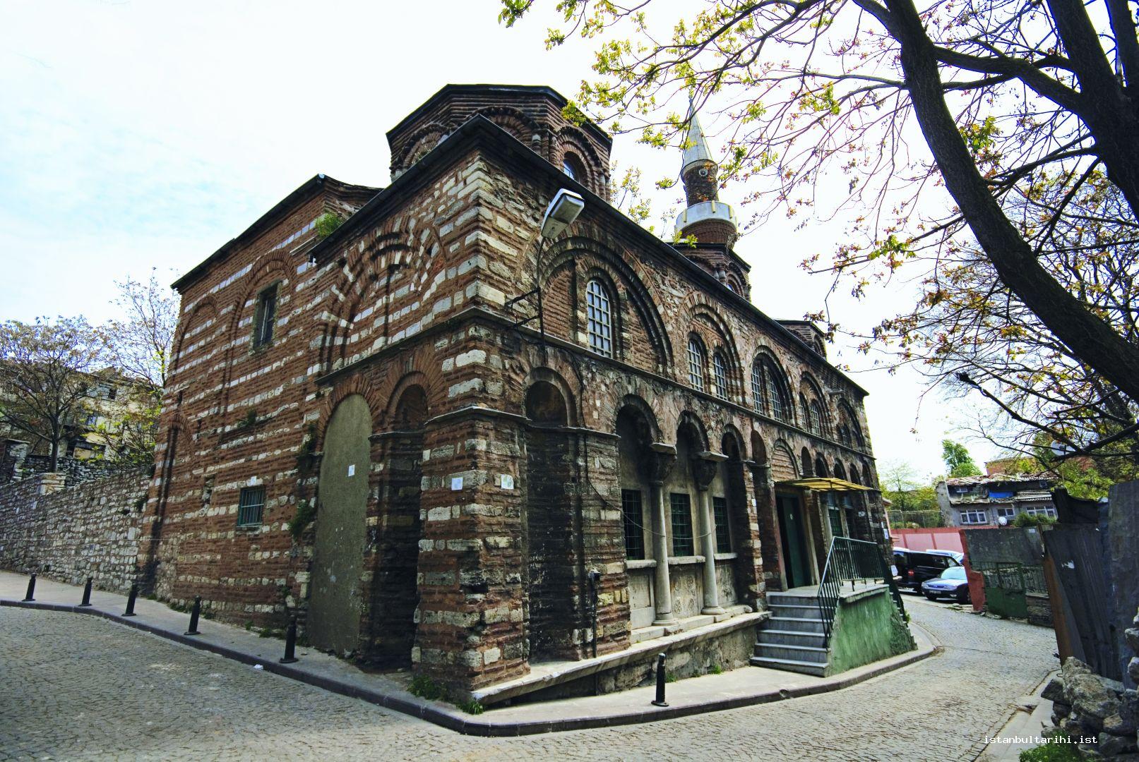
It is possible to find various architectural remains in the garden to the east of the building. Presenting material from squat columns to monogrammed column header and apsidal brick wall remains, the garden will provide new information after a new excavation, which is going to be conducted at this point since it is one meter higher than the basis of the building. The tombstone of Gepid King Thrasarich found in 2006 is dated to the reign of Justinian I is an indicator for what this desolate building can offer.
Peribleptos Monastery Church of the Virgin Mary Church (Church of St. Mary of the Spring)
Probably because of the springs in the area assumed as holy water in the monastery, this building is called Water Monastery. It was built by Romanos Argyros III (1028-1034) on a substructure in the vicinity of Helenianai Palace known to have been nearby, at a great expense. 1031 is the proposed year of construction; however, the construction of this monastery church, dedicated to the Virgin Mary, must have been completed by 1034 because the emperor was buried there on April 12, 1034. After construction, it was repaired by Nikephoros Botaneiates (1078-1081) around 1080. The same emperor dedicated himself to this monastery as a monk in order to save his life right after he was dethroned. Like Romanos Argyros III, who had built this building, Nikephoros Botaneiates was buried there as well as the emperor who repaired it. It is known that Emperor Romanos Argiros III was buried there in a marble sarcophagus to the north of the building.
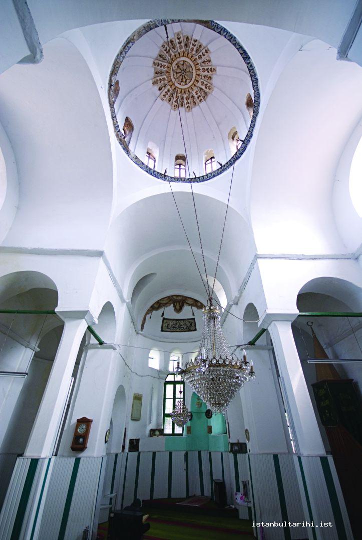
The fact that the monastery church only has a substructure today prevents us from obtaining exact information on the original church. On the other hand, it is possible to claim that the church was also cross-domed because the substructure and superstructure of the monastery churches, which are built on a substructure, were generally in the same plan. It can be claimed that the church on top of the substructure was also completely made of brick. Terracing was made to the south with wide brick arches in order to prevent the substructure from slipping from the hill it was built on.
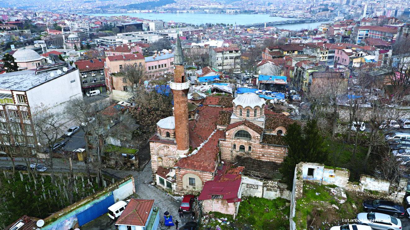
After the capture of the city by the Fourth Crusade army, the monastery was on the hand of the Greek monks until 1206, but invader Catholics captured the monastery after this date. Michael Palaiologos VIII, who reseized the city in 1261, repaired the monastery and had portraits of himself, wife Theodora and son Constantine commissioned within. This mosaic survived until 1782 after a lightning strike and fires, the building was heavily damaged. The complex, which turned into a monastery that was visited once a year for an important religious festival during the reign of Palaiologos Dynasty, maintained its importance until the conquest. Emperor Manuel Palaiologos chose the monastery as a base with his loyal Cretan soldiers during the Turkish siege in the year 1422. It is interesting that an Armenian pilgrim travelling the city refers to the monastery as “our monastery.” Based on the information provided by the eighteenth century historian Camcıyan, it is suggested that Patriarch Yovakim (or Hovagim) and six leading Armenian families (to be referred to as six communities later) were brought to Istanbul by Mehmed II after the conquest. However, this view was opposed in the following periods, and it was later claimed that Mehmed II had never been to Bursa before the conquest and therefore did not attempt to bring the Patriarch Yovakim. In addition to the view that the Greeks used the church after the conquest until 1643, Armenian historians who accept the traditional historical discourse argue that the church was consecrated to the Armenian community afterwards. Another historian İnciciyan wrote that the church was bestowed upon them in Süleyman I the Magnificient’s time. As of 1453, the year when Istanbul Patriarch Astvasatur used this title for the first time, the opinion that the church was transferred to the Armenians gained weight. In the aftermath of the renovation activities in 1722, it was burned down in 1782 and rebuilt in 1804 by Hassa architects Minas and Hagop Amira Güllapyan.
Thanks to the donations by the Mikhael and Hovannes Hagopyan brothers between 1885 and 1887, the existing Surp Kevork Church and two schools on both sides of it were built. On the substructure of the monastery church, whose remains perished over time, today lies the Sahakyan Nunyan High School. Other monastic architectural sections were excavated next to this but their exact functions could not be identified as a result of the studies done inside this substructure, which became visible in 1998.
Gül Mosque (Monastery of Christ the Benefactor)
There are various claims about the building’s name Gül Mosque (Mosque of the Rose), used in the Turkish era. According to one of these claims, the mosque was named as Gül Mosque because it was spring when Istanbul was conquered and the surroundings were full of roses. According to a second view, the mosque is known by this name because of the belief that the tomb to the south east of the building belonged to Gül Baba. The third view argues that the name, Gül Mosque, was to honor the beauty of the structure. However, none of the views can fully explain this matter. Apart from these, according to Evliya Çelebi, the origin of the name was that the building was washed with rose water during the conversion of the monastery into mosque. Moreover, the building is referred to as “Cami-i Gül” in 1546 dated cadastral surveys of the foundation, which indicates that the structure has been used as mosque since the first half of the sixteenth century. Finally, there are five different views on the dedication of the structure to Christian saints: to St. Theodosia, Christos Evergetis, Euphemia, St. Sebastian and St. Anastasia.
In one translation, it was mentioned that a Russian pilgrim visiting Istanbul in the fifteenth century saw the holy remnants of Hagia Theodosia in Evergetis Monastery; the other one is that these relics were buried in Evergetis Monastery. However, there were two monasteries in the city named Evergetis. One of these dedicated to Mary, Theotokos Evergetis Monastery, was generally considered as a structure outside the walled city. On the other hand, Christos Evergetis Monastery, which was dedicated to Jesus, was situated in the Golden Horn. The Church of St. Theodosia was first mentioned by a French man who had been in Istanbul in the first half of the sixteenth century, saw the structure and referred to this building as “Church of St. Theodosia next to Ayakapısı and Cibalikapısı.” The other traveler who visited the city in the same century, was a German and he wrote that Ayakapı numbered 12 acquired its name from St. Theodosia while referring to the gates of the walled city. He also claimed that Church of St. Theodosia was Sinan Paşa Mescid nearby Yeni Ayakapı. It was written that this was because the relics of Theodosia, which Russian pilgrim Zosimos claimed to see in the Monastery of Evergetis, were actually present in St. Theodosia Church. This misunderstanding was caused by the confusion of two similar structures by a foreigner who did not know the city very well.
The building is one of the examples of corner wall supported cross-in-square plans. While the buildings of this plan type are generally small, the implementation of it in a building of this size led to some structural problems.
The Gül Mosque is very high and has a big structure as well but the main purpose of the substructure almost the same size of the building is not exactly known. As in the upper structure, bricks were used as the construction material in the substructure. A structure in the form of long narthexes was built here in this section, which is understood to have not been built as a cistern or mausoleum unlike other examples. Though it was claimed that it was used as ammunition of the navy in the time of the Turks, there is no solid evidence to support this. It was mentioned that these narthexes were used as the burial place of some important families in the Byzantine time, but in the period of this author’s claim (end of the nineteenth century) they were used as houses by some Turkish families.
Some façades in the superstructure of the building are remarkable. The East façade has the most complicated view. Especially in some lower sections of this façade, stone was widely used in the wall and three rows of brick and one row of stone walls were decreased to one row of brick and one row of stone. Above these, there are traces of brick keramoplastik decoration dated to the Palaiologos period. The likes of this façade decoration can also be found in the eastern façades of Pammakaristos and southern building of the Lips Monastery. The northern side apse is the replication of the south, but here there are traces of keramoplastik decoration in better condition and just on top of these and approximately one meter below the roof lies a saw-tooth-shaped pattern. This is the only saw-tooth pattern that can be seen in the building.
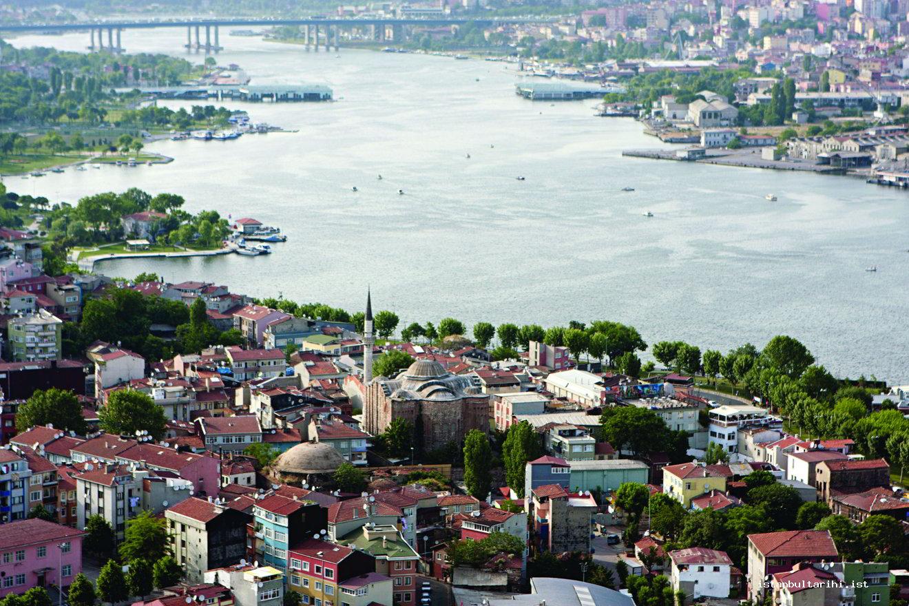
The passage from the main apse, which is located on the eastern arm of the cross in the square plan of the building to the side apses in the north and south, are provided through the arched narrow spaces in the side walls of the bema. There is a room in the piers, which is situated to the south supporting the eastern arm of the cross or the main apse. The window of the room viewing the north can still be seen. It is learned from Millingen that this room, which is still closed, was reached via nine stairs, and there was a sarcophagus inside with cloaks covering it and a turban. Above the entrance it is written, “Merkadi havariyun eshabi İsa Aleyhisselam” (Here lies one of the apostles of Jesus). It was told to the Russian Mouratieff who visited the city in 1851 that the tomb inside the building belonged to the Byzantine emperor. The Patriarch Constantine referred to this tomb in 1862 as the tomb of the last Byzantine emperor. It is accepted that the same site is publicly known as the tomb of Gül Baba.
By taking construction techniques into consideration, it is concluded from the only monographic work conducted on the building that the Gül Mosque was built with the wall techniques of the eleventh and twelfth centuries. Consequently, it is stated that the building cannot be St. Theodosia but might be Christos Evergetis Monastery. It was concluded that the earliest stage of the edifice, which underwent three construction stages, possibly belonged to a pre-existing structure and the second stage was of the twelfth century. It is further noted that the first period building and the substructure partly demolished during the construction of the second stage and the final construction stage can be observed to the south of the current building. However, the construction of the third stage is difficult to discern from the previous stages as the upper sections were demolished.
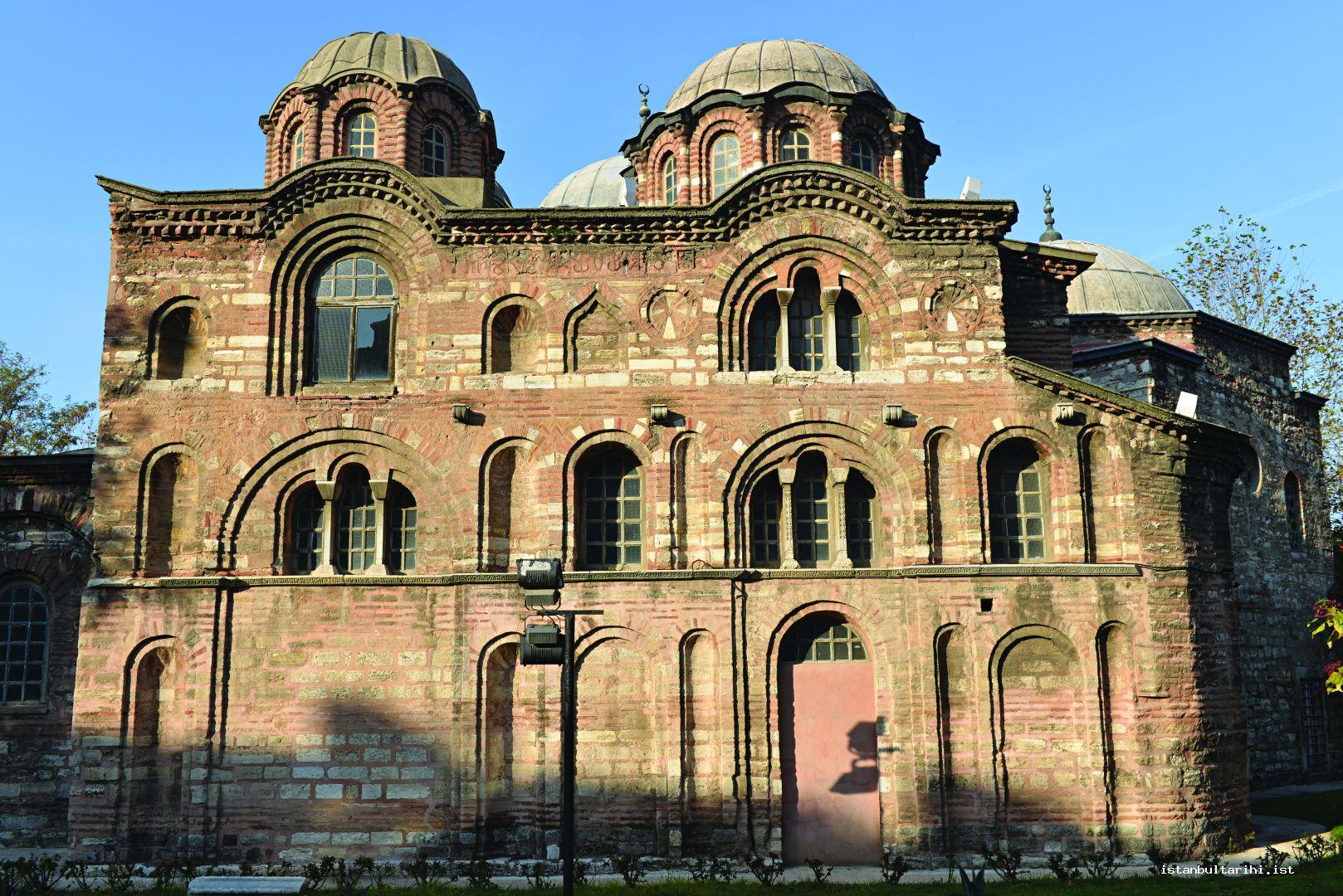
According to the view that we support as well that the Gül Mosque is not St. Theodosia Church but Christos Evergetis Monastery, is the most likely view. It is thought that the remains of this structure, which had been referred to as Ayakapı Chapel because of its proximity to Ayakapı in the 1930s, perished over time. However, after we rediscovered the remains in 2000, it was understood that the edifice became indiscernible because the remains enshrouded the other buildings constructed around and on the remains. A distance of only 15 meters between the remains and Ayakapı suggests that the building that named the gate might be St. Theodosia. The interior of the apse viewing the north, which was built in stone brick technique, was used as a cistern in time, as seen from the cistern plaster. It was understood that the remnant was a substructure. As a result of the research, it was determined that the remains of the edifice that stretched over a wider area might have belonged to St. Theodosia Monastery. In this case, it will be quite right to regard that the Mosque of the Rose is Christos Evergetis Monastery and the Ayakapı Church in the immediate vicinity is St. Theodosia. Therefore, it becomes clear why the annual St. Theodosia memorials are held in a much larger church, Christos Evergetis Church, instead of the same-name St. Theodosia.
It was mentioned that the transformation of the edifice into a mosque after the Ottoman conquest commenced on April 26, 1490 and was completed in a period of six months. The previous view suggesting that the substructure of the Gül Mosque, which was converted into a church, had been a navy ammunition or depot lacks a solid foundation. Hüseyin b. İsmail (Ayvansarayî) refers to the mosque as a vault where navy equipment was stored. However, this view, which asserts that because the shipyard and its stores were situated in Kasımpaşa, the edifice was used as a navy storehouse for some time before it was used as a mosque, might have resulted from an incorrect assessment. The classical Ottoman dome might have been built in the aftermath of the earthquake in the sixteeth century. The Gül Mosque was completely renovated by Hacı Stefanos Gaitanaki Maditenou probably in 1832 during the time of Mahmud II (1808-1839). Hünkar Mahfili (royal prayer loge) may have been added during this renovation. As there is no known repair in the following period, it was mentioned that the edifice underwent a repair in the early 1960s, but no record of this was found.
Eski Imaret Mosque (Christos Pantepoptes)
In the time of the Byzantine, the Patriarch Constantine suggested the first name for the building, which is now referred to as “the Old Almshouse.” In almost all of the works produced after him, the building was regarded as the church of Pantepoptes. Being one of the attributes of Jesus Christ, pantepoptes means “the all-seeing.” The church was built by the mother of the Emperor Alexios Komnenos who was the most trusted person for the Emperor and operated the administrative chores, while the emperor commanding the military maneuvers. Considering Anna Dalassena, mother of the Emperor, died on November 1, 1102, the monastery must have been built prior to this date. There is not much information available regarding the condition of the structure after completion. Richter referring to the Byzantine chronicler Pachymeres states that this monastery was a friary. It is written that after the capture of the city by the Crusader Army, this building was granted to the Benedictine in 1206 and after 1261 it came back to the Byzantine.
Following the conquest of Istanbul, it is claimed that the monastery was one of the first of eight structures that were converted into a mosque. After the construction of eight medrese buildings of the Fatih mosque, the structure, named as Eski İmaret, was used until the imaret building of this complex was completed. The minbar of the Eski İmaret Mosque was located in wakf of Hagia Sophia and the Şeyhülislam İshak Efendizade Ahmed Efendi, a martyred in the conquest of Belgrade, gifted it to the mosque. Also historical sources mentions that the building was not converted into a mosque but into a madrasa after the conquest; this madrasa made use of the thirty-five rooms called monk rooms and the church of the monastery was turned into classrooms. After the construction of the Fatih Mosque was completed, the church of the monastery was converted into a mosque and the madrasa became an imaret. In the early 1990s, when the footing of the dilapidated minaret was removed, cross-shaped keramoplastik decoration behind the wall came to light.
In 2000, imam of the mosque dag along the southern and eastern walls of the building in order to solve the humidity problem and the stone slabs were revealed in the ground. These stone slabs were probably belong to the upper part of the lower cistern. However, it should be considered that due to the possible presence of an additional chapel or parekklesion, the stone lids might belong to the covers of the lower tombs. Again, Byzantine ceramic in the soil, spilling out from the same site to the next alley was found. While a triple window opposite the southern front inside the building and the drawings of two columns belonging to this trio can be seen in the old drawings, today it is possible to see the headers of the columns embedded in the wall when looking carefully. This section probably opened to the parekklesion, which was located in the south of the building. This is evidenced by the remains of light-colored frescoes, which can be seen in an arch in the southeast. The building’s entrances are through the exterior and inner narthexes. There are four hexagonal piers supporting the dome inside the naos. These piers were probably replaced with the columns, which had been previously used in the Byzantine period in the same place. There are barrel vaults, which constitute the arms of the cross in square building on the sides of the domes that is supported by these piers.
This section would be reached through the wooden balcony and stairs on the only door, which provides the entrance to the naos. There are two small rooms in the north and south ends of this section. These rooms should be regarded as special places of worship as in Lips monastery in terms of dimensions.
The presence of an arch between the house located right to the east of the building and the church indicate that the hill where the structure is situated was terraced and the arches were located to prevent shifting. The substructure of the building functions as a cistern. As understood from the illustrations, the cistern is exactly same as the upper structure and it cross-in-square shaped in this form. Therefore, it might be possible that similar churches existed either on the cistern numbered 21 with a cross-in-square plan situated under Topkapı Palace chemistry laboratory or on another cistern next to Fatih mosque with the same plan. Only the substructures of these two buildings are known today. Due to the considerable similarity between the substructures and upper structures of Eski İmaret Mosque and being the only example to this kind of structures surviving from the Byzantine times, the mosque is an important building.
Atik Mustafa Pasha (Şeyh Cabir Mosque)
The dedication and construction date of the building is obscure. Researchers propose six different point of view to illuminate the construction date and dedication issues. The first view asserts that the building was dedicated to Jesus Christ’s disciples Peter and Mark and the second view is that the structure was dedicated to St. Thekla. According to the third view, it was dedicated to the Prophet Elijah; the fourth proposes it was dedicated to St. Kosmas and Damianos, namely to Anargiroi. The fifth view suggests that though the building is regarded to have been dedicated to St. Peter and Mark in respect of establishment this view changed into dedication to St. Anastasia in the fourteenth century. Finally, the last view that we are also in favor of, states that the building is the Euphemia Monastery Church in Petrion. This building where the majority of Basileos I’s (867-886) family members were buried was referred to as Nea Mone (New Monastery) and the monastery is the most important monument built during the reign of the emperor Basileod I. Despite the uncertainty of Petrion’s location, it is thought that this area might be the site referred to as Kesme Kaya in the vicinity of Kariye and next to Aeitos Cistern. An English pilgrim visiting the city circa 1190 mentioned Euphemia Church as a nuns’ monastery near Blakhernai while giving information about the churches in the city and the relics therein. German traveler Reinhold Lubenau gave information about this building as well. According to Sahm, who published Lubenau’s travelogue, Lubenau was in Istanbul in 1589 or a short time before this date. Lubenau mentions that after visiting the Pammakaristos church in which the patriarchate was located, he saw a church where a very pleasant water was running (this is probably Blakhernai whose spring water still runs today) and next to this church, he visited another church where St. Euphemia’s body was buried. Interestingly, Lubenau states that there were colorful mosaics inside the building and he collected a purse of mosaic pieces to give his friend Hans Fugen. During the repair works carried out in the building in the 1980s, some researchers who involved the restoration mentioned that they had seen jars full of mosaics excavated from the ground during the cleaning stage of the site. As scraping the wall mosaics would not be permitted in Lubenau’s visit, he probably collected the fallen pieces. This implies that the condition of the building was quite bad in the late sixteenth century. The causes of this poor condition of the building might have been either the earthquake described as the “small apocalypse” in 1509 and the subsequent earthquakes in 1557 or the fires dated 1569 or 1588. Among these, the fire in 1569 was the biggest in the sixteenth century, which started in the Jewish neighborhood and 36,000 houses burnt down as a result of this fire. Since a tomb was found in the Rose Mosque converted from a Byzantine church, it might be indicate that these tombs both in this building and the other structures survived from the pre-conquest period.
It is generally accepted that Atik Mustafa Paşa (d. 1512) transformed the building into a mosque. It is also called Cabir Mosque because it was believed that the tomb in the building belongs to Hz. Cabir. It is mentioned that this personage was the pioneer to Abu Ayyub al-Ansari either Jabir b. Abdullah or Jabir b. Samura. The cupola of the Byzantine period was probably replaced with the Turkish dome today. The building underwent repairs twice in the Republic period; in the 1980s and 1990s.
As an example of the cross-in-square plan type, the dome is supported by the L-shaped corner walls, as the western arm of the cross is a little longer compared to the others. While some researchers argue that the building functions as a bridge in the transition from the domed basilica to the cross-shaped plan, others conclude that the cross- type plan of this building is the earliest example of its implementation in Istanbul. The dome seen today was built in the Ottoman period. This section, which is classical Ottoman dome in respect of its form, most probably was built after the fire in 1490, which caused heavy damage in the city or after the 1509 earthquake. The passage to the dome, which is supported by the corner walls, was through the pendentives. The dome is windowless and there are hand drawn decorations that were completed in the last repair. A form, which we also favor, was proposed for the upper cover of the building by Matthews and Hawkins in illustrations in their article dated 1985. Accordingly, the dome of the building is spherical, has a high cupola and inner windows.
The wooden balcony with wooden stairs on the northern and southern corners right after the middle door at the entrance to the naos is reserved for the women. There are four corner walls supporting the dome at the entrance in the center of the building. Behind the southeastern corner wall, toward the southern apse, the tomb, which is claimed to belong to Hz. Cabir, lies and in front of this are the metallic rings. There is a sarcophagus and an opening with four small columns dated to the nineteenth century at the entrance of the tomb and a triangle pediment located above the columns. A wooden minbar lies from the tomb chamber northward towards the bottom of the dome. While no traces of Byzantine decoration are seen in the building, as mentioned above it is reported that fallen mosaic pieces were collected in jars in the repairs of 1988. The fate of these mosaic pieces is unknown today. Extensive structural changes were made on the eastern front where the triple apse lies.
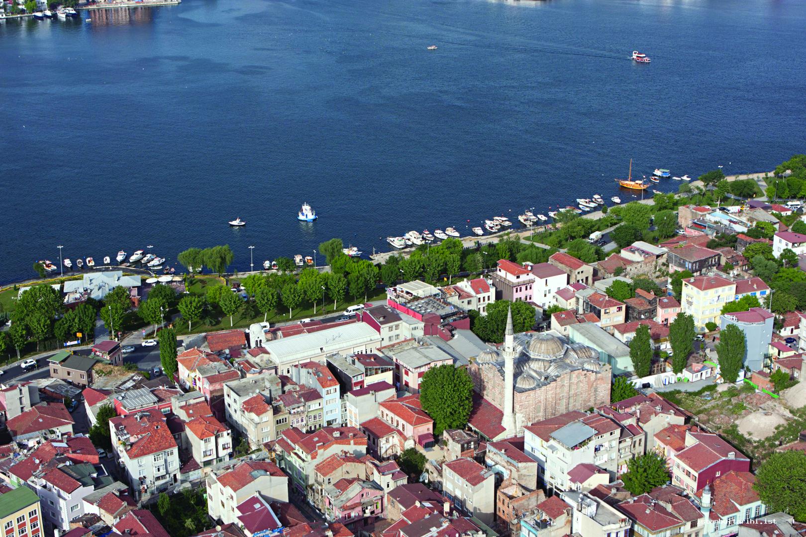
The buttresses added in the Ottoman period divide the south façade into three. While three sections from the east and west portions are substantially in the same size, the central section is the widest. This façade is the most important part of the structure due to its frescoes. Though the three arches where the frescoes were located still existed in 1924, they were covered later on. The frescoes in the central part of this façade were exactly in the same form with the frescoes in the northern façade and in the section between the two buttresses the three adjacent arches above the only window start from the ground level. The frescoes came to light during a repair in 1956 and to preserve them, Matthews covered the frescoes with wood. A year later, it was uncovered temporarily for a short time in order to take photos. However, in the following period, the frescoes remained behind this wooden coverage for a long time became imperceptible in the late 1980s because their surrounding niches were filled. The archangel Michael can be seen in the photos in the middle niche; to the east St. Kosmas and to the west St. Damianos can be seen next to the archangel Michael. Matthew wrote an article on this building and in his article he states that the building can be dated to the Palaiologos period because of the frescoes’ stylistic features. There is not such implementation in the capital city Constatinople, except on the western façade entrance of the late period katholikon in Hosios Loukas Monastery in Greece and some churches in Romania and Russia, so which suggests that this section should be covered.
Ciborium Plan Type
Kariye Mosque (Hora Monastery Church)
The only example of the ciborium type in Istanbul, this structure was built in several stages. Featuring the architectural characteristics of the era it was built, there are a small number of sections where these characteristics can be observed. The remains of a structure dated to the sixth century that lies to the east of surviving structure suggests an early construction. Following this, rebuilt in the eleventh and twelfth centuries, the latest annexes to the structure were made in the fourteenth century.
Today the windows and the lower part of the dome surmounting the naos--the main part of the building, belong to the Byzantine, but the upper part belongs to the Ottoman period with the Baghdadi technique in which spaces were filled with mortars in order to reduce the weight. The monograms of Theodoros Metochites who financed the restoration of the building located in the four directions of the marble drum frame of the dome. There are mosaic decorations in the windows dated to the fourteenth century located on the southern and western walls of the dome. To the north of the naos, at the top floor level, the monastery’s library is situated. The window opening to the naos from the library is still in the same place. There were also annexes to the building, which were made during the repairs in the fourteenth century. The most important of these is the parekklesion added to the south of the building. There is also a cistern beneath it. While a large part of the decorations in the parekklesion (the mausoleum made for the donor) are frescoes, there are a small number of mosaics. One of the additions was the outer narthex on the western side. The arches on the western side of it were also turned into donors’ tombs by filling in over time. The lower parts of the frescoes belonging to these donors can still be seen.
The minaret was built after the structure was converted into a mosque in the same site by using the base of the heavily damaged bell tower, which was probably damaged by the earthquakes, in the southwest of the building.
The oldest historical event regarding the building was the transportation of the bodies of St. Babylas and his eighty four disciples to Istanbul, when they were killed in İzmit (Nicomedia) in 298, and their burial to the north of the city, where Kariye would be founded later on. Although the holy remains of St. Babylas and his disciples were a part of the Hora monastery treasure in the ninth century, they were sold to Studios Monastery because of the financial strains in the tenth and eleventh centuries.
Mikhael Synkellos and two brothers, who were named “Graptoi” (written upon) because they were stigmatized with iron during the iconoclasm, were sent to the monastery of Hora by Leon the Fifth, a supporter of iconoclasm. Mikhael Synkellos was assigned to the head of Hora Monastery and the monastery then showed great improvement with the end of iconoclastic movement. The building was not mentioned in the sources until the eleventh century. Maria Dukaina, the mother in law of, built a new church probably between 1077 and 1081 in the place of the dilapidated structure.
It was claimed that this eleventh century building used the cross-in-square plan and was rebuilt in the twelfth century with a different plan after an earthquake in the eleventh century and the the structure reconstructed by the Komnenos family in ca. 1120. The emperor’s brother Isaac Komnenos first wanted to be buried in this building but later he built Kosmosotira Virgin Mary Monastery for himself in Ferecik near the river Maritsa in Greece today. Afterwards he wanted the transfer some of his belongings from Hora Monastery to the new monastery. However, despite a period of more than a century, even after the repairs done by Metochites, the mosaic portrait of Isaac could preserve its place on the southern part of the interior narthex.
Though there is no information regarding the building until the Latin invasion, it is known that the bones of Patriarch Cosmas were transferred from his tomb in Hora Monastery to France. At the end of the thirteenth century, probably Patriarch Johannes Bekkos XI (1275-1282) and Athanasius I (1289-1293 and 1303-1309) lived here because the monastery was close to the residence of the emperor, the Blachernai Palace. Theodore Metochites had the building extensively restored between 1315 and 1320/1321.
The structure was transformed into a mosque first by Hadım Atik Ali Pasha in 1509. Following the cleaning and restoration of the mosaics conducted by architect Pelapidos Kuppas between 1875 and 1876, the 1894 earthquake damaged the building and the mosque remained closed for a while but it was opened before Kaiser Wilhelm II’s visit in 1898. The Russian Academy of Science Archaeology Institute performed restoration works under the leadership of Smith between 1903 and 1906. A new restoration activity was held by the Foundations in 1929, which was followed by excavation and extensive repairs conducted by the Byzantine Institute of America between 1948 and 1959 in cooperation with Dumbarton Oaks under the presidency of Paul Underwood.
Single Naved Plan Type
Kefeli Masjid
This building is described since it is relatively in a better condition compared to the other derelict structures in this plan type, although they are still standing. Even though its exact function could not be determined, it is thought that it was used as a church for some time. It is believed to have been built in the ninth century traditionally, but alternating wall technique and the construction material indicates the late Byzantine period. The building was adjusted for the Christian community displaced from Kefe in the Crimean peninsula but the church was converted into a masjid around 1630.
The biggest change in the lifestyle during the Byzantine period occurred in the religious sphere. Not admitted to the temples in ancient polytheistic religions thus remaining passive, the public could both see the clergy during worship at every stage and became an efficient part of the worship thanks to the new religion. The monumental size of architecture of the Roman Empire was maintained with several structures in the early Byzantine era but religious architecture was represented in modest sizes.
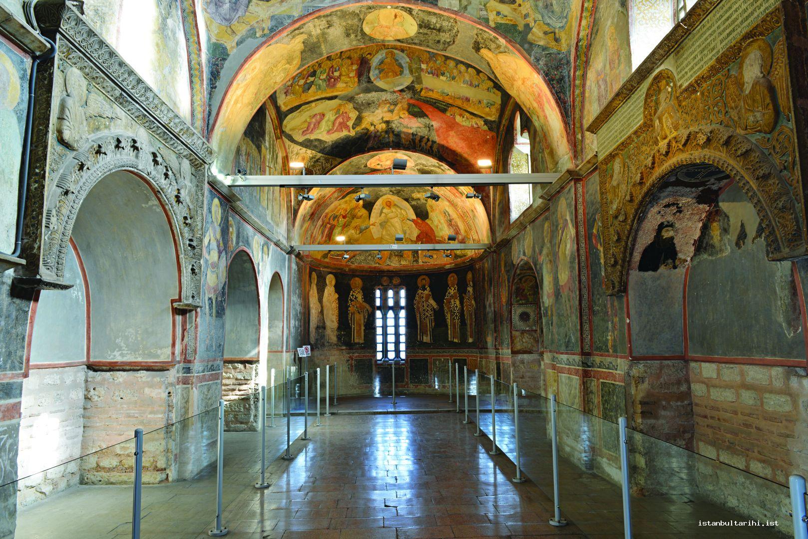
CONCLUSION
As a city shaped at the heart of Roman imperial tradition, Istanbul became a cultural, religious and a commercial hub. However, the effect of land losses, which was caused by the inability of the army-the most essential element of the Roman Empire-to stop the moving tribes, was felt in every area over time. The aqueducts provided water to the city, which experienced water problems at every period, but they were damaged during these attacks and remained unrepaired for a long time. This resulted in the cisterns loss of function or change in the cisterns, which were dependent on the aqueducts. The ports, which required continuous maintenance started to be filled in slowly with waste because of both financial restrains and their inability to stand up against the fleets of Italian city-states that were growing stronger, which in turn led to their loss.
The walls which defended the city under every circumstance and could be overcome only once prior to the Ottoman conquest, have survived as the only structure that could maintain their function for more than ten centuries.
Christianity, which was first perceived as a formation special to a group that could easily be neglected, became the official religion over time. Therefore, the temples of polytheistic religions in the city were closed down or used as quarries. On the other hand, splendid baths of the Roman Empire were replaced with relatively smaller residential or monastery baths, as the clergy considered baths inappropriate because of the changing belief system. The most basic public gathering and entertainment venue in the Roman Empire, theatres, were closed down on the same grounds. With the prohibition of theatres, the new public meeting space became the hippodrome.
With the falling of hippodrome into disuse over time, people of the city came together on the main road and the squares on this road, which were used for the weekly religious procession by the icons that were believed to have miraculous powers. Because the statues in the squares were perceived as protective charms among the public despite the prohibitive regulations introduced by Christianity, they only perished due to a natural disaster or when the Fourth Crusade Army took them away.
As a city reviving the splendor of Rome in the establishment, in time Istanbul turned into a neglected city, which was content with old memories due to the negative effects encountered. The culture and tradition created by the city over hundreds of years did not completely die out and with the Ottoman era, it regained the glory which was thought to have been lost.
BIBLIOGRAPHY
Bardill, Jonathan, “Visualizing the Great Palace of the Byzantine Emperors at Constantinople: Archaeology, Text and Topography,” Byzas, no. 5 (2004), pp. 5-45.
Bassett, Sarah Guberti, “The Antiquities in the Hippodrome of Constantinople,” Dumbarton Oaks Papers, vol. 45 (1991), pp. 87-96.
Başaran, Sait, “Demirden Yollar ve Marmara Kıyısında Eski Bir Liman,” Yenikapı’nın Eski Gemileri, ed. Ufuk Kocabaş, Istanbul: Ege Yayınları, 2007, vol. 1.
Baydur, Nezahat, İmparator Iulianus, İstanbul: İstanbul Üniversitesi Edebiyat Fakültesi, 1982.
Berger, Albrecht, “Der Langa Bostanı in Istanbul,” Istanbuler Mitteilungen, no. 43 (1993), pp. 467-477.
Berger, Albrecht, Untersuchungen zu den Patria Konstantinopoleos, Bonn: R. Habelt, 1988.
Blazquez, Francisco A. Aguado, Guia de Consantinopla, Aviles: Instituto Asturiano de Estudios Bizantinos, 2007.
Burckhardt, Jacob, The Age of Constantine the Great, tr. Moses Hadas, New York: Dorset Press, 1989.
Chronicon Paschale 284-628 A.D., tr. Michael Whitby and Mary Whitby, Liverpool: Liverpool University Press, 2007.
Corbett, G.U.S., “The Building to the North of the Boukoleon Harbor Called the House of Justinian,” The Great Palace of the Byzantine Emperors: Second Report, ed. D. T. Rice, Edinburg: Edinburgh University Press, 1958.
Çetinkaya, Haluk, “Ayasofya Meydanında Bilinmeyen Bir Çukurçeşme,” Mimar Sinan Güzel Sanatlar Üniversitesi Sosyal Bilimler Enstitüsü Dergisi, no. 4 (2011), pp. 34-39.
Çetinkaya, Haluk, “İstanbul’da Orta Bizans Dini Mimarisi 843-1204” (PhD Dissertation), İstanbul Üniversitesi, İstanbul, 2003.
Dirimtekin, Feridun, Fetihten Önce Haliç Surları, Istanbul: İstanbul Fetih Derneği, 1956.
Dirimtekin, Feridun, Fetihten Önce Marmara Surları, Istanbul: İstanbul Fetih Derneği, 1953.
Effenberger-Asutay, Neslihan, Die Landmauer von Konstantinopel-Istanbul: Historisch-topographische und Baugeschichtliche Untersuchungen, Berlin: Walter De Gruyter, 2007.
Ertuğrul, Özkan, “İstanbul’da Bizans Devri Su Mimarisi” (Ph. D. Dissertation), İstanbul Üniversitesi, İstanbul, 1989.
Erzen, Afif, İlkçağ Tarihinde Trakya: Başlangıçtan Roma Çağı’na Kadar, Istanbul: Arkeoloji ve Sanat Yayınları, 1994.
Esin, Ufuk, “İstanbul’un En Eski Buluntu Yerleri ve Kültürleri,” Semavi Eyice Armağanı: İstanbul Yazıları, Istanbul: Türkiye Turing ve Otomobil Kurumu, 1992.
Eusebius, Life of Constantine, tr. Averil Cameron –and Stuart G. Hall, Oxford: Oxford University Press, 1999.
Eyice, Semavi, “İlk Kuruluştan Türk Devrinin Başlarına İstanbul,” İstanbul Armağanı: Fetih ve Fatih, ed. Mustafa Armağan, Istanbul: İstanbul Büyükşehir Belediyesi, 1995, vol. 1.
Eyice, Semavi, Tarih Boyunca İstanbul, Istanbul: Etkileşim Yayınları, 2006.
Featherstone, Jeffrey Michael, “The Great Palace as Reflected in the De Cerimoniis,” Byzas, 2004, no. 5.
Foss, Clive and David Winfield, Byzantine fortifications, Praetoria: University of South Africa, 1986
Gökçay, M. Metin, “Yenikapı Kazılarında Ortaya Çıkarılan Mimari Buluntular,” Gün Işığında İstanbul’un 8000 Yılı: Marmaray, Metro, Sultanahmet Kazıları, Istanbul: Vehbi Koç Vakfı, 2007.
Grierson, Philip, “Tombs and Obits of the Byzantine Emperors 337-1042,” Dumbarton Oaks Papers, vol. 16 (1962), pp. 1-63.
Grosvenor, Edwin, A. Constantinople, London: S. Low, Marston, 1895, vol. 1.
Gyllius, Petrus, İstanbul’un Tarihi Eserleri, tr. by Erendiz Özbayoğlu, Istanbul: Eren Yayıncılık, 1997.
Herodotus, Herodot Tarihi, tr. Müntekim Ökmen, Istanbul: Remzi Kitabevi, 1993.
Hipodrom Atmeydanı İstanbul’un Tarih Sahnesi Sergi Kataloğu, II vol., Istanbul: Pera Müzesi Yayını, 2010.
Kızıltan, Zeynep, “Marmaray Projesi ve İstanbul’un Gün Işığına Çıkan 8000 Yılı,” Gün Işığında İstanbul’un 8000 Yılı: Marmaray, Metro, Sultanahmet Kazıları, Istanbul: Vehbi Koç Vakfı, 2007.
Kiilerich, Bente, The Obelisk Base in Constantinople: Court Art and Imperial Ideology, Rome: G. Bretschneider, 1998.
Komnena, Anna, Alexiad, tr. Bilge Umar, Istanbul: İnkılap Kitabevi, 1996.
Ksenophon, Anabasis: Onbinlerin Dönüşü, tr. Tanju Gökçöl, Istanbul: Sosyal Yayınlar, 1998.
Magdalino, Paul, “Maritime Neighborhoods of Constantinople,” Dumbarton Oaks Papers, 2000, vol. 54, pp. 209-226.
Mango, Cyril, Le Developpement Urbain de Constantinople (IVe-VIIe Siècles), Paris: De Boccard, 1990.
Mango, Cyril, “Constantinopolitana,” Jahrbuch des Deutschen Archaeologischen Instituts, no. 80 (1965), pp. 305-336.
Mango, Cyril, “The Shoreline of Constantinople in the Fourth Century,” Byzantine Constantinople: Monuments, Topography and Everyday Life, ed. Nevra Necipoğlu, Leiden, Boston, Köln: Brill, 2001, pp. 17-26.
Mathews, Thomas F., The Byzantine Churches of Istanbul: A Photographic Survey, London: Pennsylvania State University Press, 1976.
Mathews, Thomas F., The Early Churches of Constantinople: Architecture and Liturgy, University Park: Pennsylvania State University Press 1971.
Meyer-Plath, B., Schneider, A.M., Die Landmauer von Konstantinopel, Berlin: Walter De Gruyter, 1943.
Müller-Wiener, Wolfgang, Bizans’tan Osmanlı’ya İstanbul Limanı, tr. Erol Özbek, Istanbul: Türkiye Ekonomik ve Toplumsal Tarih Vakfı, 1998.
Müller-Wiener, Wolfgang, İstanbul’un Tarihsel Topografyası, tr. Ülker Sayın, Istanbul: Yapı Kredi Yayınları, 2001.
Ogan, Aziz, “1937 Yılında TTK Tarafından Yapılan Topkapı Sarayı Hafriyatı,” TTK Belleten, vol. 4, no. 16 (1940), pp. 317-335.
Özdoğan, Mehmet, “Tarih Öncesi Çağlarda İstanbul,” Dünya Kenti İstanbul, ed. Afife Batur, Istanbul: Tarih Vakfı Yurt Yayınları, 1996.
Öztürk, Necdet, “Fetih Öncesi İstanbul Kuşatmaları,” İstanbul Armağanı: Fetih ve Fatih, ed. Mustafa Armağan, Istanbul: İstanbul Büyükşehir Belediyesi, 1995, vol. 1.
Paspates, A. G., The Great Palace of Constantinople, tr. William Metcalfe, London: Kessinger Publishing, 2004.
Paspati, Alexandros G., Byzantinai Meletai Topografikai Kai İstorikai Meta Pleiston Eikonon, Istanbul: Antoniu Koromilas, 1877.
Plinius, Naturalis Historia, tr. H. R. Rackham, London: Heinemann,1958.
Porphyrugenitii, Konstantinus, De Cerimoniis: Aulae Byzantinae, tr. B.G. Niebuhr, Bonnae: Impensis Ed. Weberi, 1829.
Schneider, Alfons Maria, “Brände in Konstantinopel,” BZ, vol. 41 (1941), pp. 382-403.
Sodini, Jean-Pierre, “Images Sculptées et Propagande Impériale du IVe au VIe Siècles: Recherches Récentes sur les Colonnes Honorifiques et les Reliefs Politiques à Byzance,” Byzance et les Images, Paris: Documentation française, 1994, pp. 44-47.
Strabon, Geographika, tr. Horace L. Jones, London: Harvard University Press, 1917.
Tekin, Oğuz, Eskiçağda İstanbul, Istanbul: Türk Eskiçağ Bilimleri Enstitüsü Yayınları, 2005.
Tsangadas, Byron, The Fortifications and Defense of Constantinople, New York: Distributed by Columbia University Press, 1980.
Van Millingen, Alexander, Byzantine Churches of Constantiople, London: Macmillan And Co., 1912.
Van Millingen, Alexander, The Walls of the City and Adjoining Historical Sites, London : J. Murray, 1899.
